Includes an updated roadmap:

Includes an updated roadmap:
France and Benelux in the next World update.
Heh, I had to look up what the heck Benelux was. A union of Belgium, Netherlands and Luxemburg, it turns out.
I thought I heard somewhere that Norway was also on the list to get a world update. Maybe Scandinavia as a whole. That’s what I’m waiting for.
Hey awesome! I get to fly over my coworkers office, hopefully. For parts of it the GPS data seems a bit stale. Then again, I only tried that early on, a lot has changed in the app and the map data since then.
I hadn’t seen that, but Norway, the Netherlands, etc., would be really welcome.
There are quite a few free enhancements to Norway up on Flightsim.to: https://flightsim.to/by-country/NO/
And OrbX has an inordinate number of Norwegian and Swedish airports for the serious Scandanavian. :)
Slartibartfast’s best work!
MSFS Mobile Companion App 1.5 released:
https://www.reddit.com/r/MicrosoftFlightSim/comments/ld7ddq/msfs_mobile_companion_app_v15_released_added/
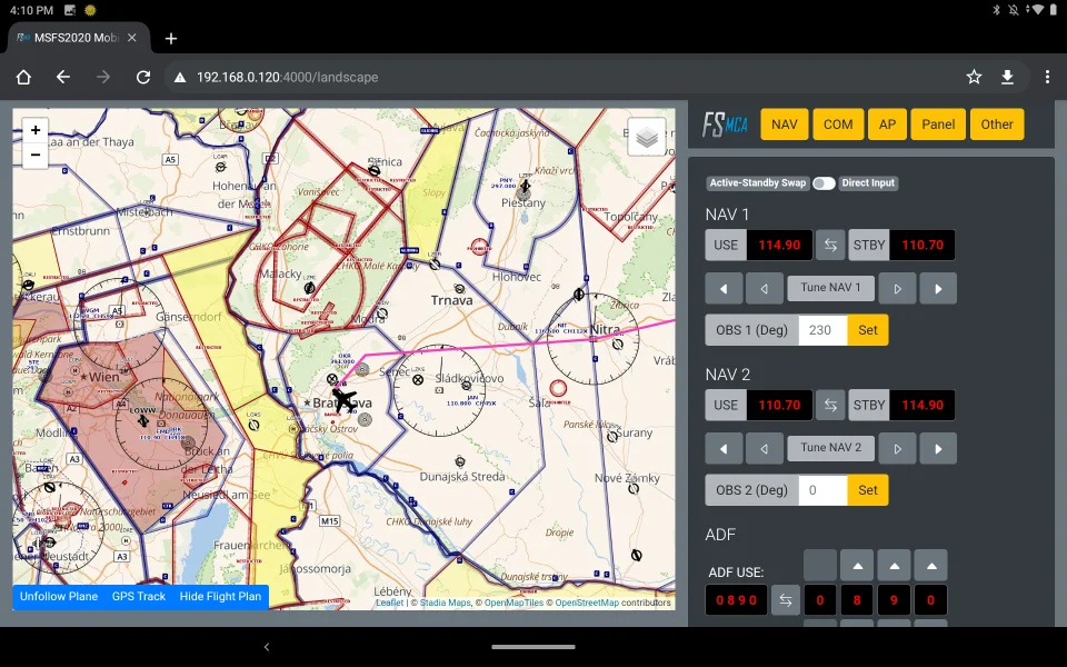
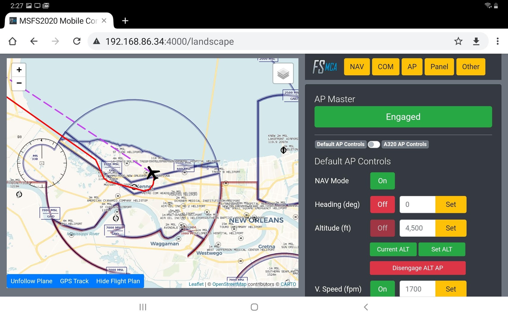
Finally, landscape mode with side controls:
Additional controls and functionalities:
I’m excited to announce the release of version 1.5 of MSFS Mobile Companion App. This release adds a dedicated landscape mode (split-screen for map and controls) and the option to load your flight plan.
MSFS Mobile Companion App is a tool that allows you to control essential aircraft instruments such as NAV/COM frequencies or autopilot using almost any mobile device. The MSFS Mobile Companion App is free to use.
List of new features:
- Added landscape mode (split-screen for map and controls).
- Added option to load your current flight plan.
- Switched active and stand-by NAV/COM displays.
A note on the load flight plan feature: Currently, only waypoints of the flight plan are shown on the map. Arrival and departure procedures like DME arcs, glideslope intercepts, etc. are not supported
Where can I get it? You can download the MSFS Mobile Companion App for free on GitHub or flightsim.to. It’s free. No ads, no in-app purchases, nothing.
Important notice for new users: Don’t install the app on your mobile device! Download and run it on your PC. This creates a local web server to which you connect via an IP address. You can connect to the app from your Android, iOS, Windows or Linux devices. To find out more about this app, visit the GitHub project page.
Have you been using it much, Skipper? I downloaded a previous version but didn’t try it out, but I might be approaching the point where I’d use it now.
I like twiddling with the knobs on the planes though, does this remove the need for all that? :)
Off and on, mostly for longer flights. I’ve tried a few of these types of trackers, this one is my favorite. Basically you run it on your PC which in turn is a program that feeds info from the simconnect to the game into something akin to a private web page display. You view that private URL on your tablet and he’s coded it with many features that have direct control input. It’s really helpful for navigation and you can see it allows direct update for navigation and com frequencies versus playing with knobs in the sim. It doesn’t remove it though, you can still do everything in game and just use it for tracking your route, similar to an iPad on your knee in flight.
Let me make some coffee and I’ll get you some screenshots. I’ve not even loaded the 1.5 version yet.
I used it a bit when I was in pancake mode, but VR makes them (mostly) unusable, obviously. I could in theory use it with a pinned window with the Link, but I’ve been doing Virtual Desktop exclusively recently.
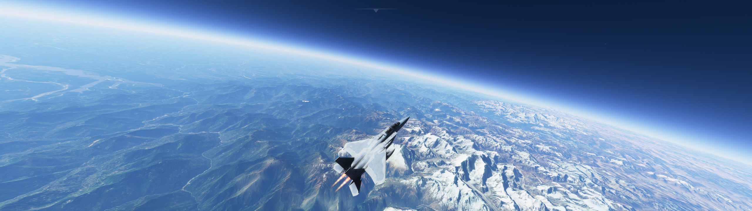
Oh wow, okay now I want an aircraft to see this with. That looks awesome, plus with the moon in the background!
Is the moon to right scale? It looks tiny!
Those shots look incredible.
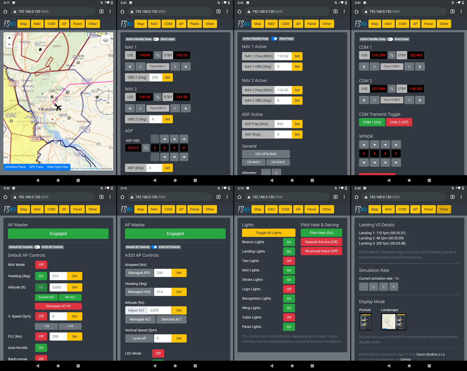
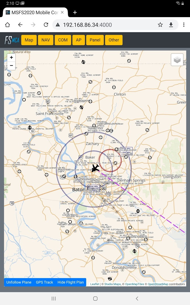
@Pedro Here are some examples:
Vertical mode:
Landscape mode about 1/2 through a short flight. I’ve used the controls here to up my sim speed:
Another in Landscape mode with me changing my vertical speed settings in autopilot:
That looks really neat, thanks for posting.
I will try it tomorrow; I’ve been doing a lot of TBM 600-800nm flying in FSE to raise dosh as I went a bit mad financing planes. Looking forward to it.
I think it’s the ultra-wide-angle view. Zoomed in the moon would be bigger. :)
The F-15 is really, really fun because of the flight envelope. My favorite planes so far are the F-15, MB-339, and Savage Grravel.
Those are insane. I’m getting more enjoyment from the screens in this thread than from playing the game :)
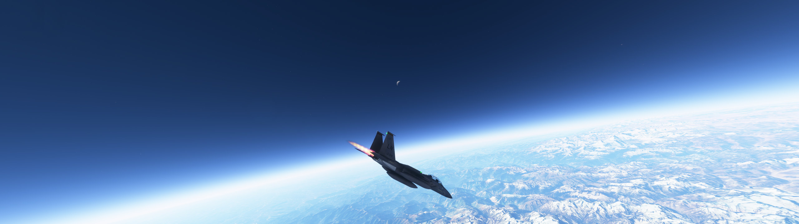
Oh wow, Denny, amazing.
I tried to take a drone camera shot from that height for a bush trip and I got a CTD :)
Can the mb-339 go that high or just the f-15?
Just the F-15 right now. You have to take it up to about 40,000 feet, level out, and accelerate to about Mach 2.2. Then pull up to about 70 degrees and zoom-climb up to max altitude.
You can generally make it up to 85-92,000 feet before you hit apogee and start falling back down.
What’s cool is this is actually technique real test pilots used in the 50’s and 60’s for high-altitude testing.
How does texture loading go beyond mach 1? Do you get much pop in or blurriness?