The Real Great White North:

This is a generic map for your mapping needs.
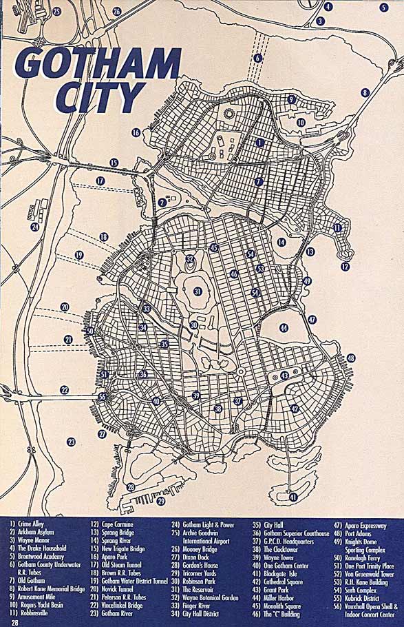
This map has been used in a cartoon. Or at least a comic book.

Newer map of the same place.
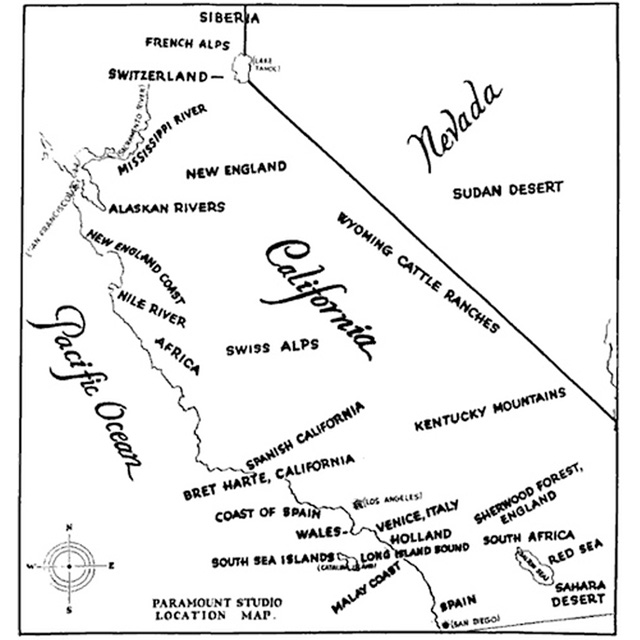
This is where a film company like, say, Paramount could travel away from their studio and shoot “on location” without having to trek out to the real location
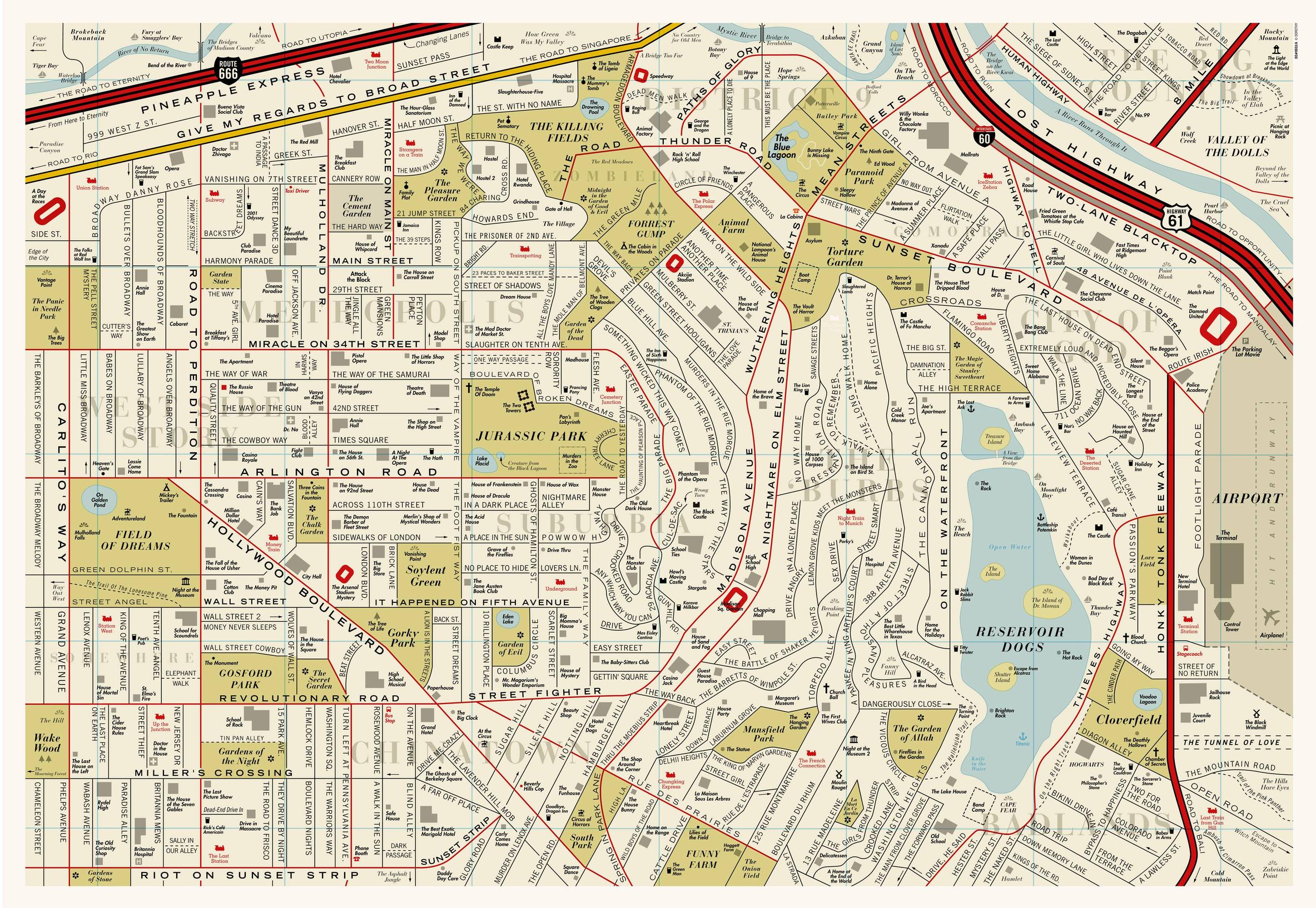
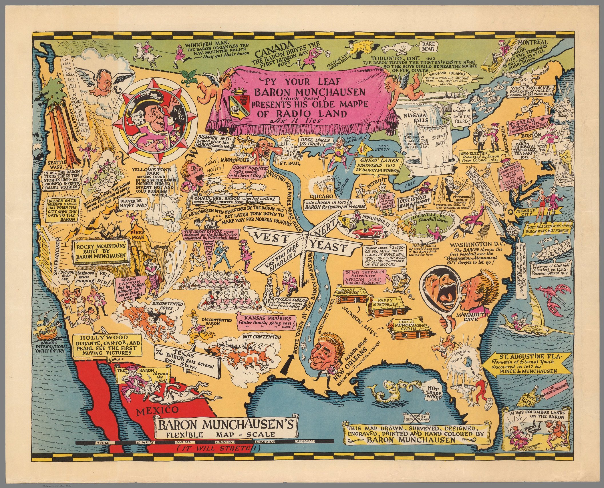
This is a map of a mashup of movies.

And this shows the melting of the polar ice caps, as imagined by a fan or two.
This was my favorite.

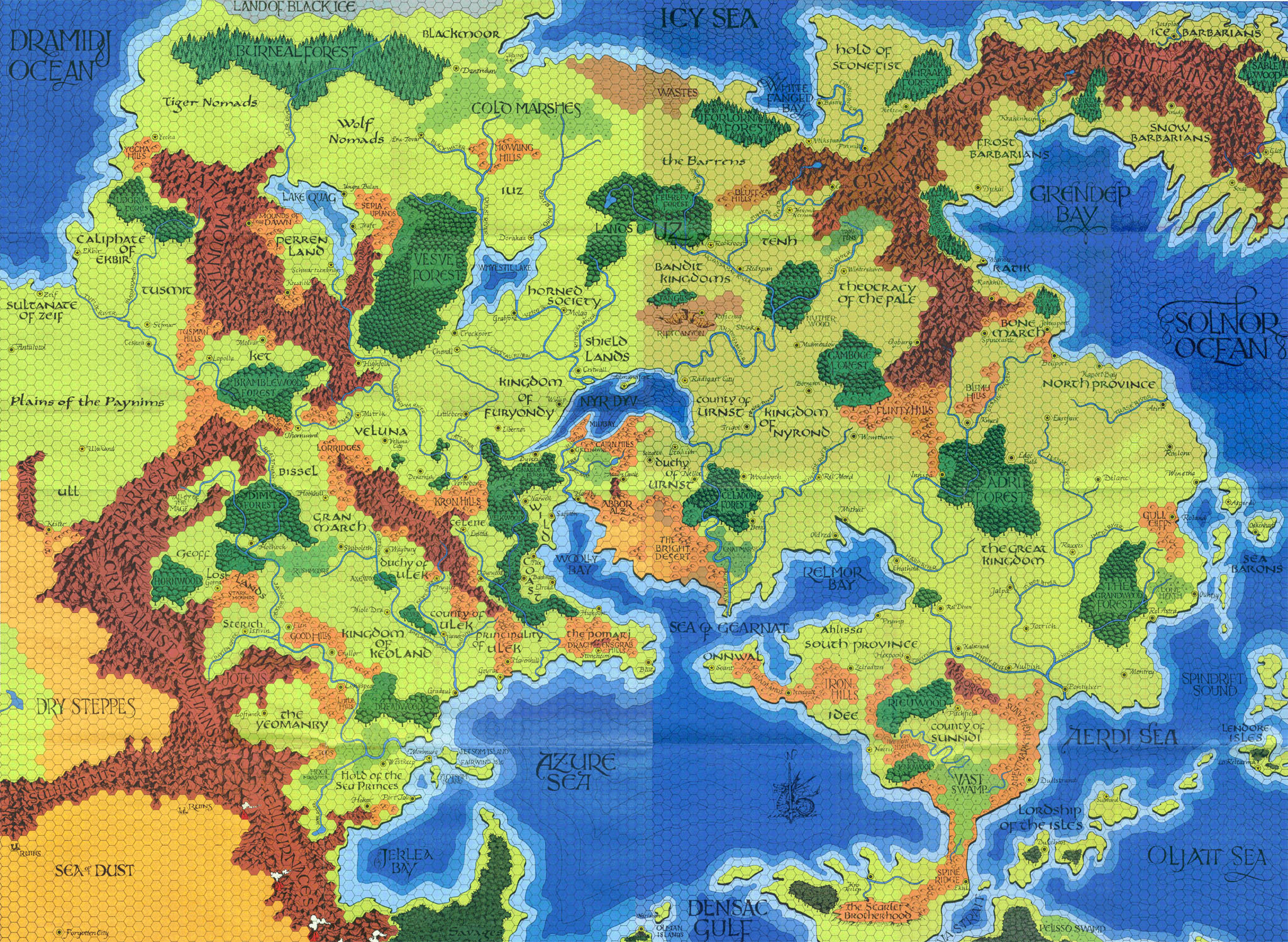
Normally I’d say hexes make everything better…
I have this one hanging on a wall:
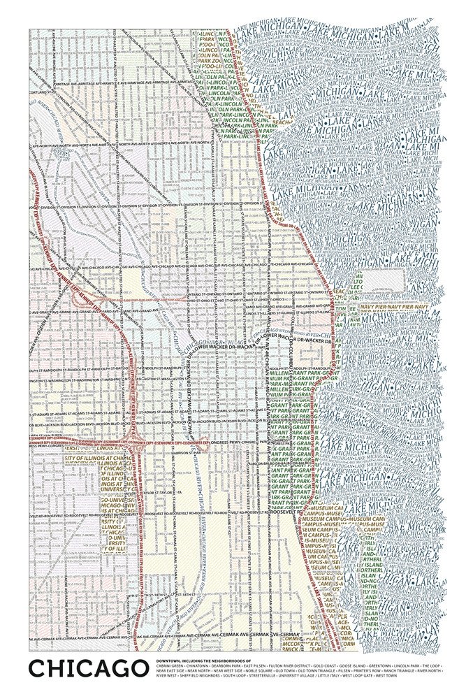
Topographic = old and busted.
Typographic = new hotness.
I couldn’t agree more. Do you still have yours? As the Jerky Boys said, “I’ve got all that sh*t, tough guy!”
That is one I actually do have, saved from the Parental Unit destruction machines. She is in poor shape, poor lass.

That gives off a mighty Route 66 vibe.

The Triangle noted on the political map is a setting from Star Trek The Role Playing Game by FASA , detailed in the supplements The Triangle and The Triangle Campaign.
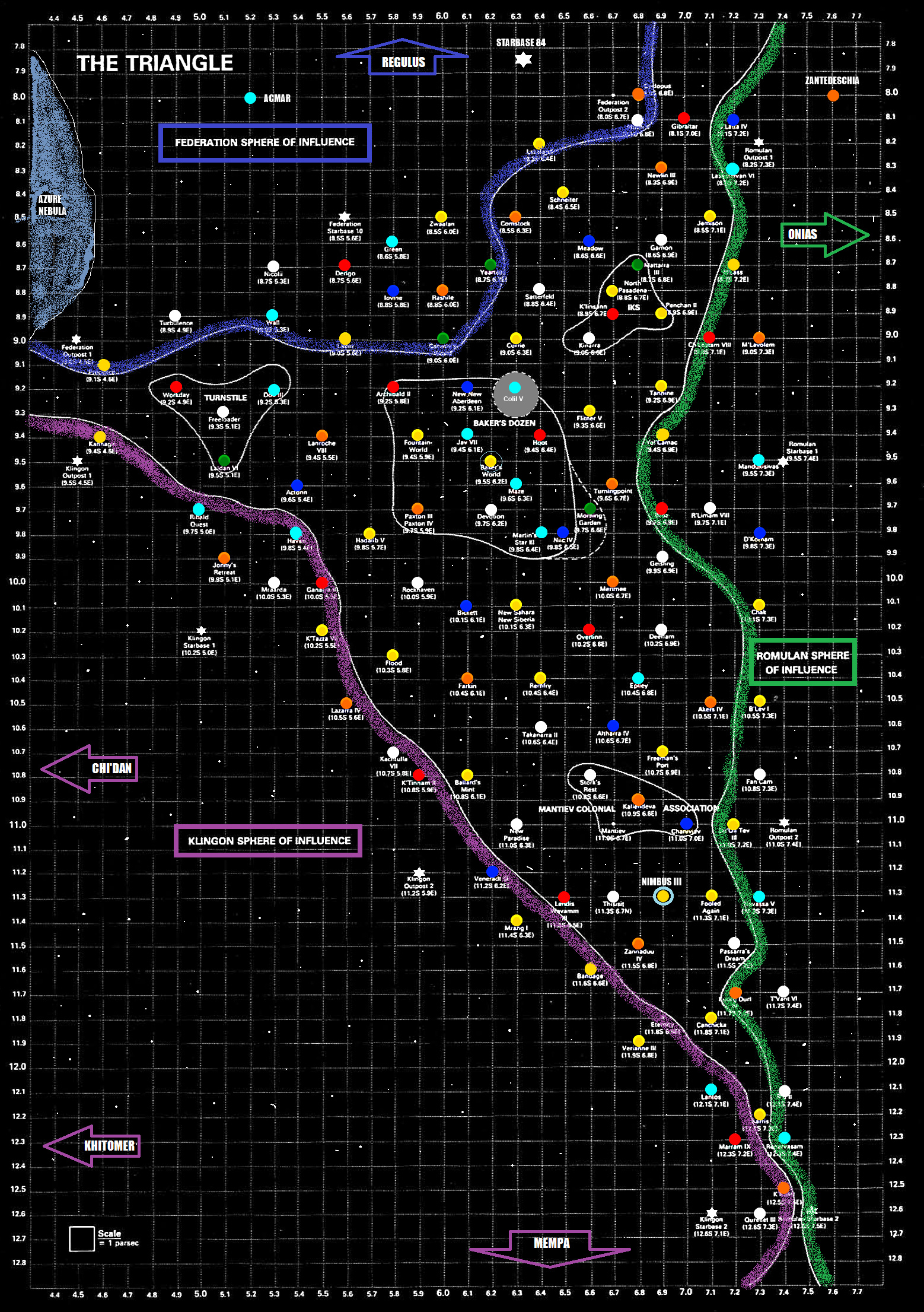
In “Bakers Dozen” I see “New New Aberdeen”. I really, really don’t want that to be a typo.
It wasn’t :)
I’m going to leave that un-googled, because the story behind it can’t be any better than what is rolling around in my head.

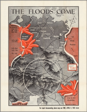
Time Magazine put out some nice covers during WWII