

i love this pic of it in context.

Don’t Hate, Appreciate!


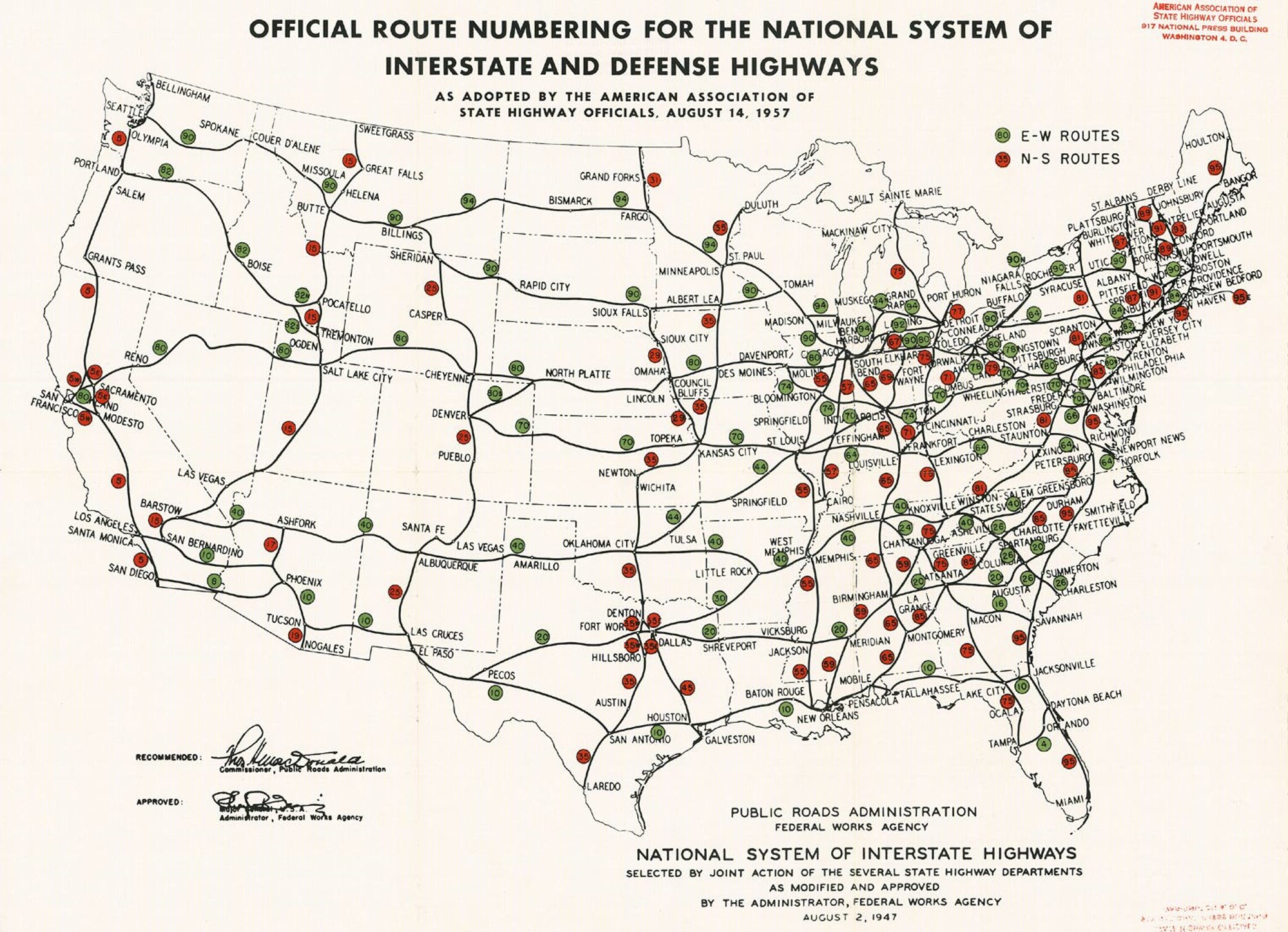
Huh, I wonder why some of the number changes. 82 is actually numbered 84 (Salt Lake to Portland) and 92/94 in Michigan is actually 94 runs the south, 96 the north loop. I-80 runs north of its projected route, and ends in NYC not Philly.
But fascinating map regardless.

More visualization than “map”, but arguably a memory address is a “place”:

From: http://benfry.com/distellamap/
I still think he should sell those in poster sizes.
iirc, this was in part due to issues with getting I-84 and I-90 approved by the localities they were going to run through.
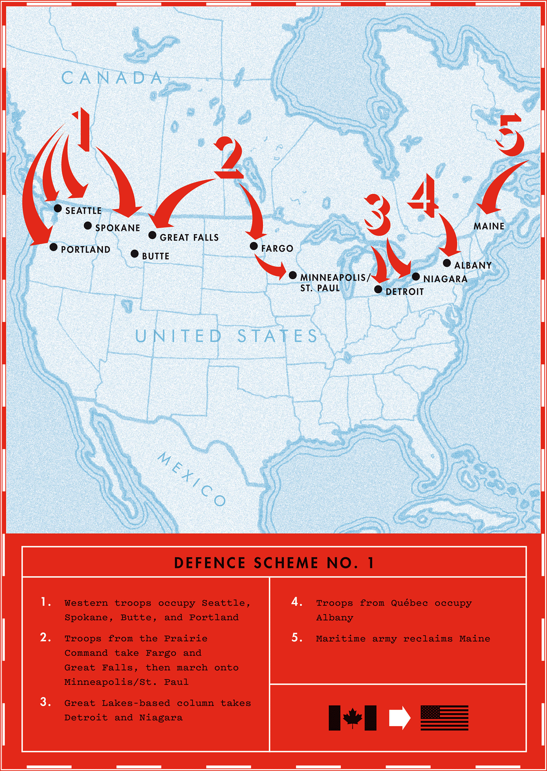
Only Canadians could think Albany is important.
As an interstate highway nerd, the Wikipedia pages on the system and the individual routes are fascinating reading. (I’m still waiting for the city builder that’s “Freeway Tycoon”/“Sim Interstate.”)
