The "Hike On!" thread of Hiking, Camping, Backpacking, and Outdoor Adventure

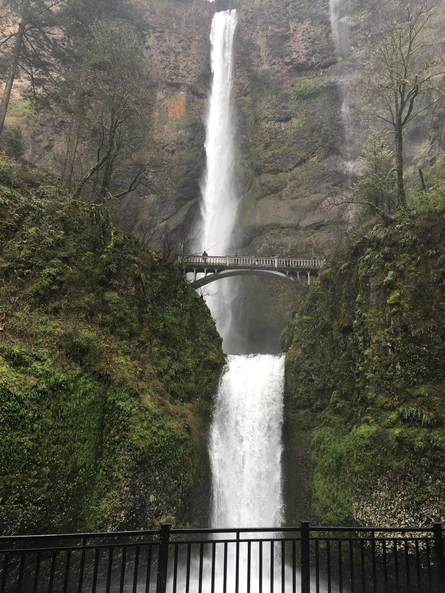
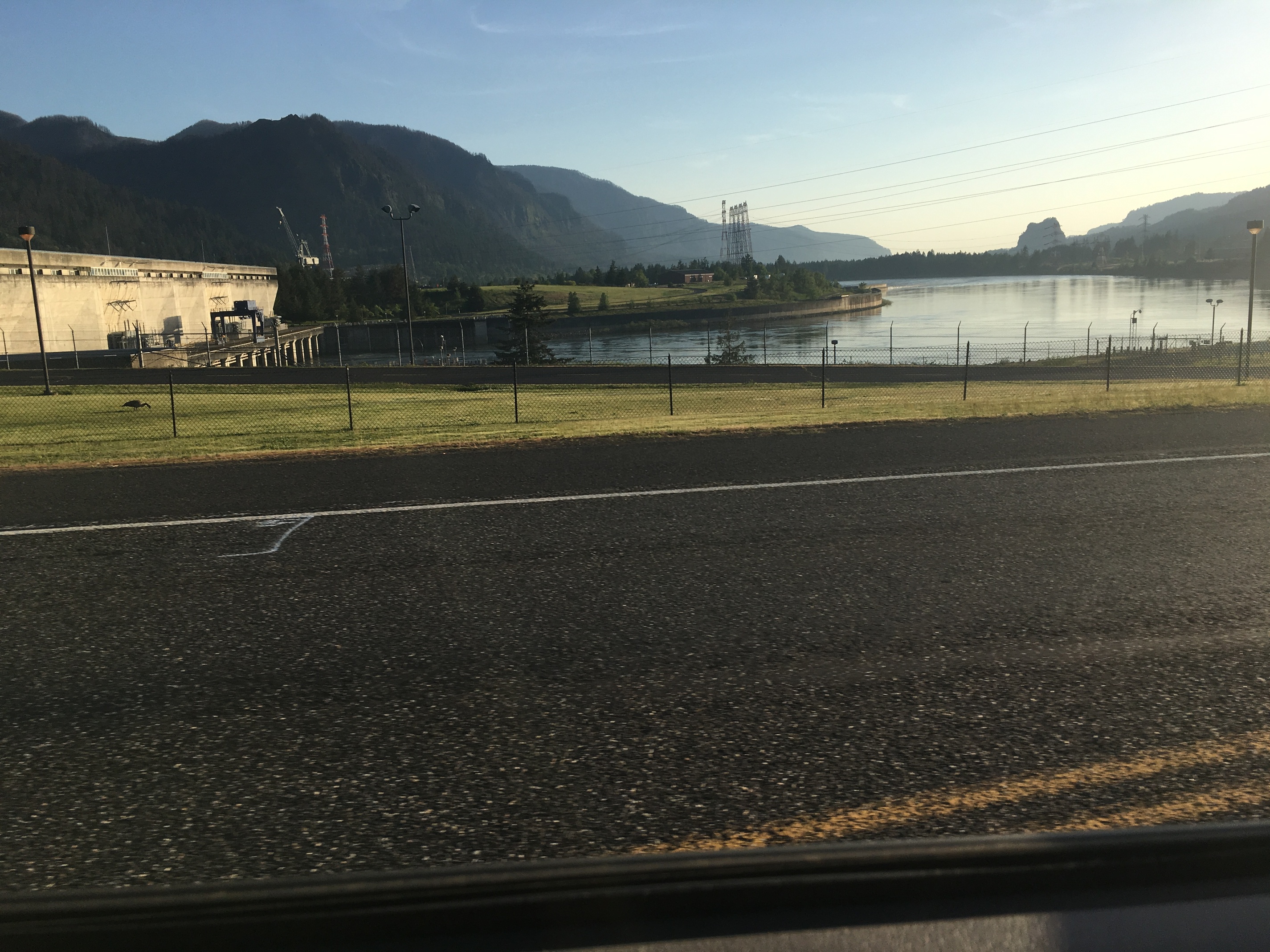
Nice pics @Hal9000. I admit, the Tetons are high on my list of places to visit.

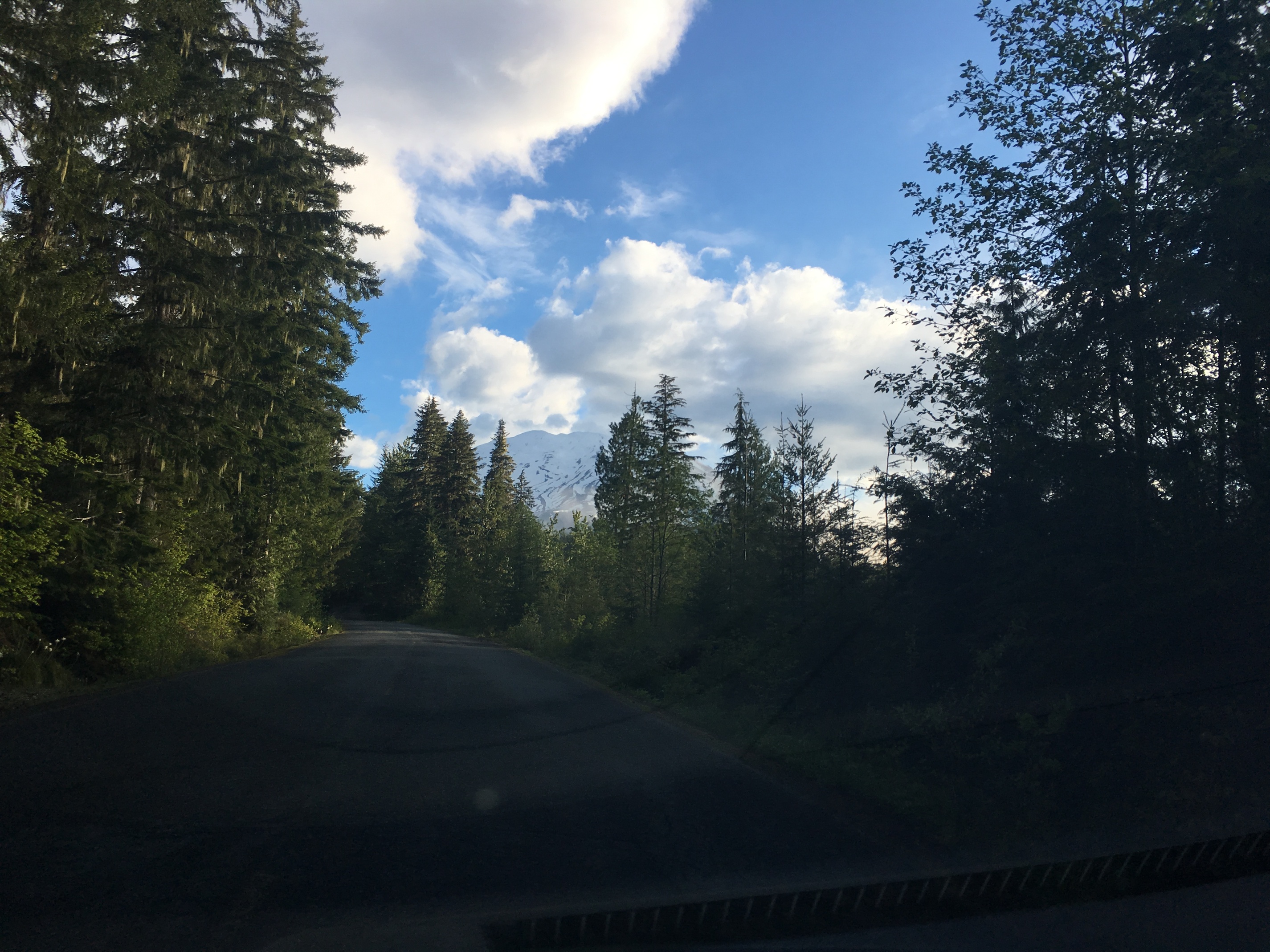
Speaking of hikes, I did one last weekend over at Mount Hood. Nothing too unusual, I stuck to the very popular Tom Dick and Harry trail, and it was quite heavily trafficked that day despite conditions. Probably because it was a gorgeous day in the 60’s with clear skies.

This is the extended version of the famous Mirror Pond loop, which goes to the top of the ridge behind it. Now the reason I did this trail was simple.

I’d never been to Mirror Pond
It’s lower elevation
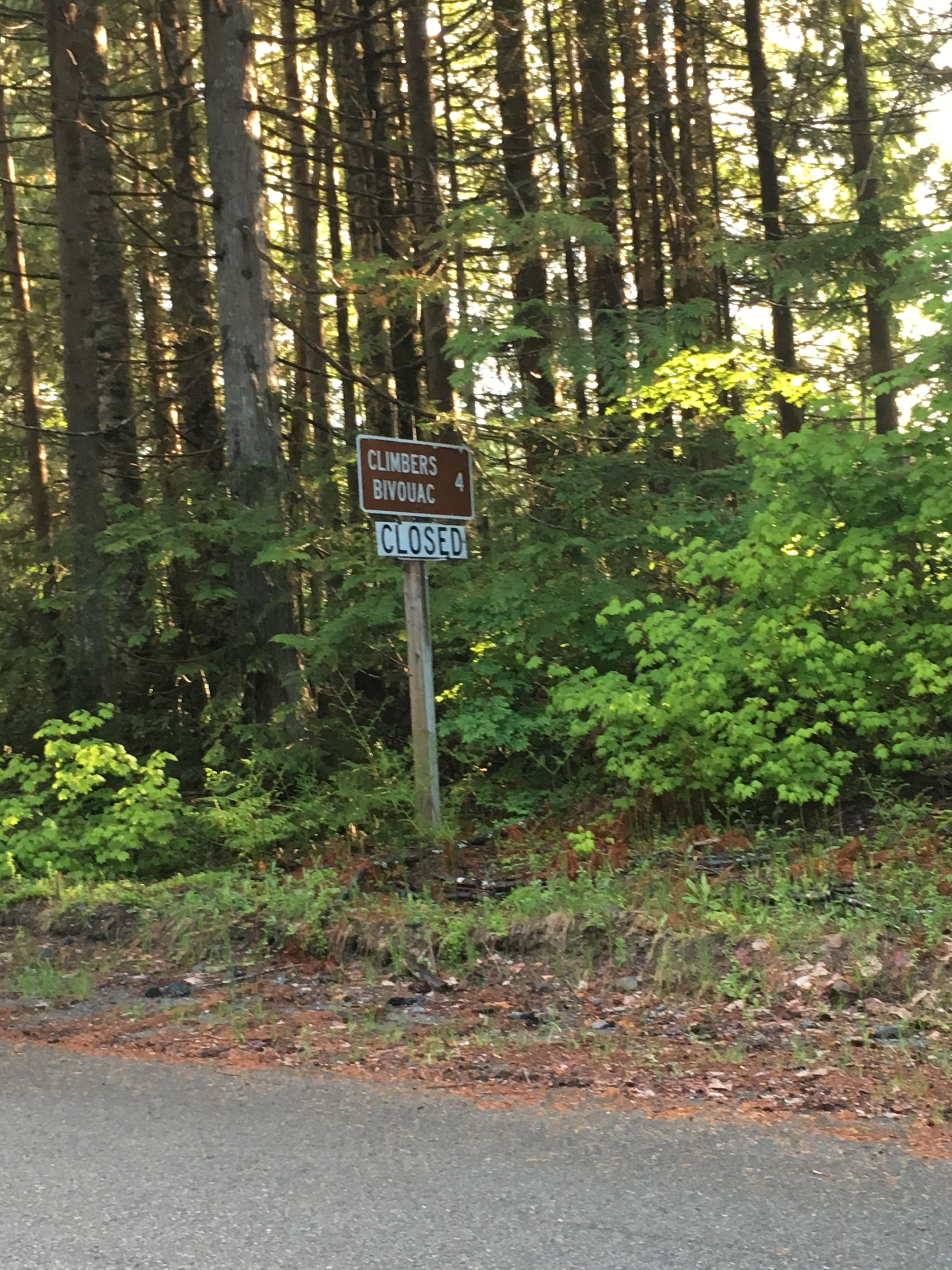
It’s a heavily trafficked trail

2&3 are linked as a single reason really, everything above 3000 feet was snow the weekend before in Tillamook, and I figured the same would be true at Hood. Nothing worse than driving an hour and a half to discover your planned hike is inaccessible. So keeping it low and heavy I could give my self the best chance of a trail that was passable, especially as I lack snow shoes, crampons, or proper snow boots.

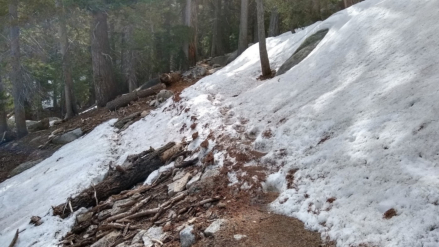
So the snow was now above 3000 feet, so retreated a few hundred feet from the week before. Still this trail starts at 3400 feet, so it was going to be all snow.

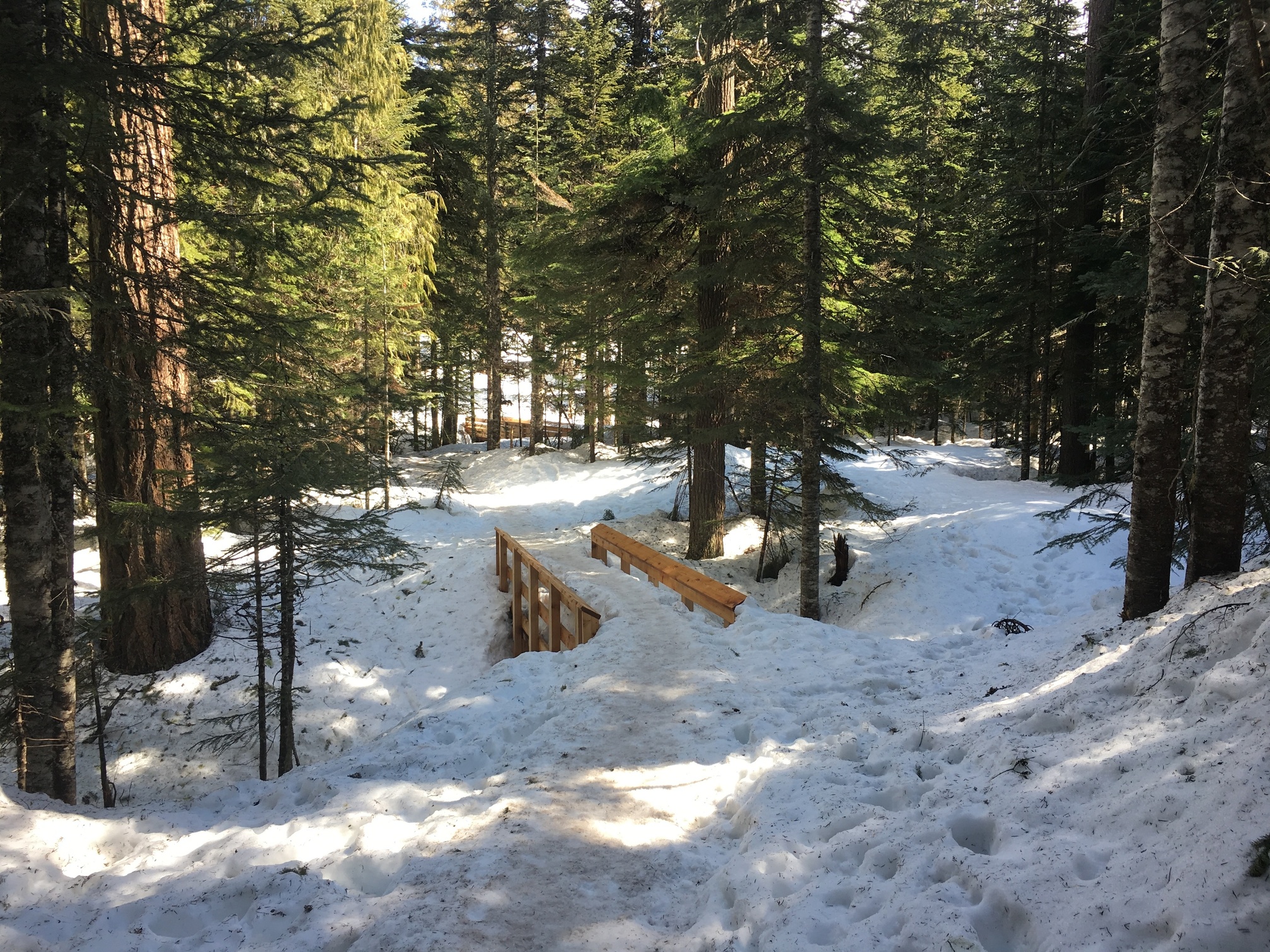
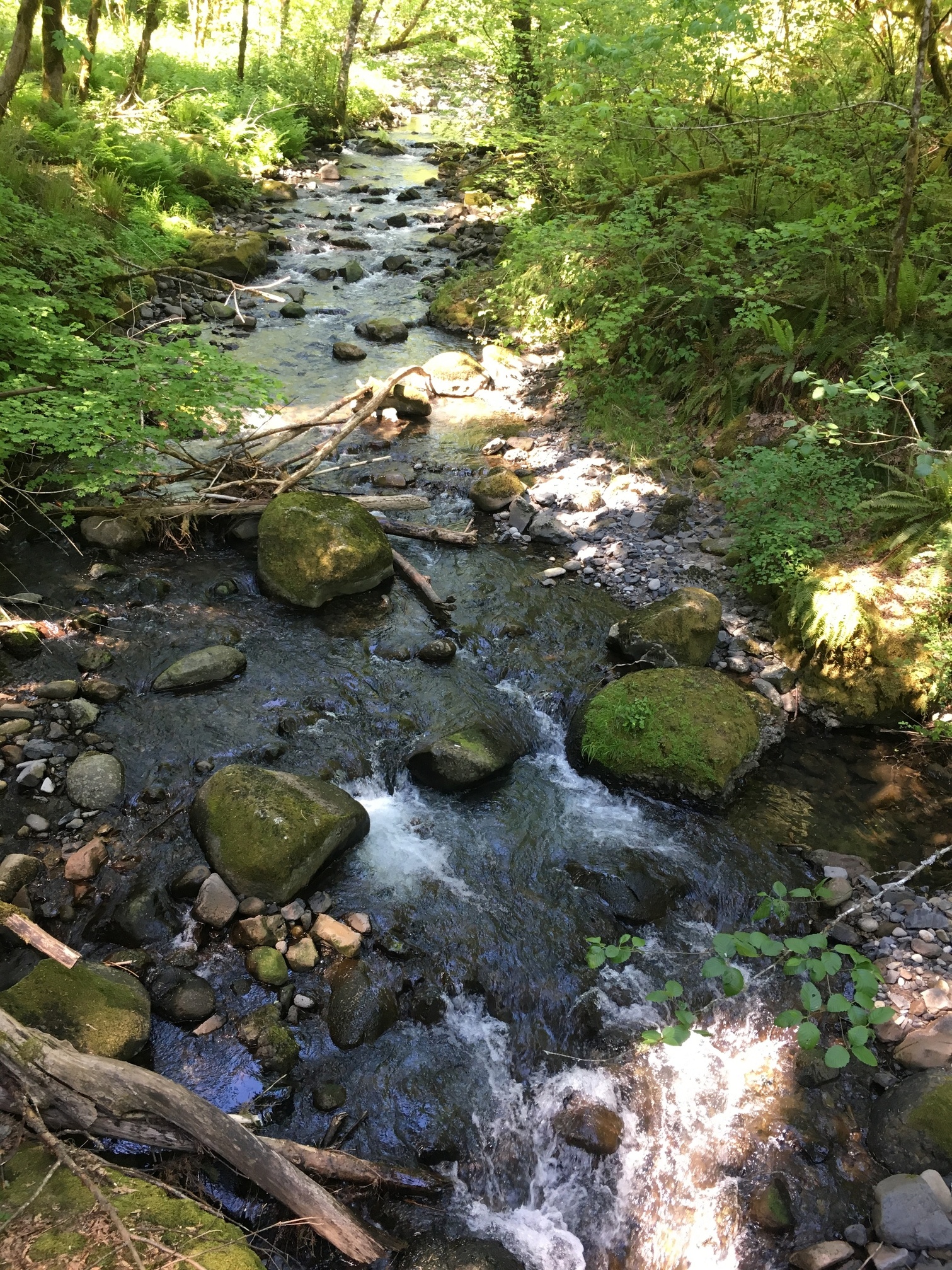
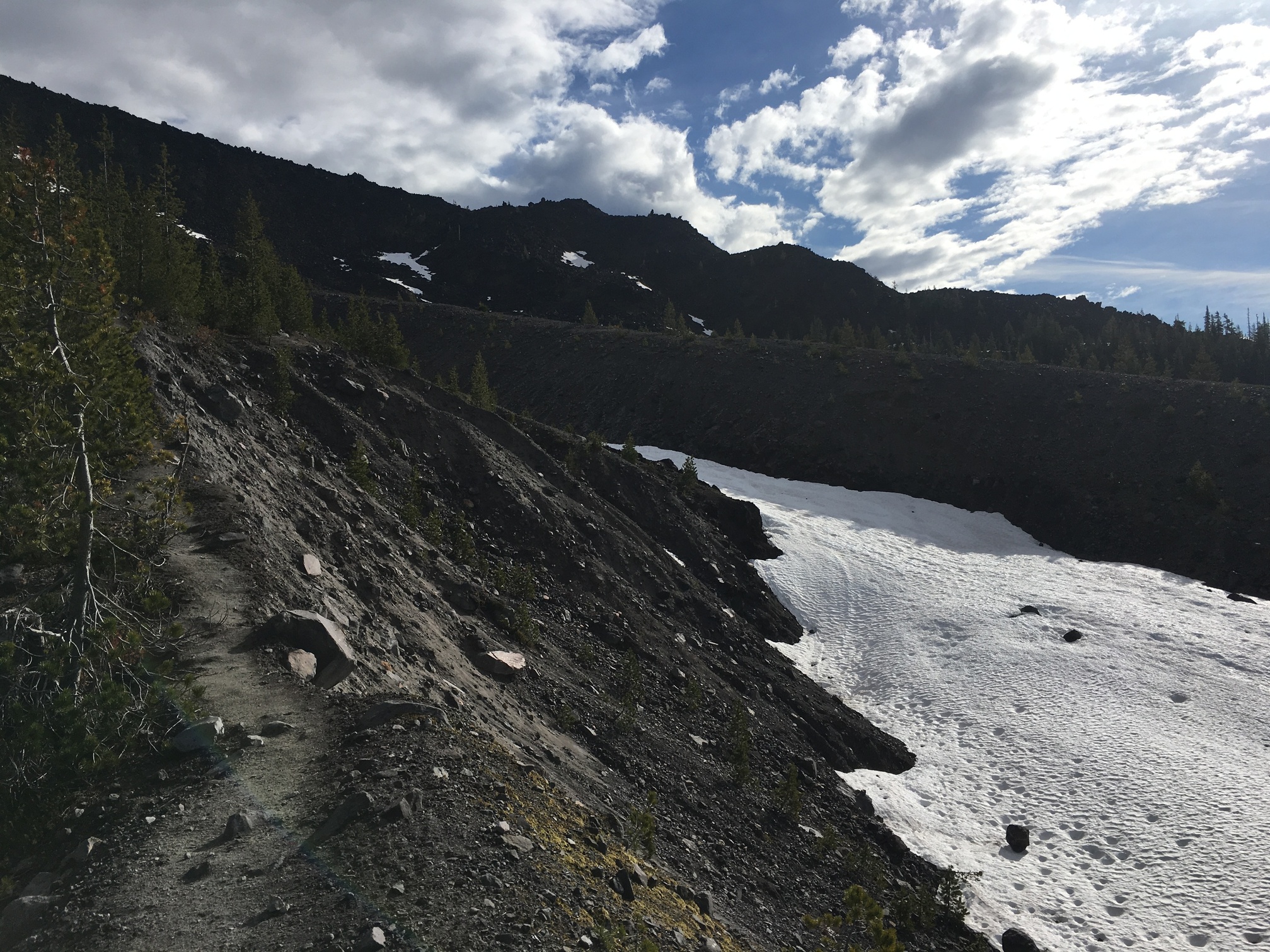
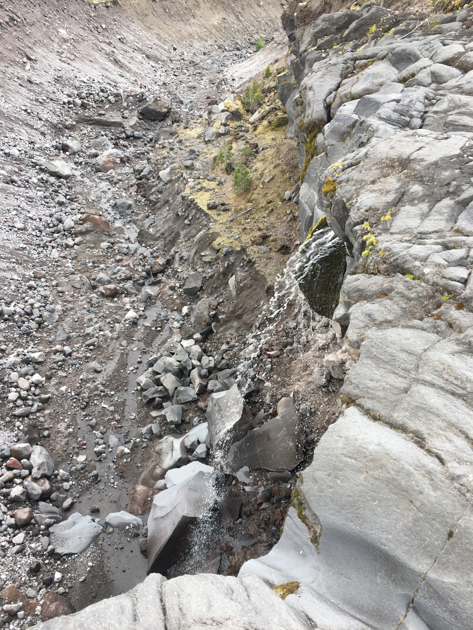
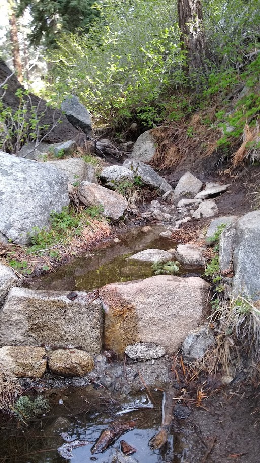
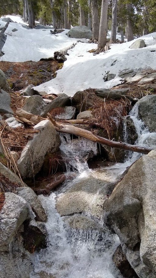
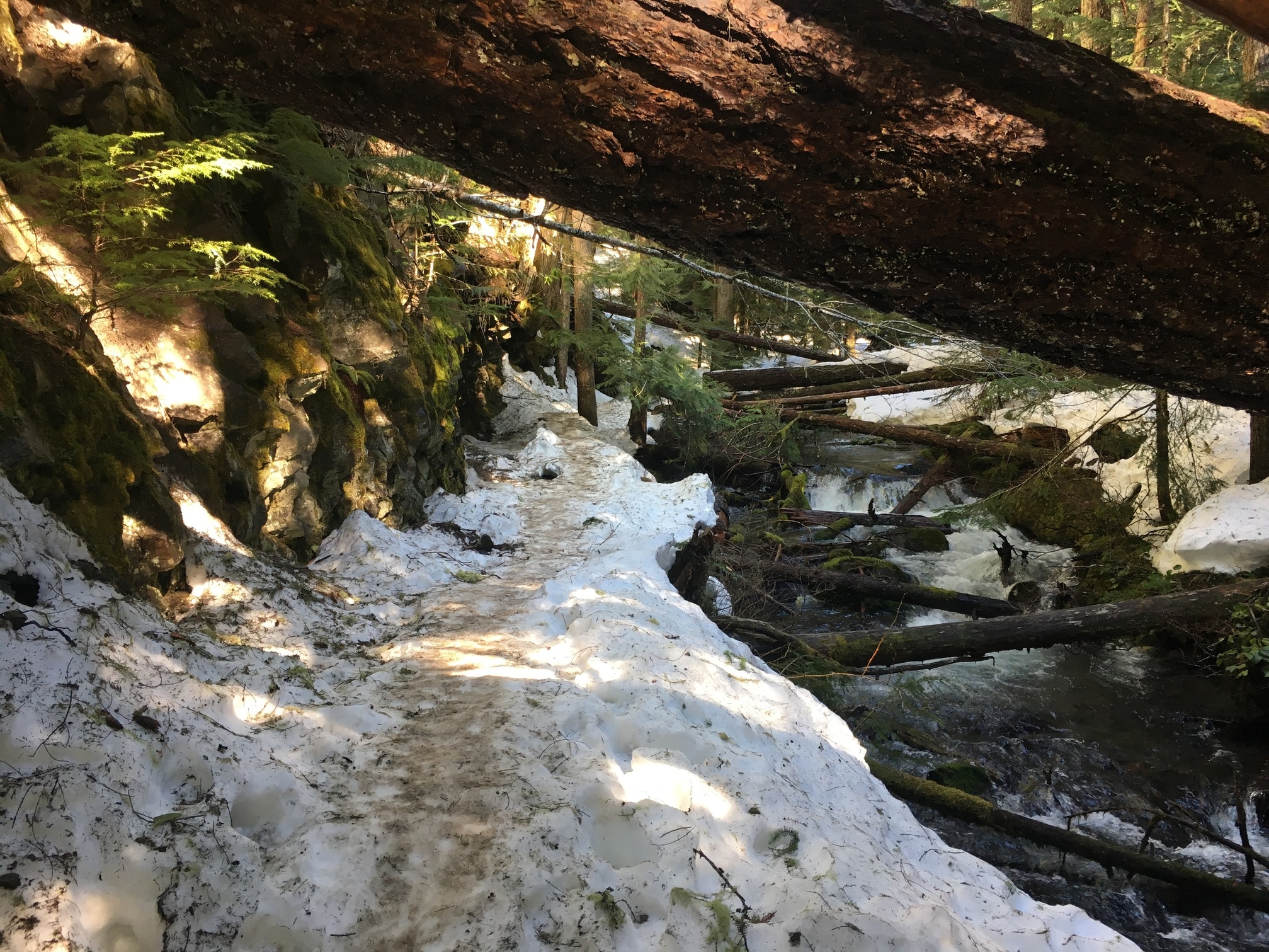
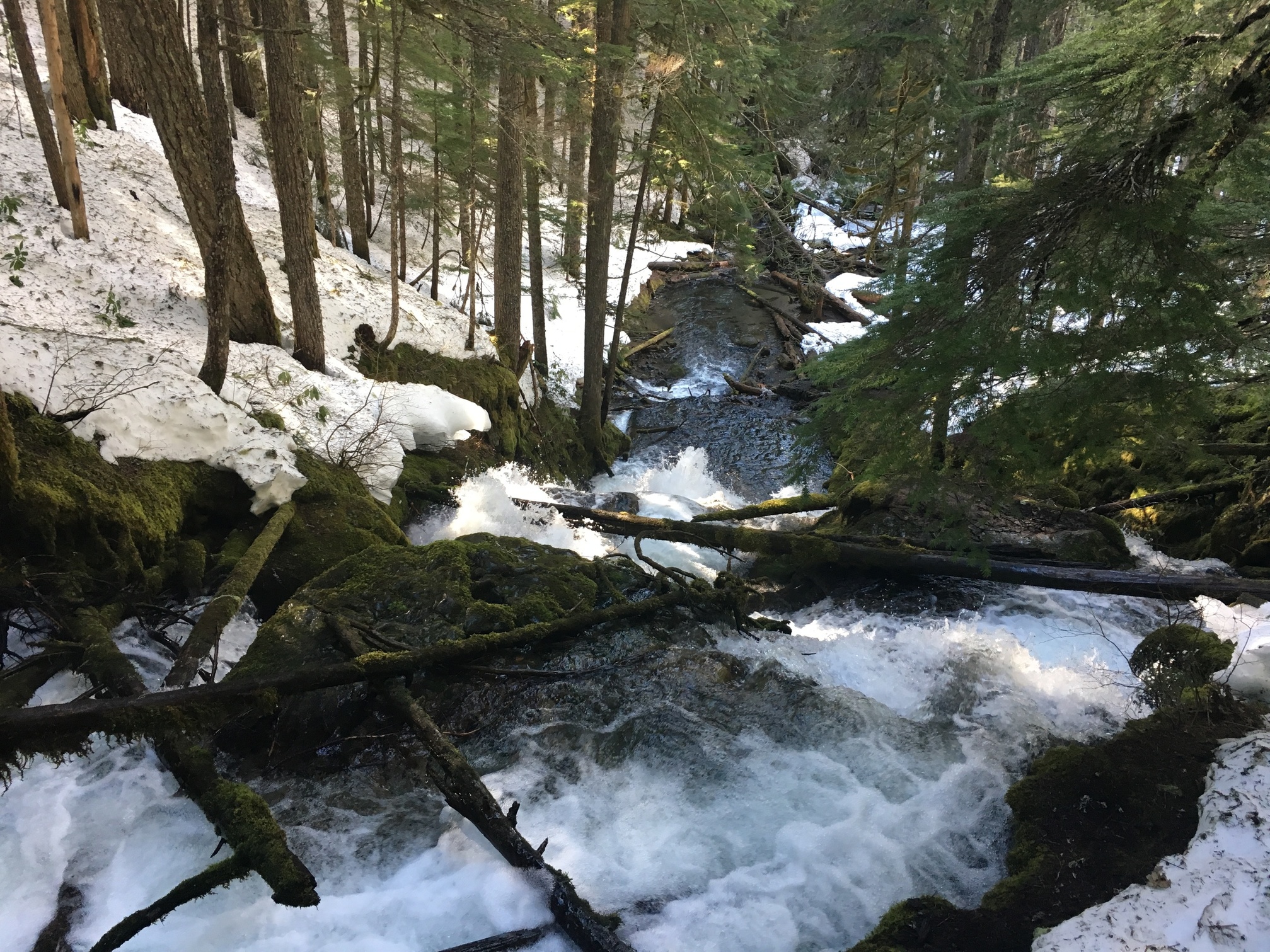
Was fine though. The snow was hard, and provided you stayed on the path would be accessible. Was cool too, lots of little creeks along the way

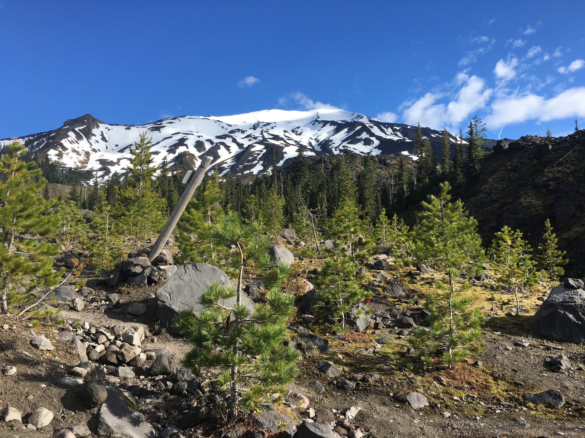
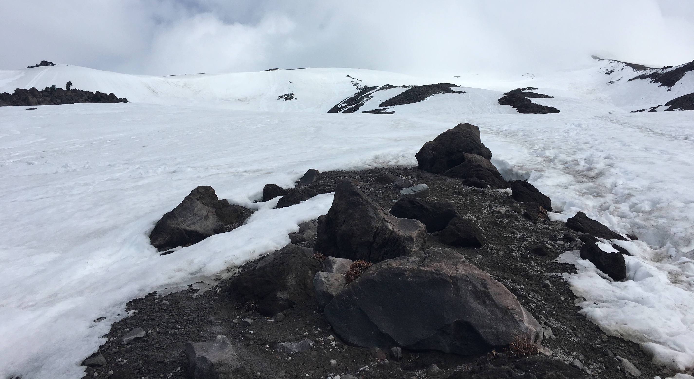
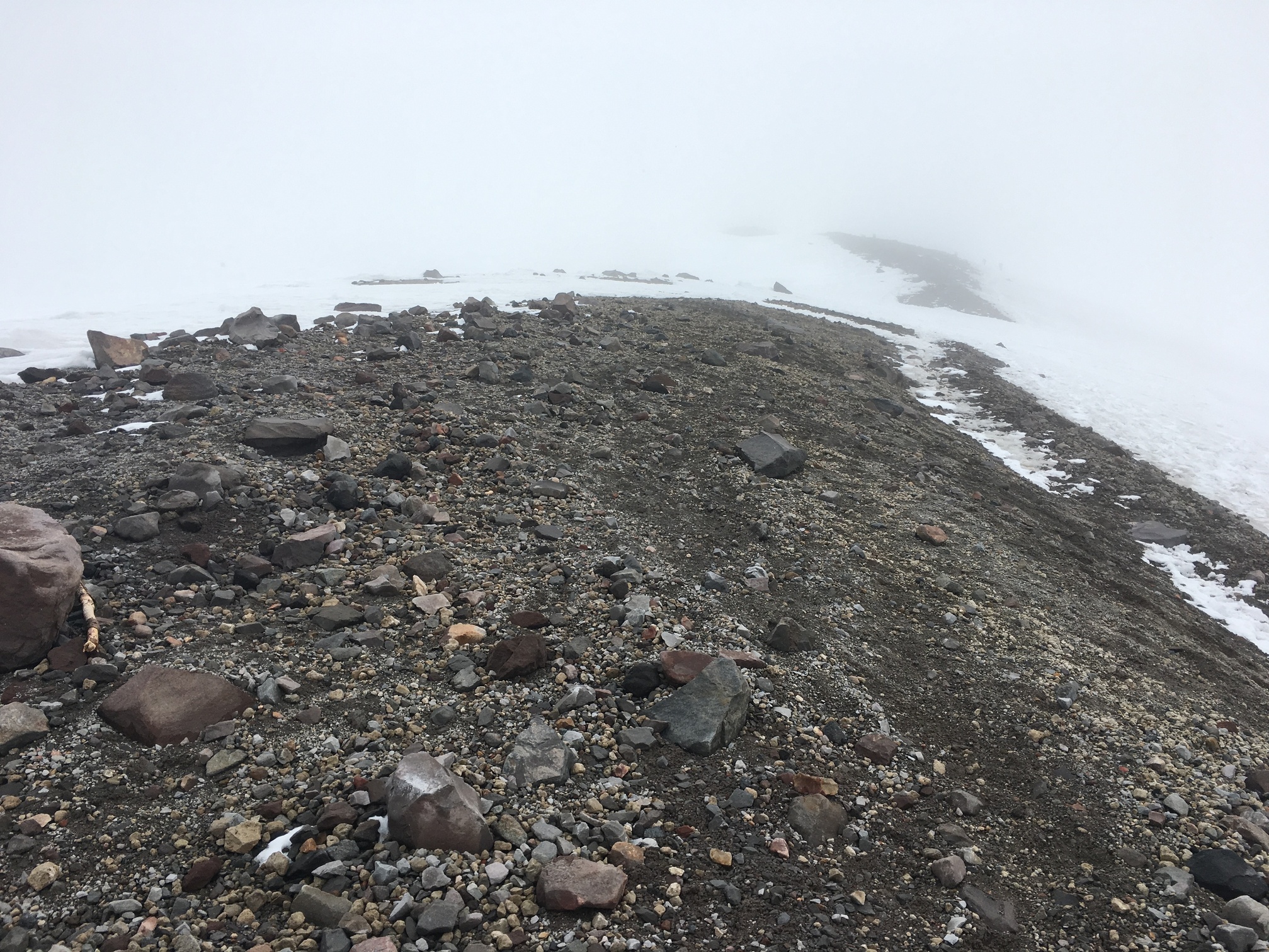
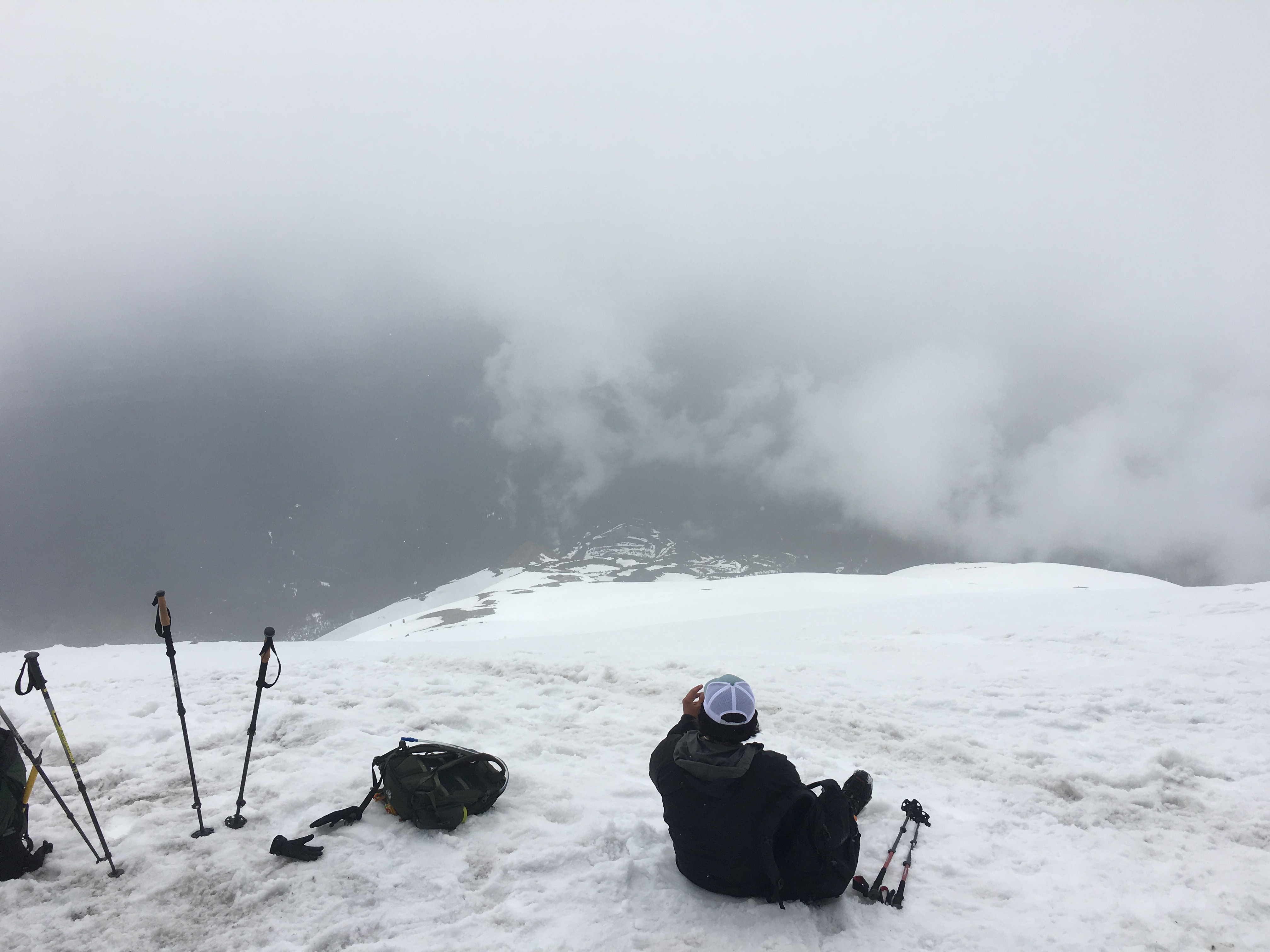
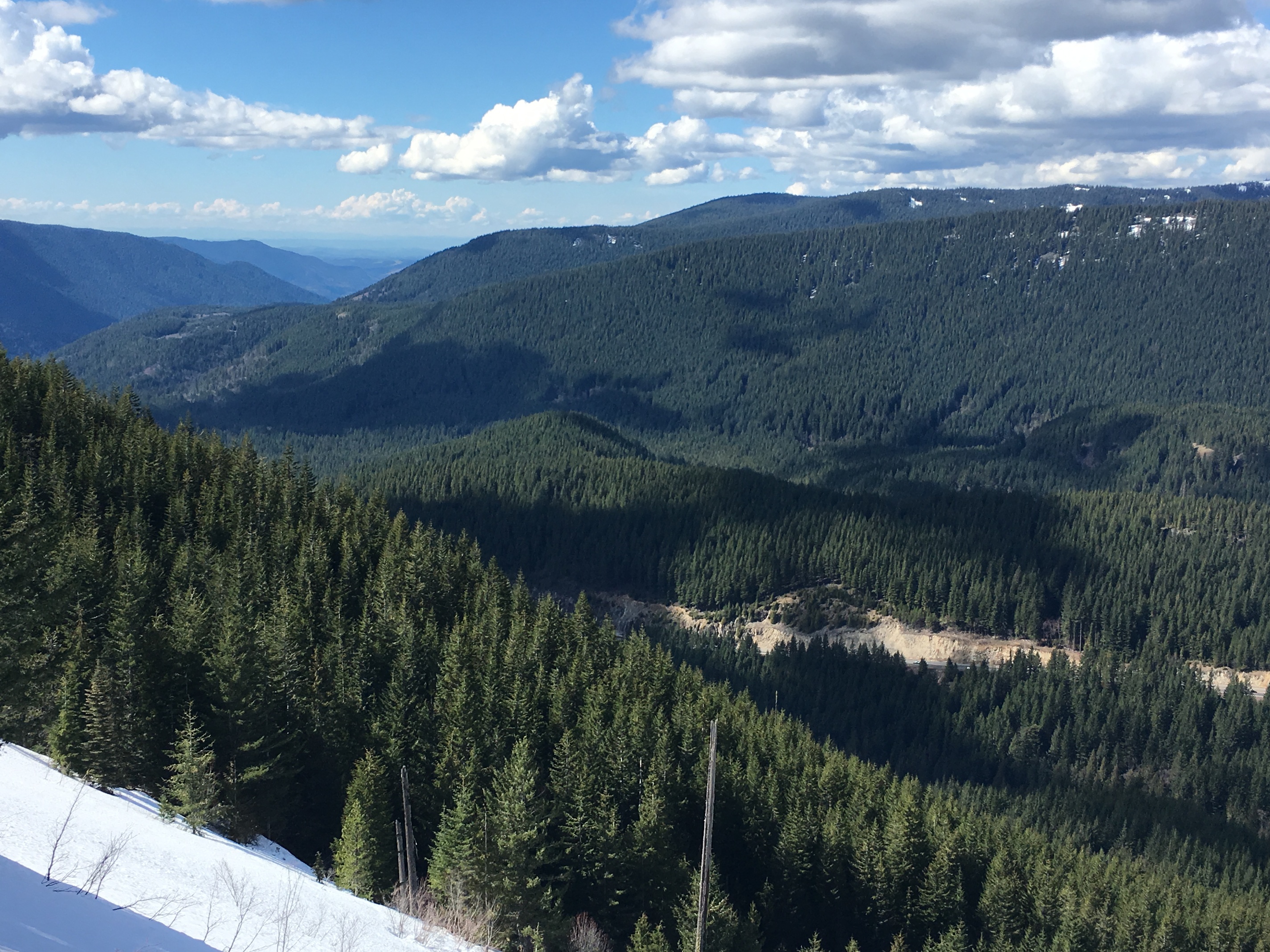
Getting to Mirror Pond wasn’t that hard. Which meant I was passing people left and right. Most people only go to the pond, so once I passed that things were quite a bit more open (and slippery!). However I took the opportunity for a brief detour to enjoy the view.

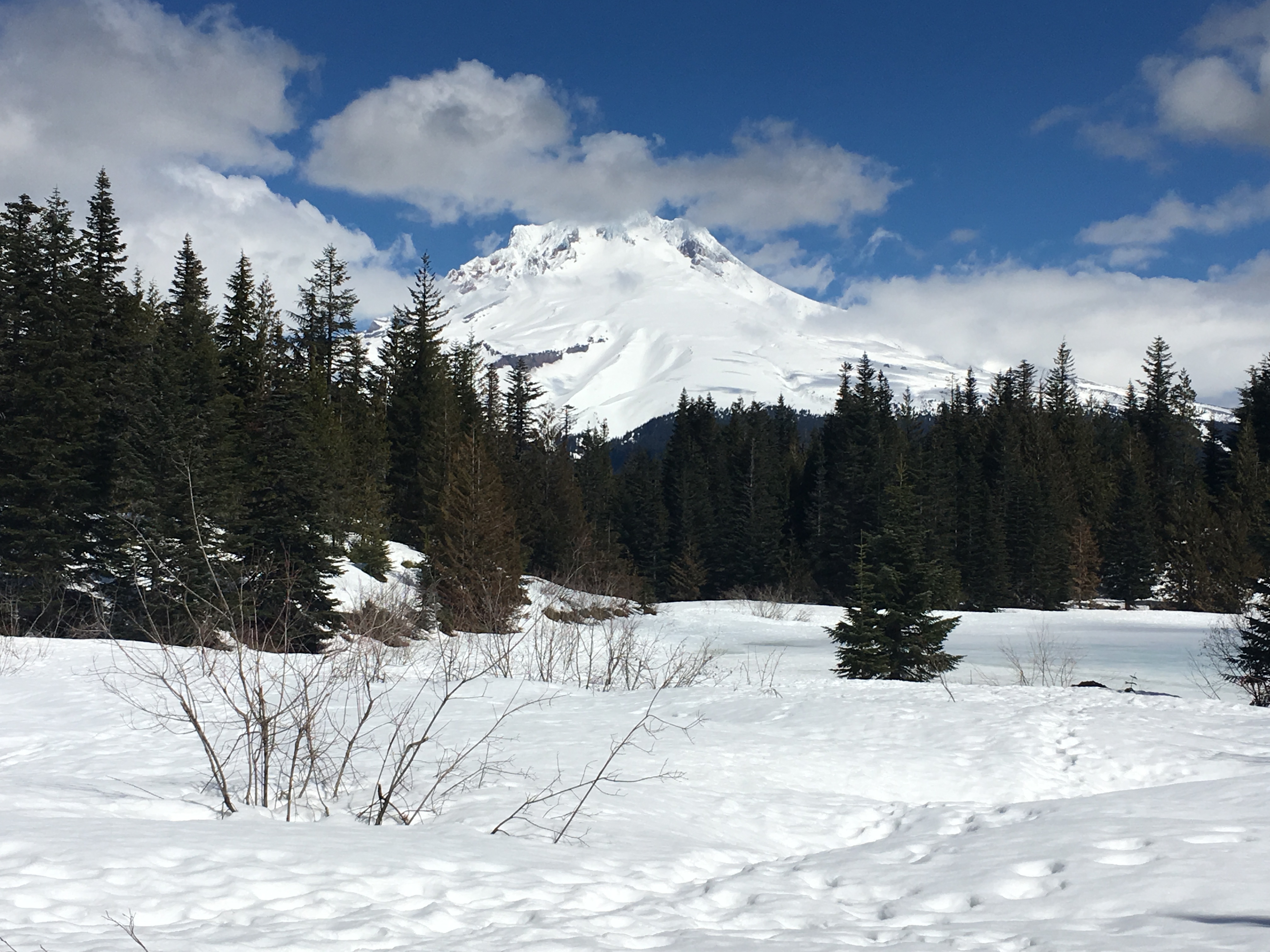
Admittedly snow does not a mirror make.

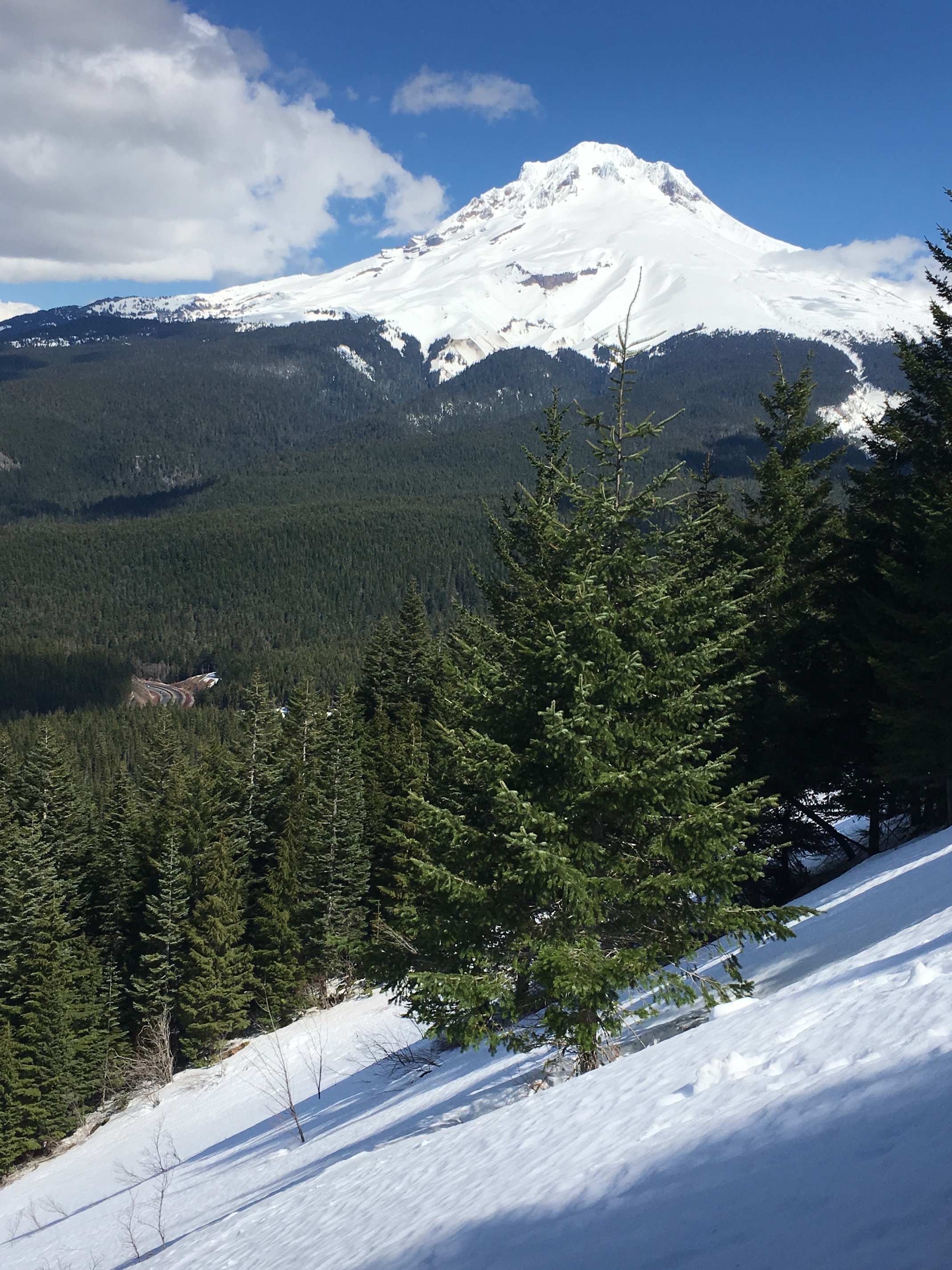
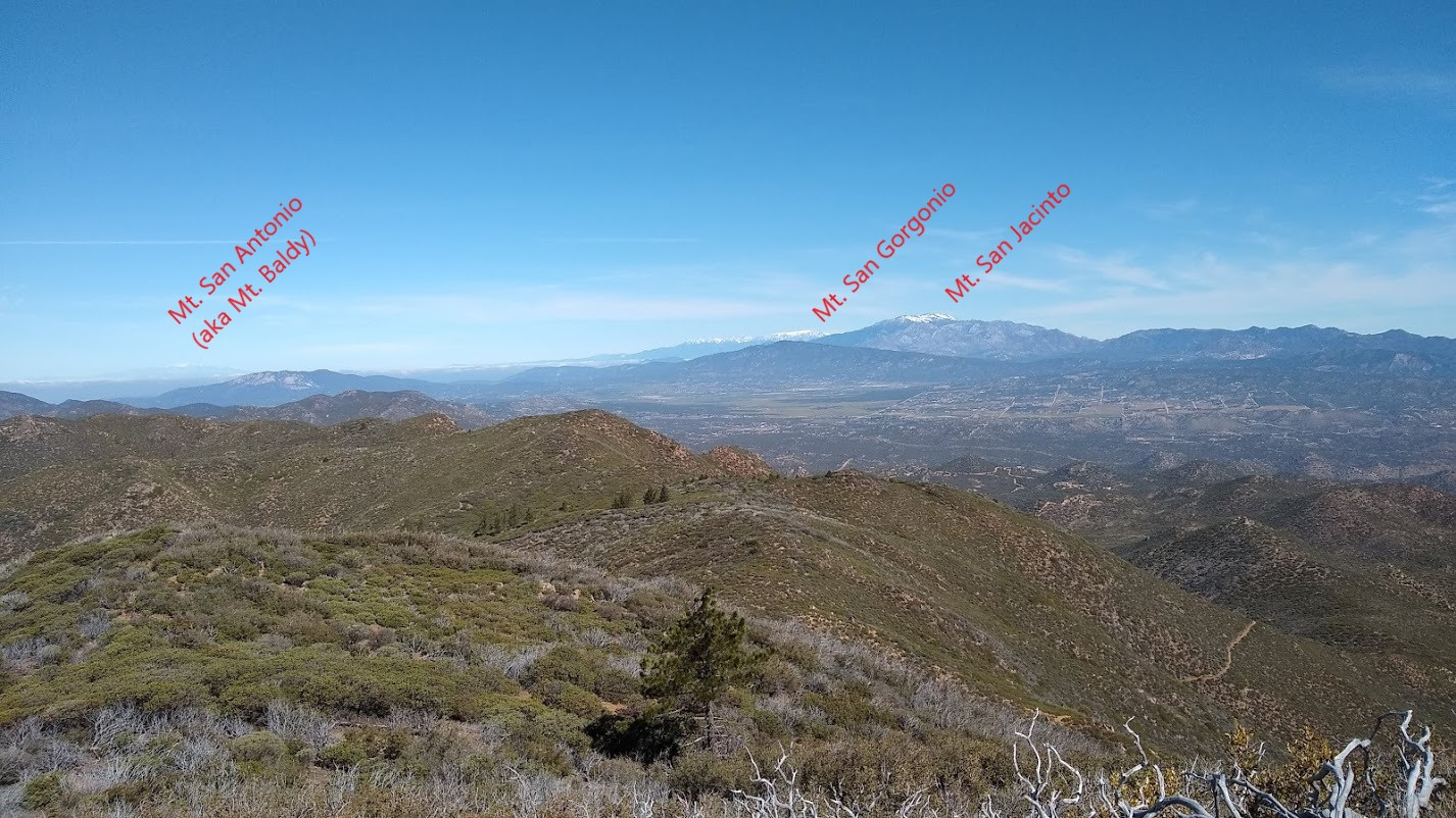
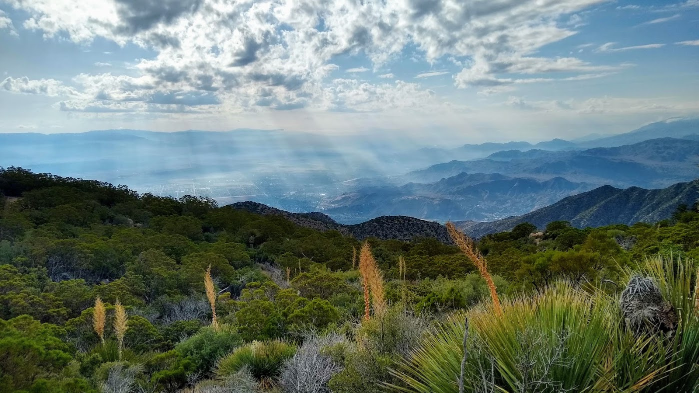
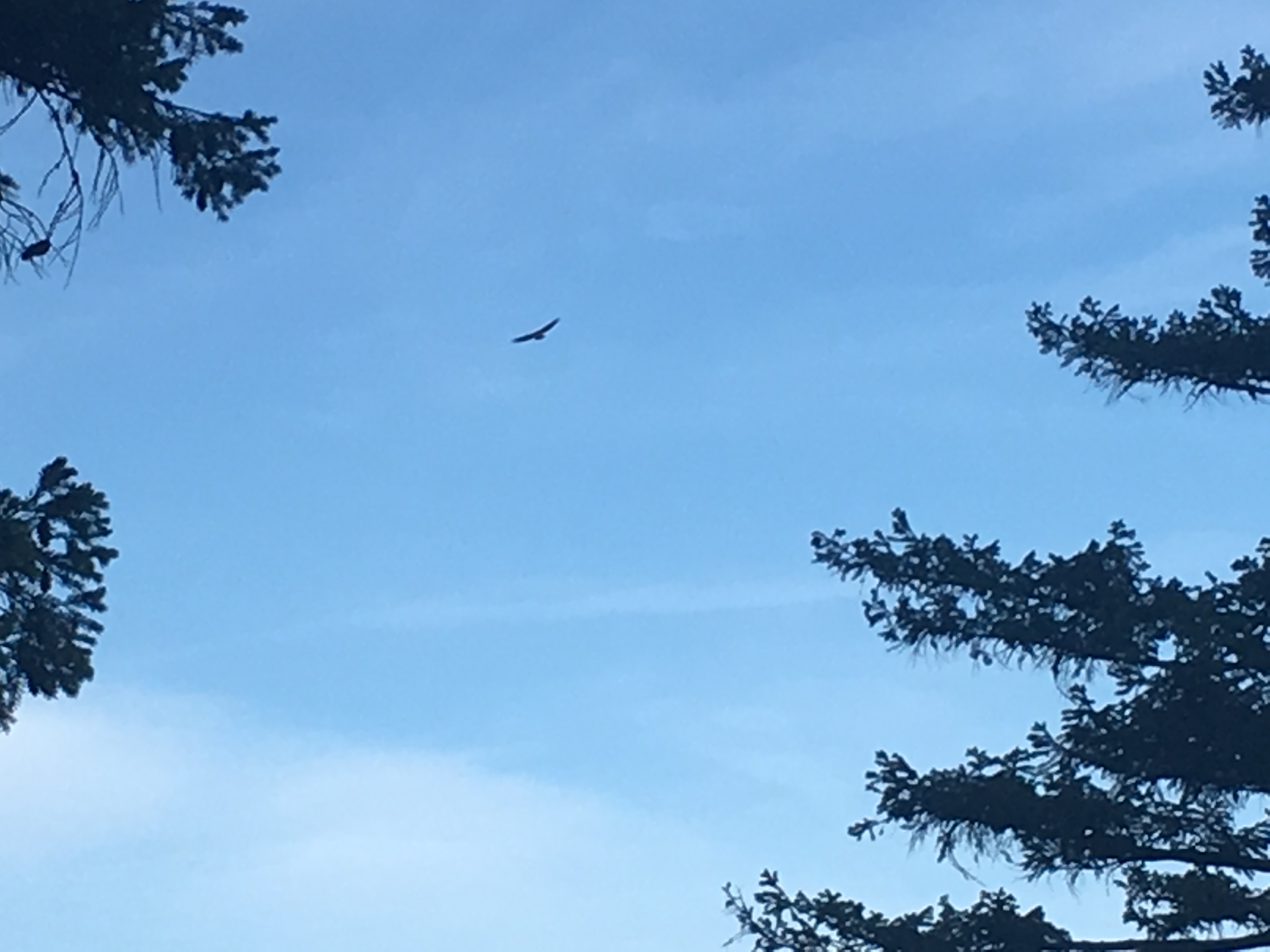
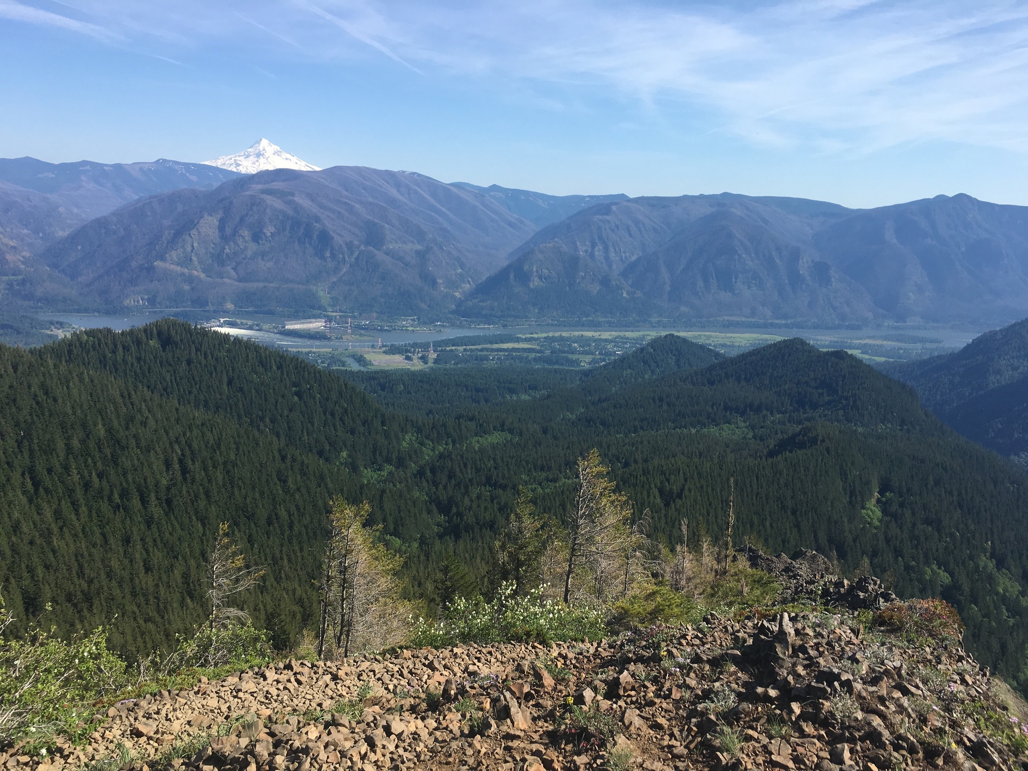
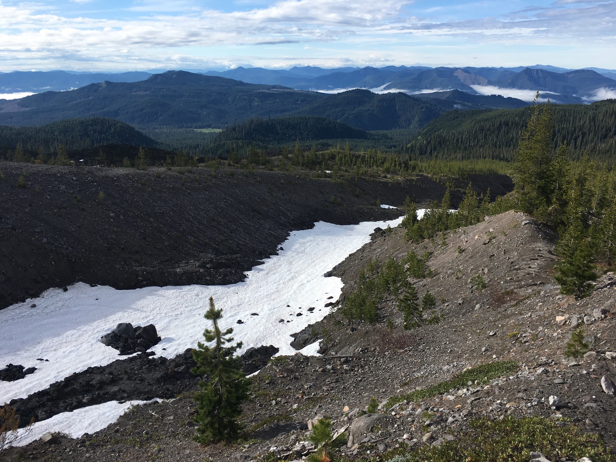
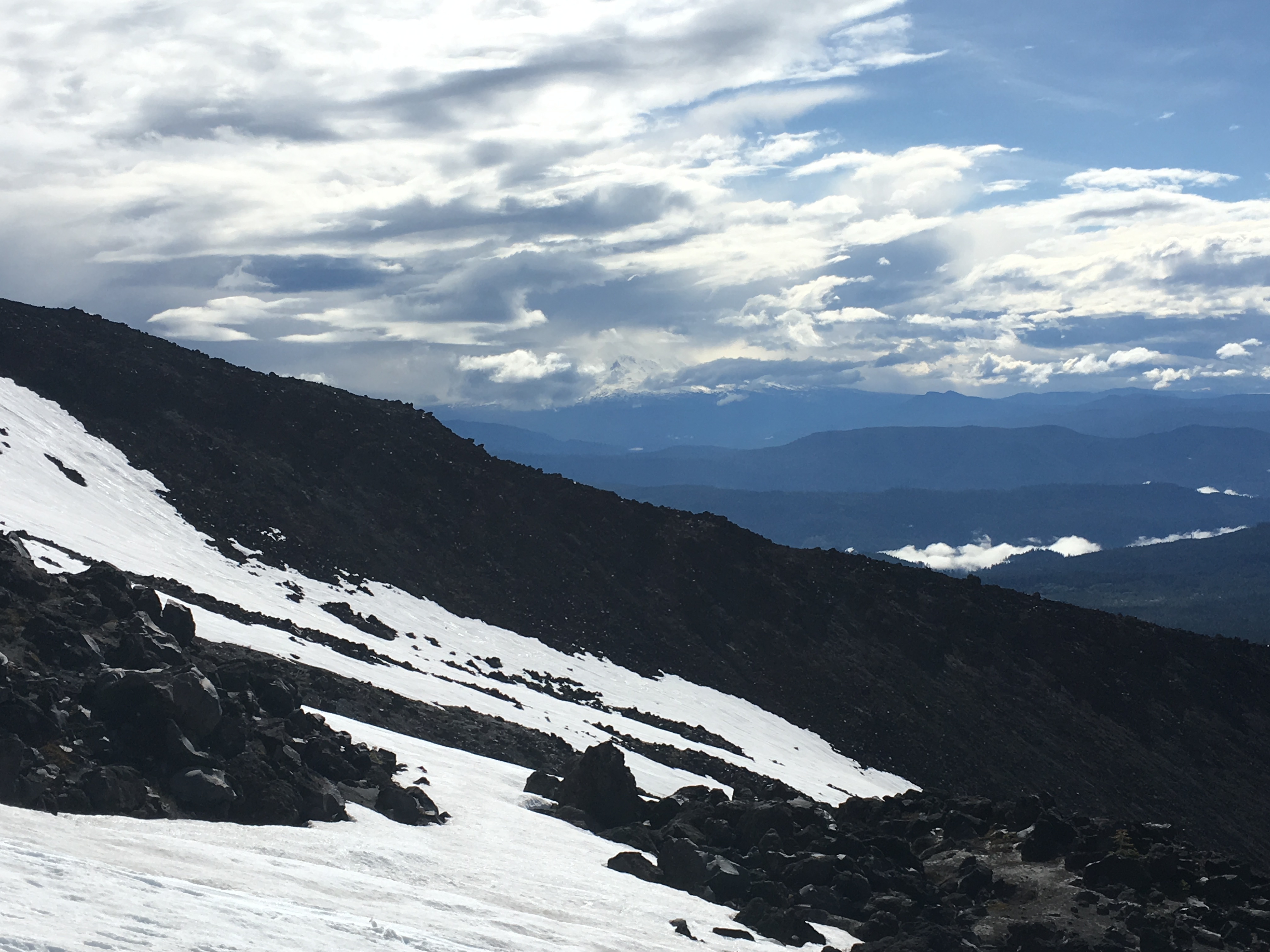
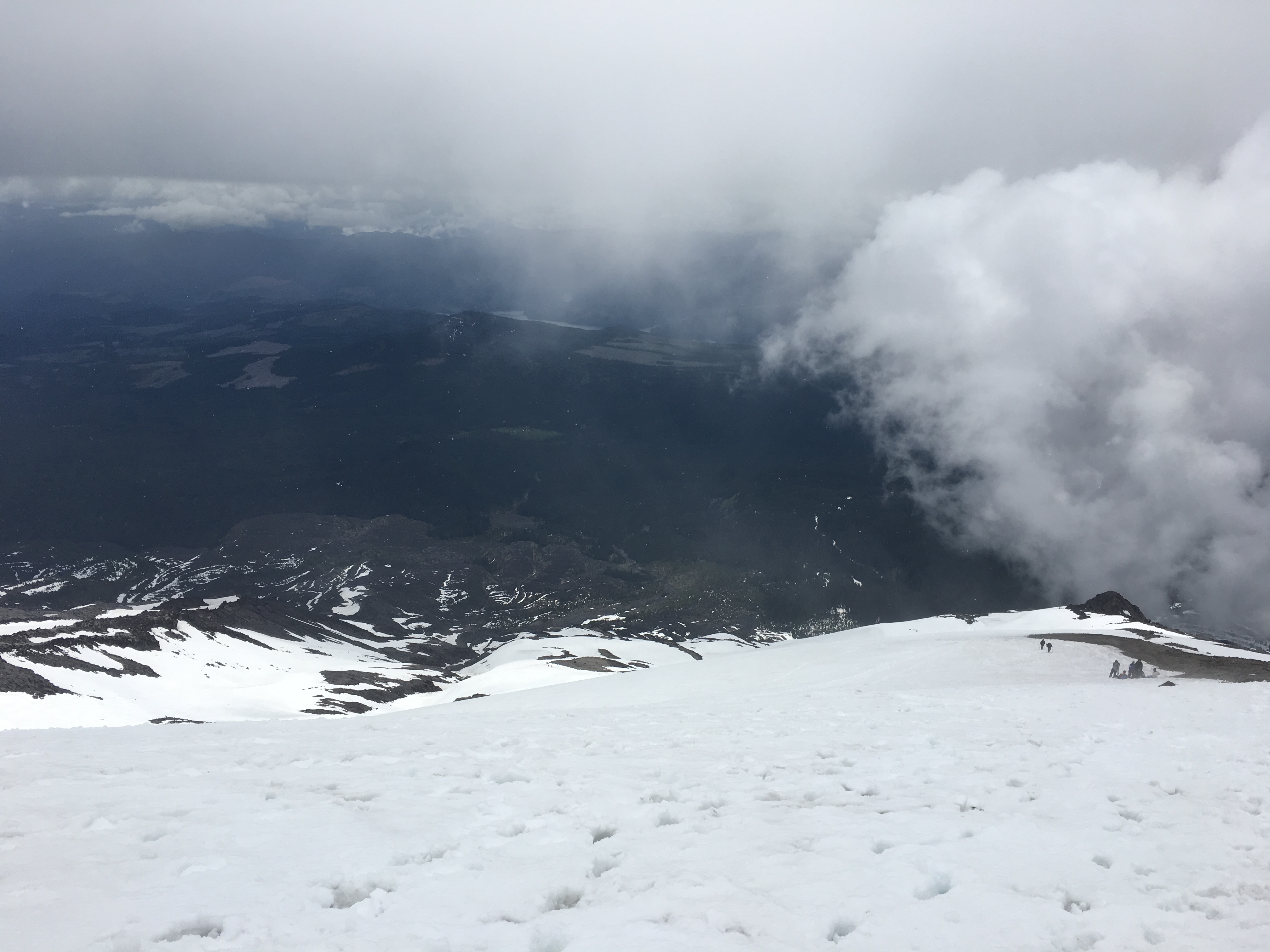
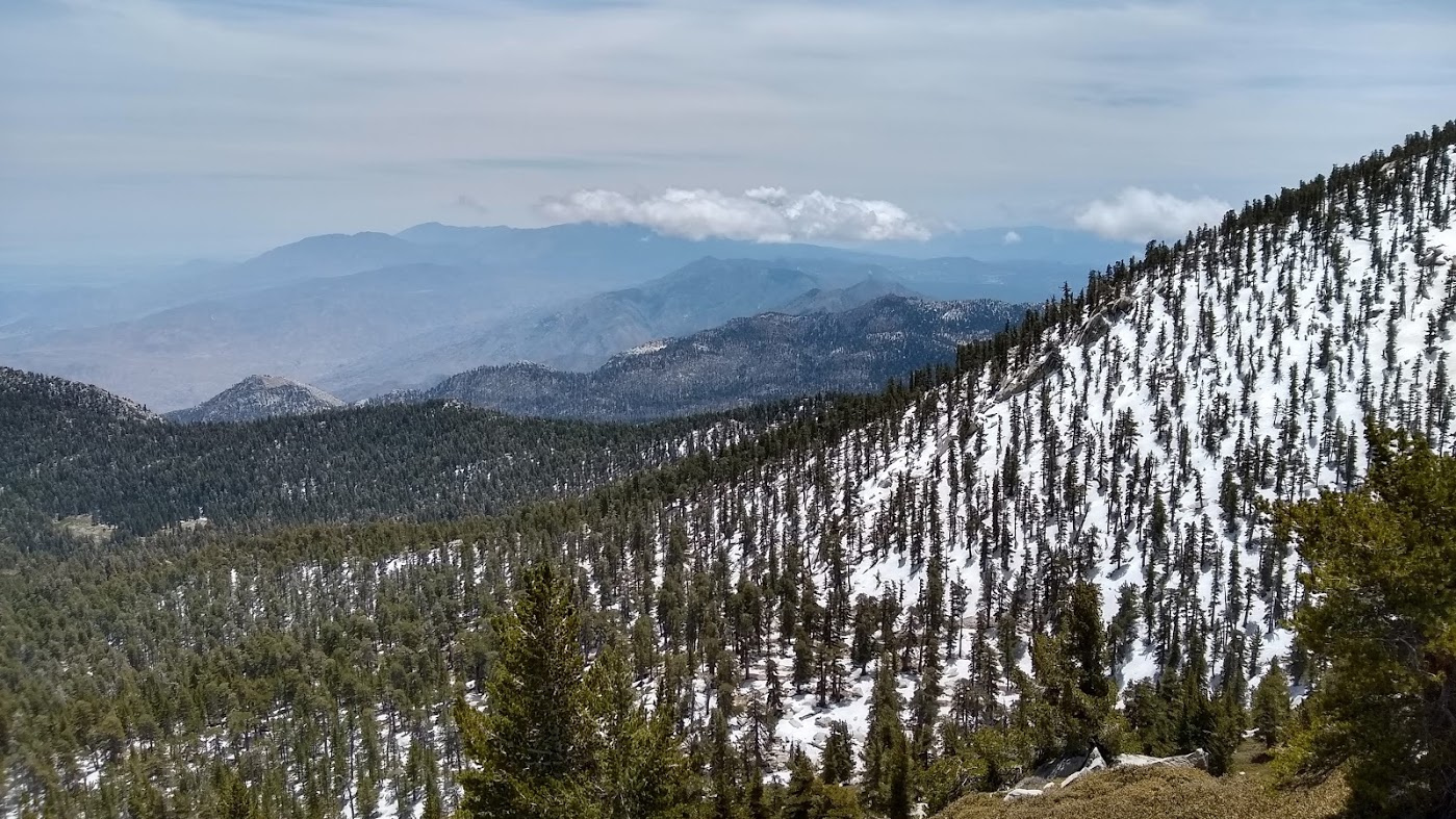
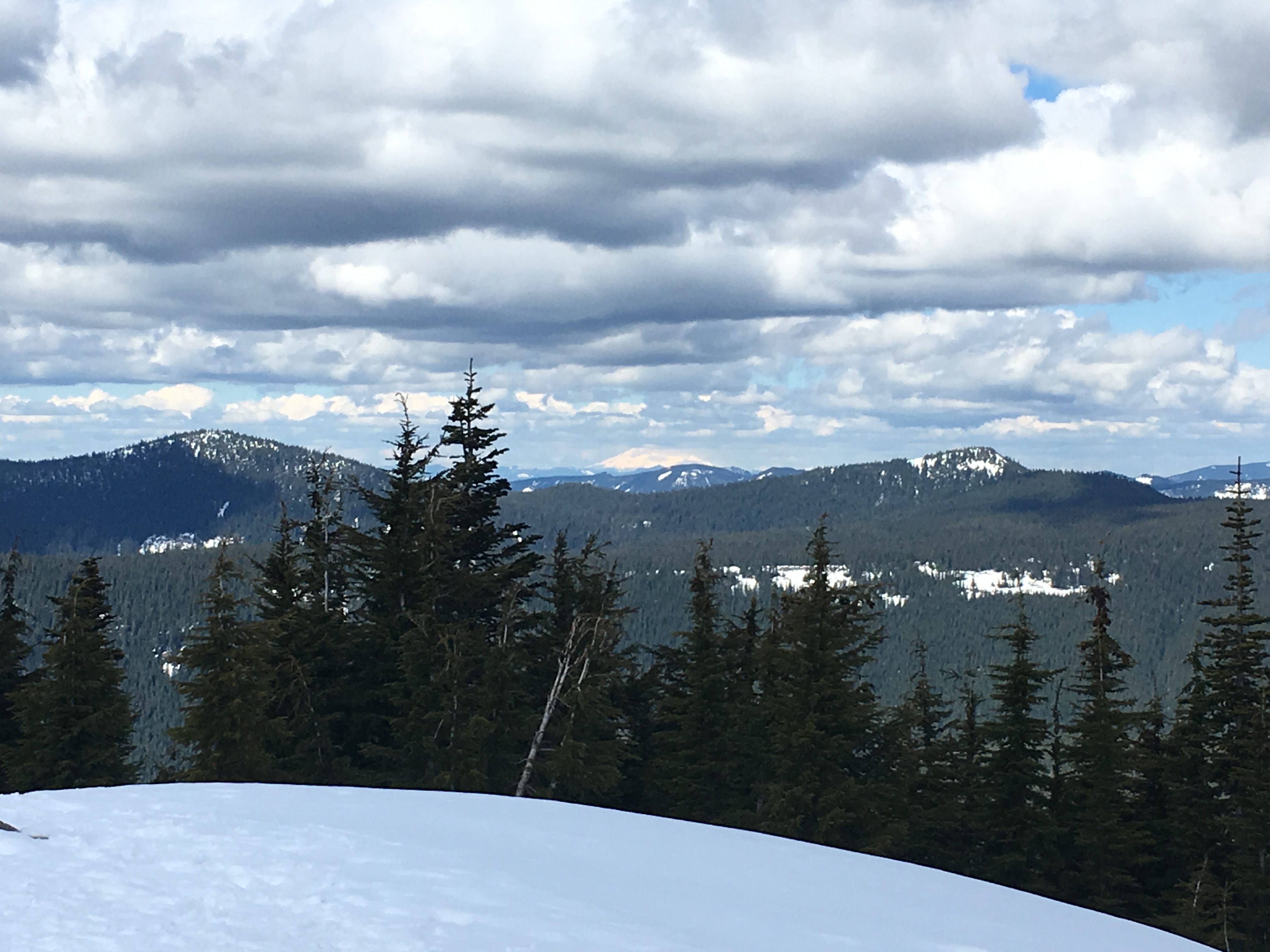
It is a cool trail. And from the top I had views of Mt St Helens, Mt Adams, and Mt Jefferson. Which is only possible on really clear days.

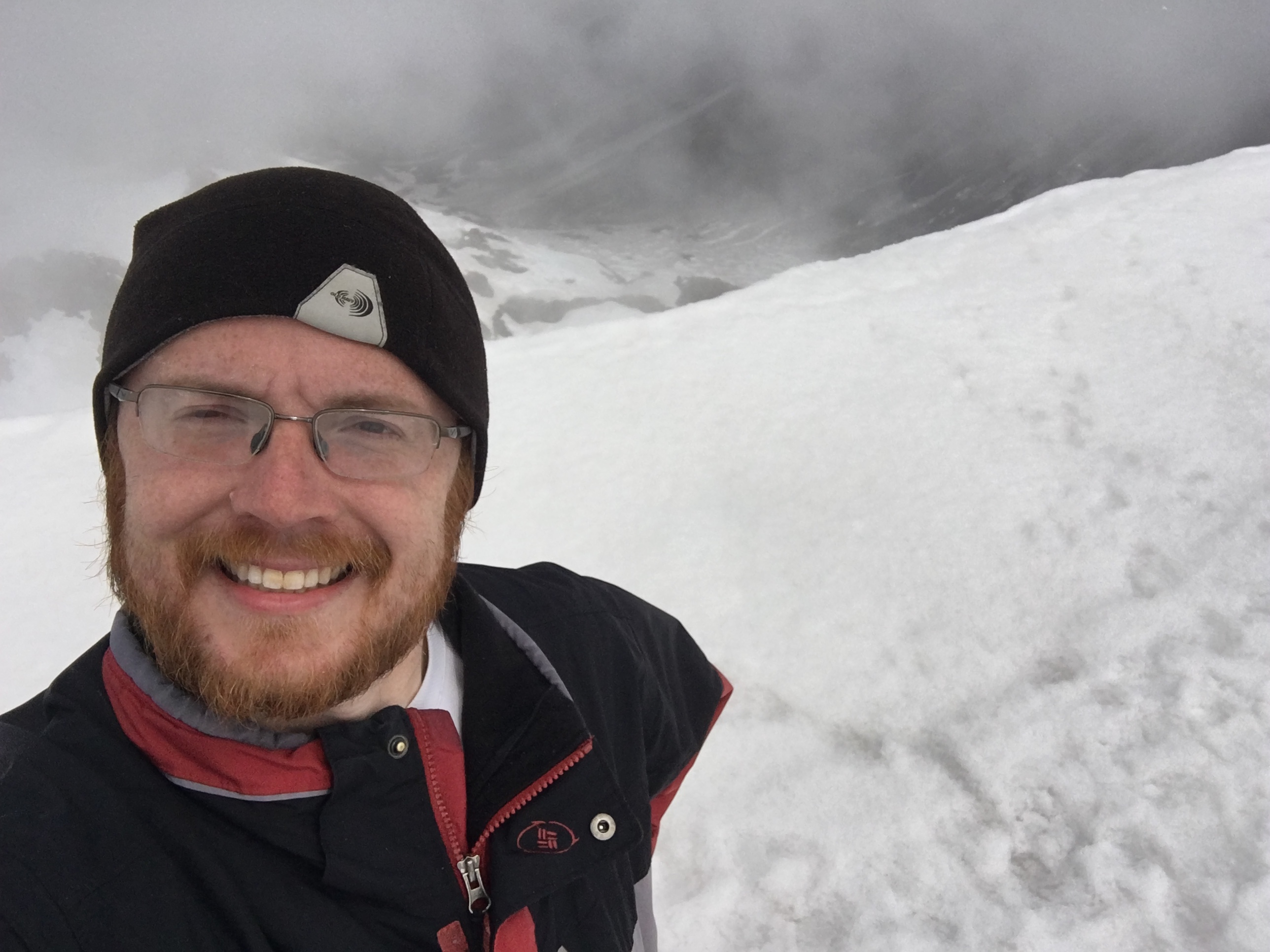
Me with my locally sourced, artisanally curved, wood composite climbing tool

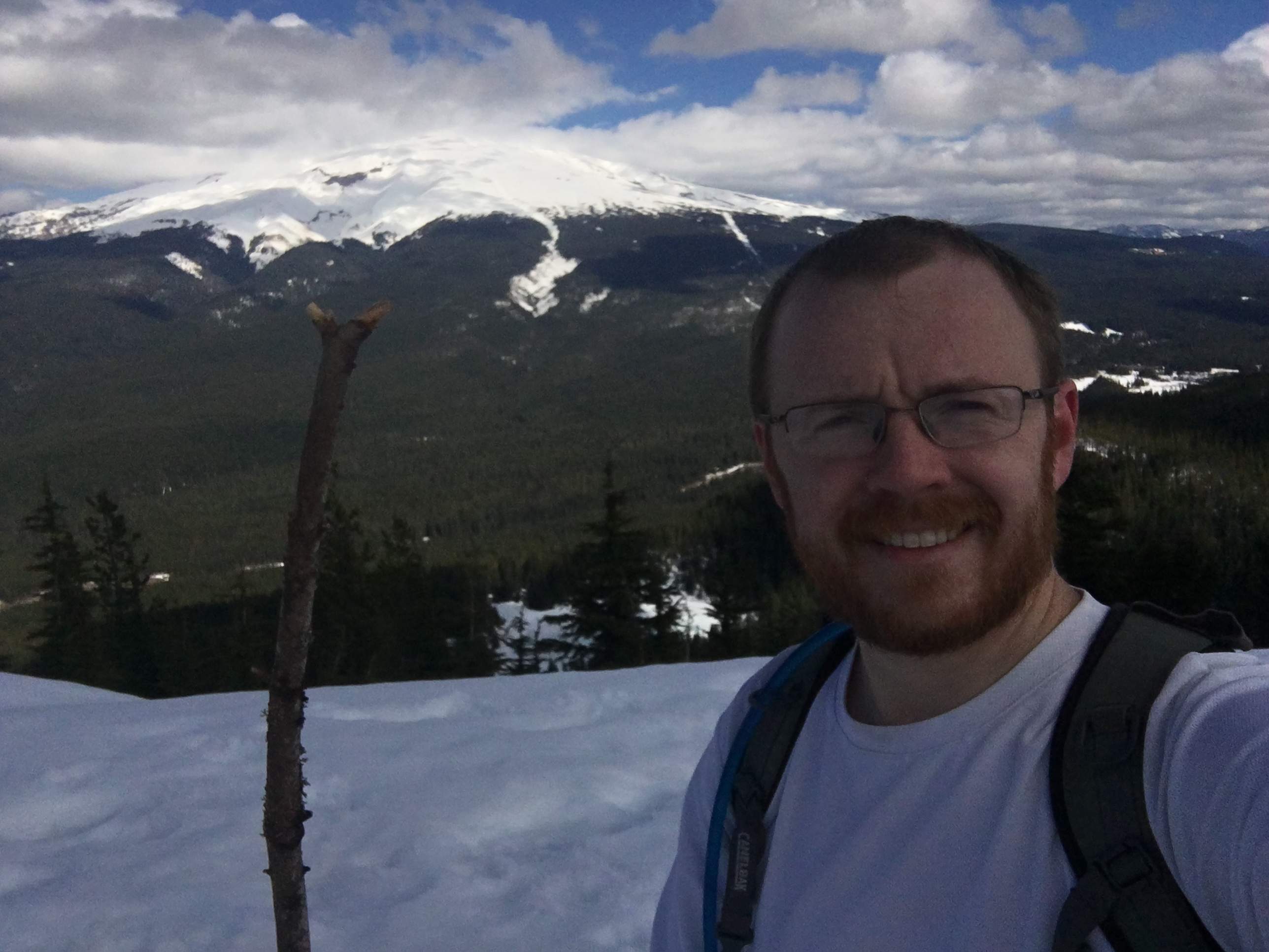
Aka the stick I found halfway up when it got slick.

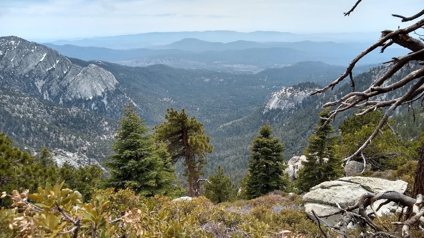
Portland is thataway

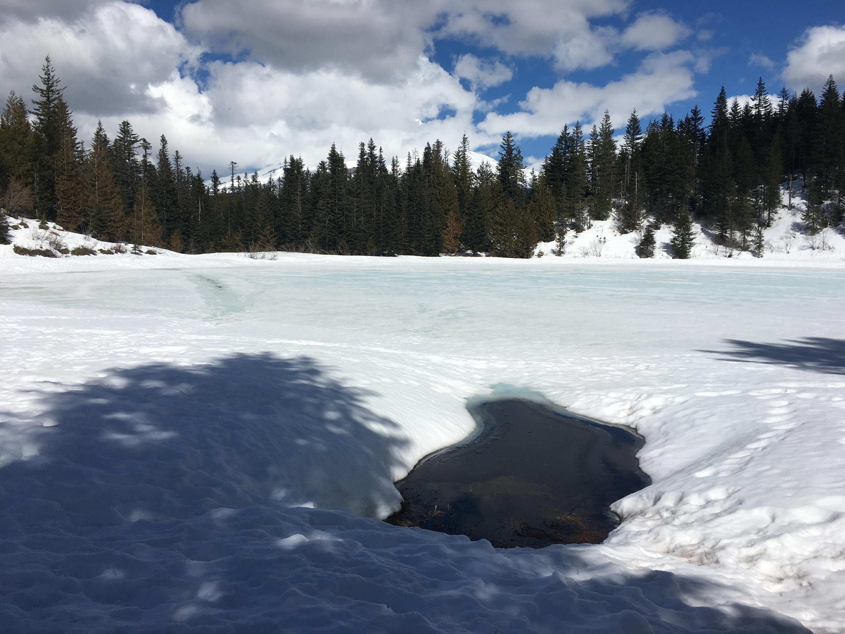
Open water! But no mirror…

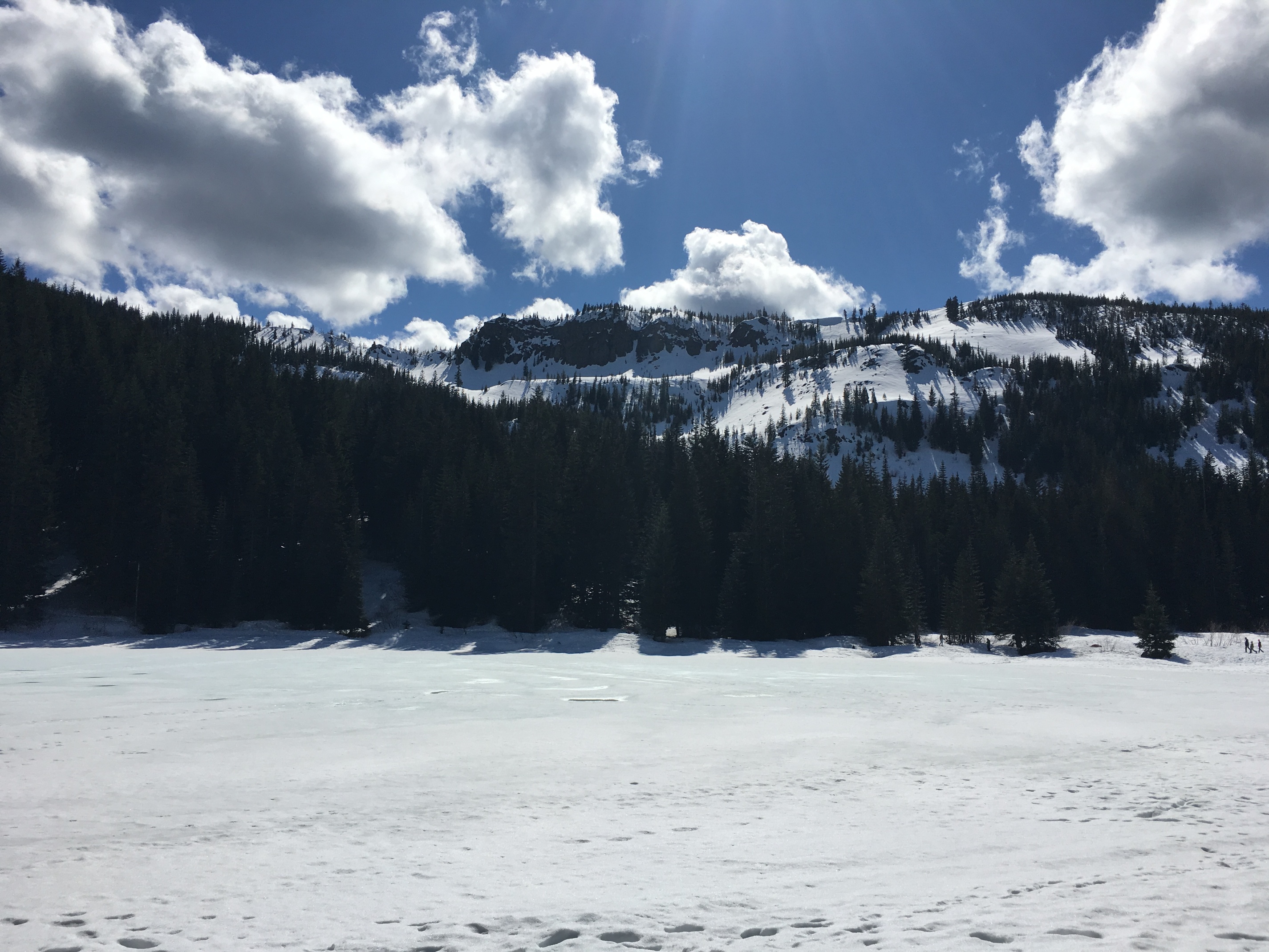
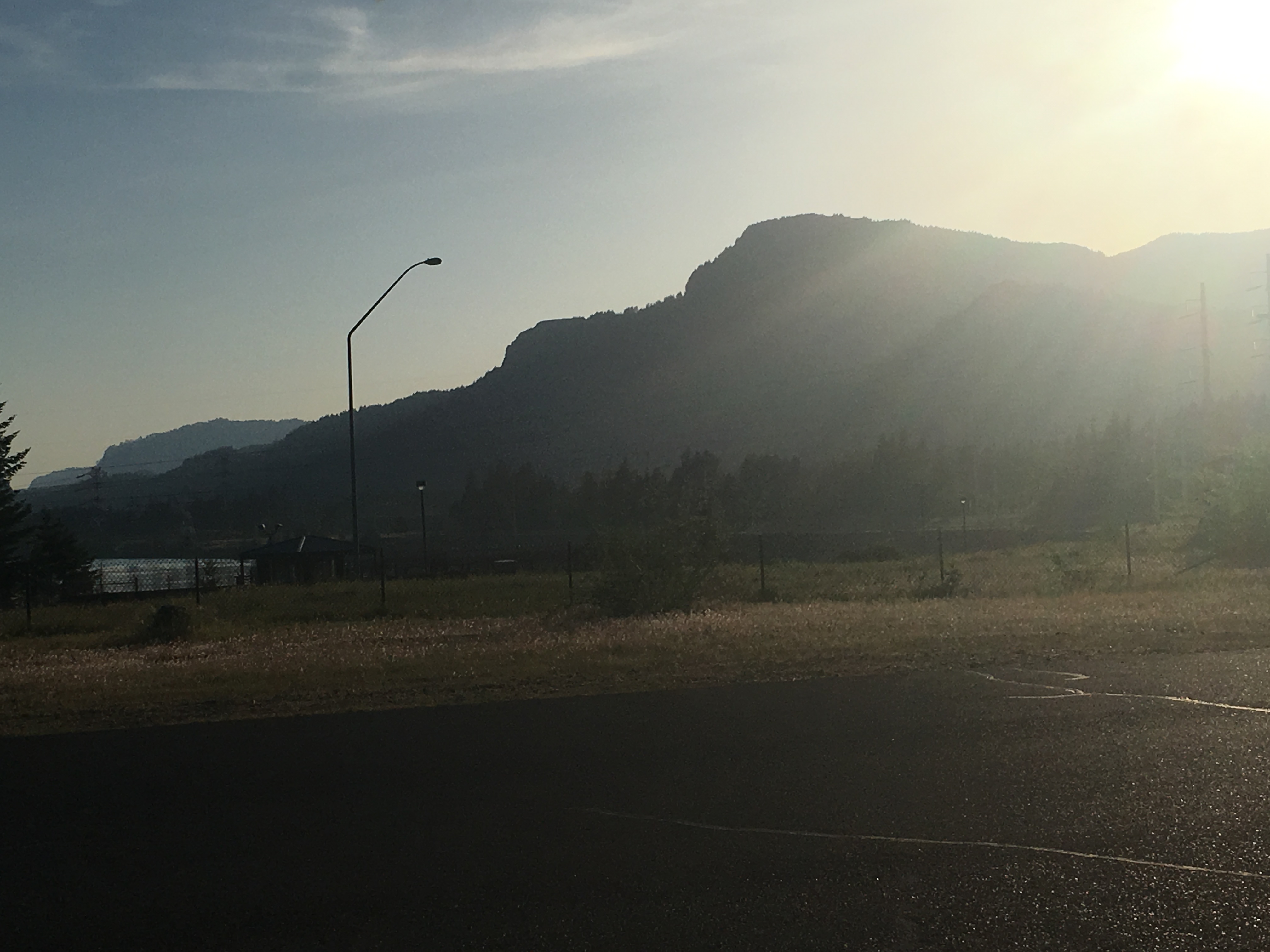
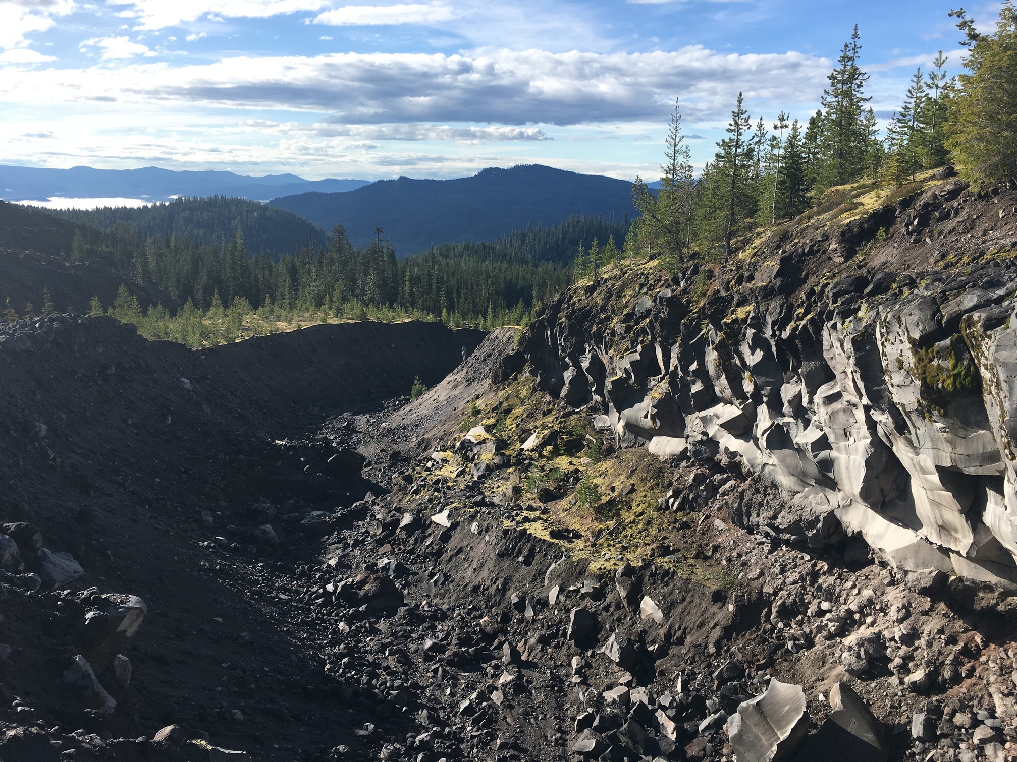
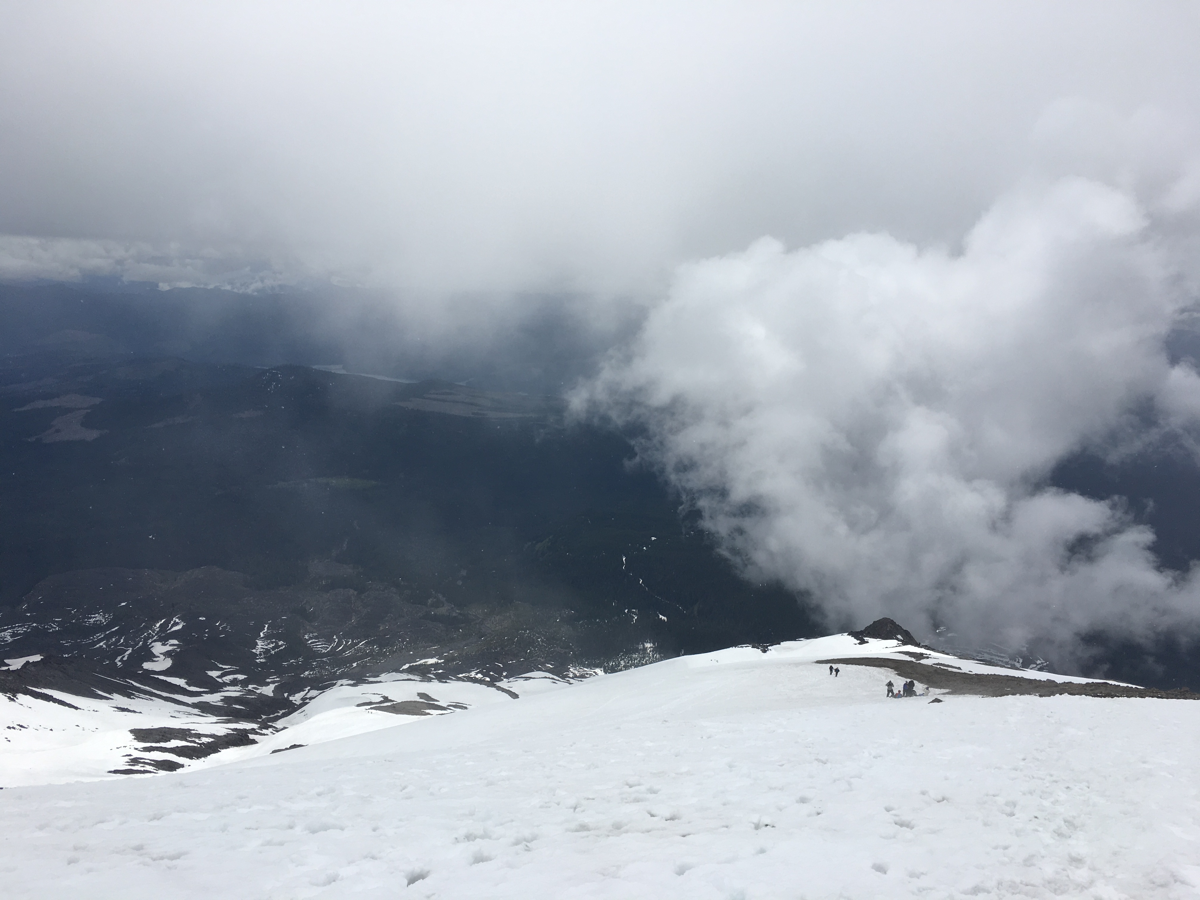
The Tom Dick and Harry ridge, where I had been.

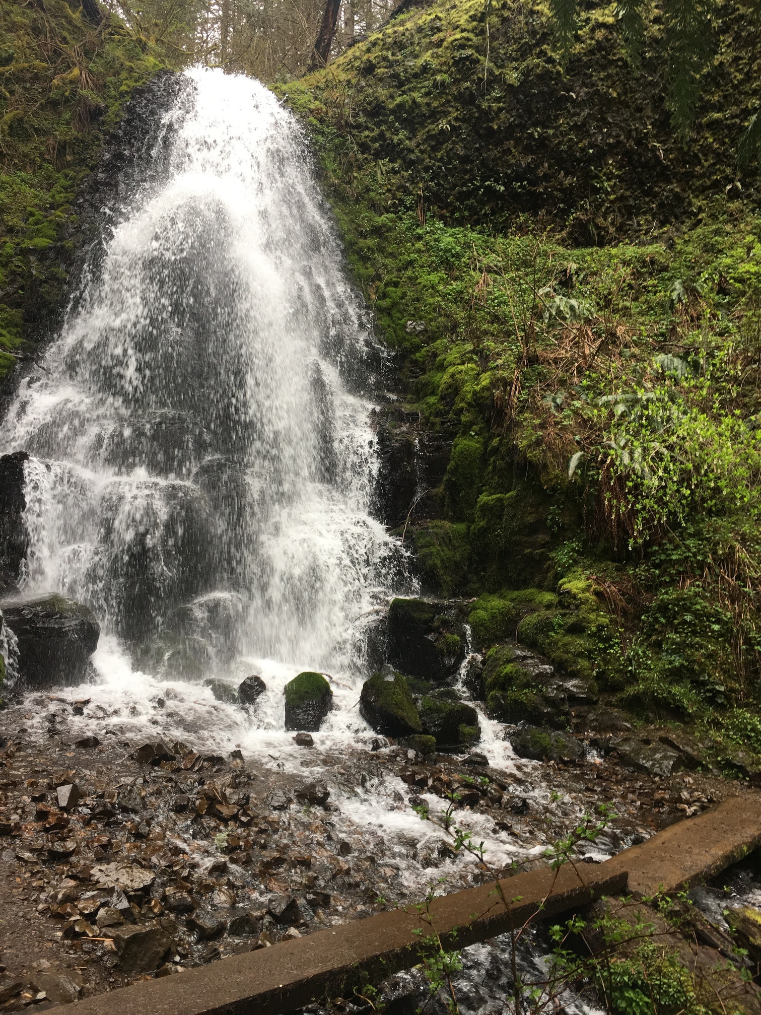
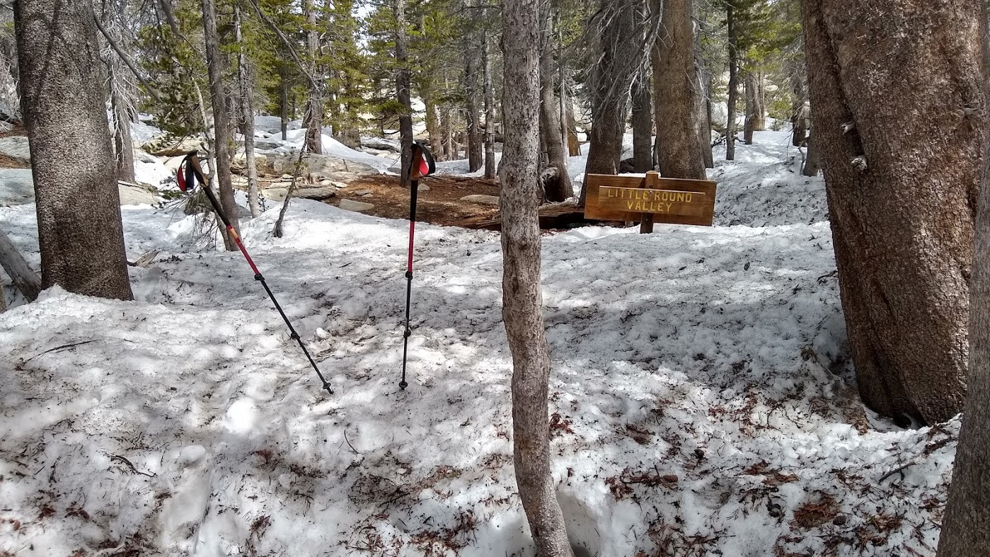
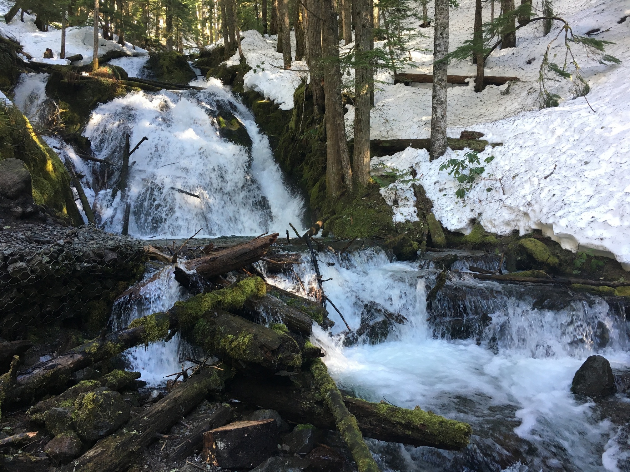
I had plenty of time left, as this wasn’t a particularly strenuous 9 mile hike, so decided to do a short additional, to the Little Zigzag falls.

Overall an easy day of hiking, about 11 miles total, but an enjoyable one. I think my decision to keep it lower elevation was the right one, as once I hit the lower trafficked parts of the Tom Dick and Harry, the trail became much harder to navigate, and the last bit was postholing with every step. Which just isn’t enjoyable. Had I done Hood proper, it’s unlikely I would have gotten the views, or enjoyment, of the hike I did.

That hike looks incredible Craig. I haven’t done any snow hiking at all, though my regular Meetup group has and is, in fact, going to attempt a Whitney summit in a couple of weeks. (I’d like to get at least a little familiarity with self-arrest and melting snow for water and some other mountaineering skills before I attempt something like that.) Mt. Hood is just so breathtaking, even in photos, and I love the juxtaposition of the green moss, white foam and speckled snow in those last photos. Beautiful!

One of the guys I hike with is trying to jumpstart a Youtube channel with interesting content, including videos of these hikes. He made one for the hike I did a few weeks ago:

Should have one for the hike this last weekend in a few days too.

Hike Report: PCT Section B, Leg 2 & 3, Chihuahua Rd to Hwy 74
April 6-7, 2019
24 miles total over 2 days

Like the Leg 1 hike I posted above, this was a point-to-point hike, so we had to arrange shuttles. Fortunately, it went much smoother than last time. We met at the Hwy 74 parking lot, then shuttled around (an hour long drive!) in half of the cars to the starting point on Chihuahua Rd where we’d finished in March. Some differences though:

  • last time was a day hike, and this would be an overnight trip.
  • last time, there was ample water along the route. This time, it was true desert hiking with no natural water sources at any point of the 24 miles, so we had to haul all of our water.

My pack base weight is something like 16 pounds, but with food and 6L of water (should have been 8L) it was more like 35lbs. to start, which took awhile to not feel heavy. Here’s a group photo at the start of the trail.

And marching down the trail in the first couple of miles.

A small group of us split off and took a small (very steep) side trip to summit Combs Peak, 0.6 miles off the trail. From the top, there was a great view of the “Three Saints”, the three highest peaks in Southern California, and the only three that top 10,000 ft.

Some really spectacular scenery and wildflowers

After about 11 miles, we found a great meadow to camp in (which turned out to be on private property, but no one hassled us), set up camp, ate, and then sat around with a bottle of rum someone was smart enough to bring. This is a great group.

A quite restful nights sleep and then sunrise over my tent.

Got up the next morning and stopped for water at a wildlife guzzler (a concrete cistern that catches rainwater for wildlife.) The guzzler’s roof had collapsed and the water was murky enough that you couldn’t tell if anything was in the bottom of the cistern, but filtering and boiling seemed to make it safe.

Hiked to the bottom of Nance Canyon (where we’d intended to camp, but found a better site earlier), and then started to hike back out.

There were a couple of water caches stocked by PCT Trail Angels

Views

Stopped for lunch at Brooklyn Ferry, which is on the property of a woman named Mary who maintains this whole thing for PCT hikers: covered picnic tables, a 500 gallon water tank, an outhouse and outdoor shower, space for camping. What an awesome respite!

A few more miles of hiking up and down along spectacular canyons and we made it back to Hwy 74, where we’d left the cars. Another hour or so of shuttling and we were done.

I fully expected this hike to be kind of a dull hike through the desert, but the landscape was consistently spectacular and surprisingly varied. Wildflowers were out in force and the temperatures maxed in the low 80’s, so bearable and mostly pretty pleasant. I’d love to do this one again next spring.

@Matt_W thank you. The internet is pretty limited in this dusty, rockets-always-incoming heckhole part of Afghanistan, but reading these posts really helps my mental state.

I don’t think that was a sentence but it’s 1 am here.

Hopefully this will also aid your mental state.

On the opposite end of the spectrum from @Matt_W’s climate, I hiked a section of the Columbia gorge the weekend before Easter. Not quite the PCT, it crosses the river about 10 miles east of my hike, but in the neighborhood.

First a start at Multnomah Falls

I had planned to go to Devils rest directly from here, but a rockslide the week before due to rain and the aftermath of a fire two years ago (the trail only opened back up in November) meant that the trail past the bridge was closed. Fortunately only a short jaunt west was another falls, and the boundary of the closed area. So I started my ascent there


The climb goes from about 160” at river to 2400” at the plateau. This is almost one of the shoulders of Hood, and where much of the watershed drains into the Columbia from Mt Hood. It’s a pretty steep canyon to ~2000”, then a large undulating plateau and series of ridges until you reach the volcano proper. I know you can hike to Hood from here if you wanted, but not sure the best route, probably not this though, a little far out. More interesting going through the huckleberry wilderness area I imagine.

Anyhow great views despite the weather


And in fact you can see where the streams emerge out of the bedrock in mini waterfalls sometimes. You may not be able to tell, but this is one such spring, the water comes pouring out directly from the cliff face. Like I said, plateau suddenly drops off from 2000” to about 200” over less than a mile of distance from the river, so groundwater and underground streams become above ground waterfalls and streams with frequency. Even the massive Multnomah falls are partially fed by such underground springs.

The trail crisscrosses various streams and falls constantly


So despite being a cold rainy day it was enjoyable. The view from the top across the river is great too, though a camera doesn’t do it justice.

And on the way down I took an alternate branch and was rewarded with a beautiful, and haunting, view. Haunting because the lookout point is named after a local firefighter who died during a forest fire, and well

Not my longest hike, was packed in the middle of a bunch of move related activities and the weather was sloppy at best. But still a decent 8-9 miles.

Stay safe there @Hal9000! Happy to post hikes to help your mental state.

@CraigM, man I really need to get up to Portland. I’ve been to Multonmah Falls many times as a kid, but never done any hiking around there. Looks like a great rain hike! Are you moving away from the area?

So, Mt. San Jacinto (pictured above in my last hike) looms directly above the city of Palm Springs in the desert. It’s part of a mountain range, but from the desert side of the mountain it looks like it sits by itself, rising directly from the desert plain to the clouds.

There are many paths to the summit (10,834 ft.), most originating from the southern or western side of the mountain in or near the mountain town of Idyllwild. From Palm Springs on the eastern side of the mountain, you can take a tram from the desert floor to about 8,500 ft of elevation, then hike from there 5.5 miles each way to the summit…

…or you can take an unofficial trail called the Skyline Trail, which spends 8 miles rising about 8,000 ft from Palm Springs to Long Valley (where the upper tram station is.) If you hike the Skyline trail to Long Valley, and then continue 5.5 miles to the summit, the hike is colloquially known as the Cactus-to-Clouds hike, or C2C. Most people then descend from the summit to the tram station and ride the tram back down for a total hike distance of nearly 20 miles with total elevation gain of 10,500 ft. It’s considered one of the hardest day hikes in the country, not just because of the steepness, length and altitude, but because even in April and May, daytime temperatures in Palm Springs can easily be over 100°F, and the peak can still be snow covered. (In fact, these were the conditions today.) A few dozen people have died on the route over the years, mostly due to heat exhaustion, particularly from turning back partway up and trying to descend in the desert heat.

I’ve never done the C2C before but I’m planning to do it with my hiking group in 3 weeks. I mentioned this casually to a buddy while car camping a couple of weeks ago and he seemed interested enough to do some research into the hike. He hasn’t done any serious hiking in years and was understandably concerned about his level of fitness. I remarked that he could test his mettle against our local El Cajon Mountain, which is generally considered one of the toughest hikes in San Diego County. He talked me into joining him last Saturday, and I recruited another friend from my hiking group. (She needed a warmup before running a half marathon the next day. Sheesh.)

El Cajon isn’t particularly high–about 3,700 ft–but the trail up there is quite steep and has the added bonus of having steep uphills and downhills in both directions. It’s about 11 miles total out-and-back. We started at 5:30am, with a goal of being back home before lunch.

Here are my hiking partners on an early downhill section

The trail winds around a canyon that often has running water in the spring

Usually there are amazing views from this bench at about the 3 mile point, but we were pretty socked in

Some nice views overlooking the Barona Indian Reservation

Final push to the summit

Made it! (This is me. I’m not soaked with sweat here; the fog was pretty thick and condensing on us. We got zero summit views, but took 30 minutes to snack and rest a bit.)

The sun came out during the descent (and we started to run into many hikers who didn’t get up at 4:30), so we got some more good views coming down.

Made it back to the car in about 5 hours total. My buddy kept up, but I’m not sure he’s gonna do C2C after I sent him this

Hike Report: Skyline Trail
May 11, 2019
Just under 10 miles total, 8,000’ of elevation gain

The intent for this hike was to do Cactus-to-Clouds: the Palm desert to the summit of Mt. San Jacinto. The hike occurs in two stages: the Skyline Trail, which ascends from Palm Springs, elevation 470’ to the upper tram station, elevation 8500’, followed by the summit trails, which ascend from the tram station to the summit at 10,500’. We didn’t actually make the summit, but it was still a calf-burning, epic hike. We covered about 80% of the intended elevation gain in about 70% of the mileage to the summit.

We met up in San Diego just before midnight Friday night and carpooled for the 2 hour drive to Palm Springs, arriving at the Palm Springs Art Museum at about 2am. The Skyline Trail–an unofficial but well-used trail up to the upper tram station and the San Jacinto State Park boundary–starts at the back of the museum parking lot. Here’s our motley crew of 6 intrepid hikers.


I had been able to get about 4 hours of sleep the evening before, but no one else had more than one. This proved, ultimately to mitigate the success of the hike. We started out using headlamps for illumination. For the first mile, there were painted flourescent dots on the trail to guide us on the proper path, but these soon petered out. In the dark, it was surprisingly easy to lose the trail and find ourselves scrambling over rocks on steep slopes cutting out switchbacks that probably would have saved us valuable energy. We took several unintentional “shortcuts” on the way up. The lights of Palm Springs were always at our back and with the headlamps, we had plenty of illumination to keep our footing.

After about 4 miles of continuous steep uphill hiking, topped a ridge and got our first view of the upper tram station, a tiny pinprick light on the ridge above us, still about 5 uphill hiking miles away.

Rule of thumb is that you lose about 5°F for every 1000’ of elevation gain. It was just under 70° when we started (and would end up being over 90 in Palm Springs during the day). By the time dawn broke, we were at about a mile of elevation and it was getting pretty cool. A short rain shower hit us when we stopped for breakfast.

But the rain soon passed

The views over the Coachella Valley really started to open up.

We passed a couple of rescue boxes with water, food, batteries, etc for hikers who run into trouble on the trail (as happens every year, especially during the summer.)

At about 7,000’ we got a view of the tramway cables just over the top of the ridge in the foreground of this photo. The ridge in the background is the path of the “Leatherneck Trail”: a very steep, exposed rugged, unmarked, unmaintained and unofficial trail up to the tram station.

The desert was quite pretty from up here


The last mile or so of trail was very vertical. (There’s nothing like a ludicrously steep trail after you’ve already been hiking steeply uphill for 7 hours to get your heart pumping.)

Coffman’s Crag was an excuse to pause for a minute and take a few photos after we stopped gasping for breath. We’re in the clouds here, so I guess we did hike from the cacti to the clouds.

And we finally topped out at Desert View (which had a magnificent view of the white nothingness inside a cloud) at about 10am.

Sleep deprivation, fatigue, cold and altitude had all taken their toll at this point. We hiked the 1/4 mile to the tram station, and after grabbing lunch at the restaurant there, decided to call it a day. We caught the tram down, grabbed an Uber back to our cars and headed home. Not summitting was a disappointment, but all in all it was a very satisfying and beautiful, if grueling, hike.

And I’m pretty sure I’m gonna tackle the summit next weekend via another route.

Nice trail pics @Matt_W

I also did a burner of a trail, though less elevation and more distance. And I also started much later (1:30pm).

Did Table Mountain, which is the ascent out of the Columbia River valley along the PCT on the Washington side. Now there used to be a trail head at the base of the ridge proper, but it seems in the last year or two that land was sold and the trail closed. So now you need to start at the Bonneville dam trailhead. Which moves the trail from 8 miles round trip to 16.5. Now, obviously, there is large stretches of gentle slope due to the longer trail, but realistically you only gain about 700 feet of the eventual 3300 (4000+ when factoring ridge crossings, but the base is 130” and summit 3400”) over the first 5 miles out.

Yeah, you can do the math. The last few miles aren’t messing around.

But it was a beautiful day. Clear skies and a great view of Mt Hood across the valley, and you can even see the dam.

Near Gilette Lake, about mile 3 and near the popular short and easy hike to said lake. Decent number of people here, very few beyond.


Some neat wildlife. I saw two hawks of unknown identity riding thermals along the ridge my entire trip down


The view from the end of the ascent. Wonderful view across the river. Hood is 25-30 miles straight line from here

Table Mountain is also one of the taller peaks right off the valley. From here you get the sense that the ridges in either side maintain a height of around 3-4000 feet, until you get close to the big volcanoes (Hood, St Helens).

Table mountain from the trailhead looking west


Bonus river shot

All in all a beautiful, but tiring, day. The last part to the summit, about 1 mile and 1400 feet, was brutal with lots of grapefruit sized gravel to scramble up. Going up wasn’t so bad, coming down was treacherous though. I looked like I took a dust bath by the time I made the PCT proper again, Table Mountain splits at about 1700” to do the ascent, the PCT skirts along the west shoulder instead.

All said, including lunch, took 5.5 hours.

Wow, nice long hike. Portions of my (probable) next weekend hike will be along the PCT as well. It’s pretty amazing that we can be on the same trail, 2,000 miles apart.

It’s definitely part of why I chose that hike. There’s something to the idea that I’m on a trail that crosses the country.

I’d love to conquer the south run from the Columbia to Mt Hood, but it’s a 52 mile stretch and I just don’t have the gear/ time/ logistics for that. Plus doing 50 miles back country solo isn’t the best idea ;)

Well last minute planning, but looks like I’m a go to summit Mt St Helens on Sunday.

Should be fun, hopefully the weather is decent, the forecast is ok, but the chance of rain is real.

Well today I had a hike for the summit of Mt St Helens all set up. Had it all planned, backpack and clothes all set for the 4:30 alarm. It’s a two hour drive and I wanted to be on the road by 5. By the time I had my tea made, and my traditional mountain climbing breakfast (roast potatoes with onion, cheese, two eggs over easy and a generous helping of hot sauce) I was in my car ready to leave by 5:05.

My plan was to head to the climbers bivouac trailhead. It’s one of two routes, both ending roughly the same spot, but starts an extra 800” up and a mile and a half closer.

As I arrived I got a nice shot of the volcano crest near where the road splits

The weather report was mixed, but it had been like that all week. Today was the best day, and if I hit the summit early I should be able to avoid the worst of…


Oh.

Poop.

Well fortunately I was prepared with multiple trail maps, and the alternate route, starting at Sno-Park is only a 5-10 minute drive away. Annoying, but not the end of the world. But instead of starting at 3500” feet and having a 9 mile climb, I’ll be starting at 2600” and have an 11-12 mile climb. All said 5500” vertical ascent. Back loaded, 2500” of that is over the last mile to mile and a half.

But that story is coming yet.

Anyhow the start is a nice scenic forest with lots of huckleberry bushes just getting in bloom. One interesting thing is that the lower elevation were fruiting already, while every step I took up, I could trace the process backwards. Before the bushes gave way to the mud flow canyon I could see they were just starting to bud, at the 4000” mark.

Which is about where I was treated to this sight


As you can see, the weather is quite gorgeous today. At least at this moment. But within 10 minutes of that shot I was feeling rain. A single solitary rain cloud had spilled out over the rim, and was providing a light drizzle.

It didn’t last long, but the weather was giving warnings.

At the timberline, the market where you need the summit pass to go further, looking back towards the Columbia River

And the first signs of what was to come

More to come. I took a lot of pictures. The mountain really was beautiful today.

Anyhow I continued upwards . The ascent was still pretty easy. I had set an aggressive goal of doing he summit in 2 hours. And I was cruising along. I was over halfway at the 1 hour mark.

So this is called the worm flow trail. So called because there is a lot of volcanic ash, rock, and debris from the eruption. This path follows a crevasse, seen above, all the way up. There is running water at times, even a few small waterfalls

But as you get further up, the ground becomes significantly broken. Now I’m in gym shoes, no crampons, and have two walking sticks, and I do mean sticks. But I’ve done a ton of climbing in the area, in worse conditions, in this getup. So I’m not concerned.


Just like being on Elk Mountain!

Now I was tracing a blistering pace. There are only 100 permits per day, and by the time I hit the weather station, the 4.25 mile mark, I had passed 34 people still doing the ascent. I started my hike at 7:30, and most people I passed said they started at 5:30-6. I also passed another 15 people who were coming down and had turned back short of the summit, most at the weather station. On the day I suspect only about 30 people would make the summit (I saw pretty much every person on the trail at one point or another, including every single person who summited, or was looking likely to summit. 30 is a very reasonable number, and may be a tad high even).

Anyhow I was flying. I hit the weather station just off my pace. 1:45. Ok, two hours wasn’t going to happen, but that was perhaps too aggressive, 2:30 was a more reasonable goal. But the problem is that past the weather station may only be 20% of the distance, but it is 45% of the ascent. And the wind was getting pretty ferocious. Plus the summit was shrouded in clouds, and it was snowing lightly that high.


But looking back it was still quite clear! And I could even see Mt Adams

And here is where the trouble starts. As you can see, there is no trail. It’s a series of scrambles on ridges and spines, then across steep icy snow. And, ironically, the snow was easier to traverse. All while gaining altitude on a 40° slope. The trouble is that this ground is a combination of ash, silt, dirt, and gravel that has no stability. Punctuated by chunks of volcanic rock, and heaps of former peak. Given my gear I had to pick a slow and deliberate path, and I was burning from the exertion and elevation.


What I thought was the rim, I would later discover was still about 800” of climb below. But the angle obscured the true peak from here. If you look closely you can see a group that would reach the peak about 5 minutes before me, hear the far spine.

And while the wind, which turned back many people on the day, was not particularly bothersome to me at this point, the cloud cover was going to. It seemed that the window of good visibility was closed

But I would not be deterred. View or no view, I was going to make it. And shortly after that picture, I did.

Anyhow the visibility was shot, as you can see from the reverse shot there is none, but I was hungry, there was a crowd of about a dozen people who were there, or arrived not long after me, so I had lunch at the top, and talked with others. It’s be a real waste to rush down without seeing. I could relax a bit and eat to see if the clouds blew out.

One eerie thing was we heard half a dozen mini avalanches inside the caldera. As you can see the snow overhangs the rim, and the acoustics of the ledges breaking off in the warm weather echoed across. One late arrival thought he was hearing an airplane when a particularly large and long duration avalanche occurred. When I pointed out that, no, it was snow breaking off, he took a few very large steps away from the rim.

Anyhow patience was paid off. All said I relaxed, ate, and talked to people for nearly an hour. I’d made the summit in 3:30 roughly, and so had time. Well turns out that I got a window. After an hour I was able to see into the caldera

It was brief, and after about 5 minutes it clouded up again. Not as bad as before, but enough. Time to begin my trek down.

And by reek, I meant sliding for about 3000” of elevation. Yup, I sat on my butt, gave a scoot, and was going down the mountain in style!

Worth it

All said it took me about 6 hours going up and down, excluding lunch. But now I’m tired and hungry, and going for pizza.

Thanks for sharing your adventure, it was fun to read!

Woah, awesome hike report. I love those pictures into the caldera. St. Helens isn’t a hike I’d ever contemplated before. Looks awesome!

I’ve got photos from my actual (vice aborted) San Jacinto ascent last weekend that I’ll post up tomorrow.

Nice, can’t wait to see them.

So, I did tackle the summit the next weekend from another route.

Mt. San Jacinto Summit via the Deer Springs Trailhead - 19ish miles - May 18, 2019

This is a “lollipop” route: you hike 4 miles into a loop that runs for 10 or 11 miles, then hike back out to the trailhead.

The Deer Springs Trailhead is located in the mountain town of Idyllwild, at about 5,500’ of elevation. It’s a two hour drive from San Diego, and I got to the trailhead at about 6:45am, scarfed down some oatmeal, tanked up on water, and shouldered my pack. It was chilly (low 40’s), but I run hot when hiking, so I set off, shivering a little in my shorts and t-shirt.

A couple of miles down the trail, I got a great view of Lilly Rock and Tahquitz Peak behind it from the spur trailhead to Suicide Rock. Tahquitz is nationally renowned rock climbing territory–the origin of the Yosemite Decimal System (despite being nowhere near Yosemite), which is the standard way to rate climb/hike difficulty throughout North America.

At 4 miles, I reached Strawberry Junction and hooked up with the PCT. I continued north on the trail to do a clockwise loop.

In a few places, the trail was a streambed due to runoff from the high snowfall this year.

I started to see snow on the trail as it ascended to above 9,000’.

I departed from the PCT where it heads down Fuller Ridge and kept ascending toward Little Round Valley. Many PCT hikers also take this route to the summit as a side trip. I had to make several stream crossings.

At Little Round Valley the trail finding became pretty difficult. I mostly just had to point myself in the right direction and hike over the snow until I got a glimpse of something trail-like. Google maps kept me on-route. I brought crampons, but the snow was too soft to use them. Full points for my merino wool hiking socks. I was wearing trail runners and my feet were soaked through during the snow part of the hike, but were never cold, and they dried quickly during the descent.

There’s a campground here, but the facilities aren’t very accessible yet

The final push to the summit is normally a scramble over a boulder-field, but right now is a steep trudge through deep tracks in several feet of snow:

Finally made the summit though, and the views are just spectacular in every direction. I pulled out my A16 3-Peak Challenge flag here to document my ascent. San Gorgonio (another of the 3 peaks) is visible in the background of this photo.

I ate lunch at the summit and descended, turning east to continue my loop. This is the route people take when hiking to the summit from the tram. My hike had been almost entirely solitary in the morning until I reached the summit, but now I passed dozens of hikers coming up as followed the switchbacks down toward Wellman Divide.

At Wellman Divide, I left the crowds behind again and kept descending to the junction with the PCT where it ascends the Devil’s Slide trail. The trail along the PCT from the PCT/Wellman junction west to Strawberry junction is easily the most beautiful part of this loop (excepting the summit.) There are gorgeous views down the valley into Idyllwild, with Lilly Rock and Tahquitz Peak on the left and Suicide Rock on the right.

Before long, I’d reached Strawberry Junction again and jogged the 4 miles back down to my car. I got there at about 3:30pm, so the whole hike took about 8.5 hours, including lunch. 5 stars: would hike again.

Very cool hike. It seems San Gorgonio is the ‘hardest’ of the peaks in the challenge, as it is the only one where the minimum distance is over 15 miles. The shortest ascent I saw was 16.5 miles I think. The other two could both be done under 10.

Which makes me think the 24 hour challenge is crazy. I’m a mile burning runner who all but jogs up mountains and I don’t think it would be possible for me. Baldy and San Jacinto in one day? Yeah I could probably swing that. But doing all three?

Heck the 3 day challenge seems crazy. I’d be hurting after doing two summits.

That said, it seems you and I are of a similar type. If you ever come up to Portland while I’m still here, we’ll do Mt Adams. That’ll match anything you’ve done for distance and intensity, I promise. And you’re the only person I know who could keep up with the pace I like to set!

There are two guys in my hiking group who did it in 22 hours last year and are planning to do it again this year. The tricky part (apparently) is the tram schedule for San Jacinto, since it only runs during certain hours and can get backed up with long waits by mid-day. I think I could do the 3 day challenge (a bunch of folks in my hiking group did it last year), but the 24 hour challenge is probably beyond my abilities.

I will totally look you up when/if I make my way up to Portland! And if you’re ever in San Diego or SoCal, we should do something around here.