Trip report: Cottonwood Lakes Loop, including Mt. Langley ascent - August 2018
Total trip length: about 32 miles. Online hiking profiles show 24 miles for the loop and 5 miles round trip for Langley (from the loop). We measured 32 with GPS, maybe due to some unnecessary backtracking and faffing around near the top of New Army Pass.
Elevation: minimum 9900’, maximum 14,026’ (Langley summit)
Duration: 3 days, 2 nights hiking. We also camped out at the trailhead the night before setting out.
Location: Eastern Sierra mountains in northern California. Mt. Langley’s summit is less 5 miles as the crow files from Mt. Whitney’s summit. (Though hiking from one to the other is 20-30 miles of hard hiking.)
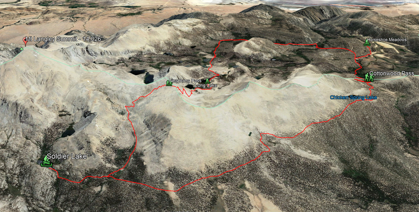
The hike: The loop itself is outlined in red. I don’t have GPS fixes for the hike up Langley, but the map shows the summit. We did a clockwise route, starting at Horseshoe Meadows.
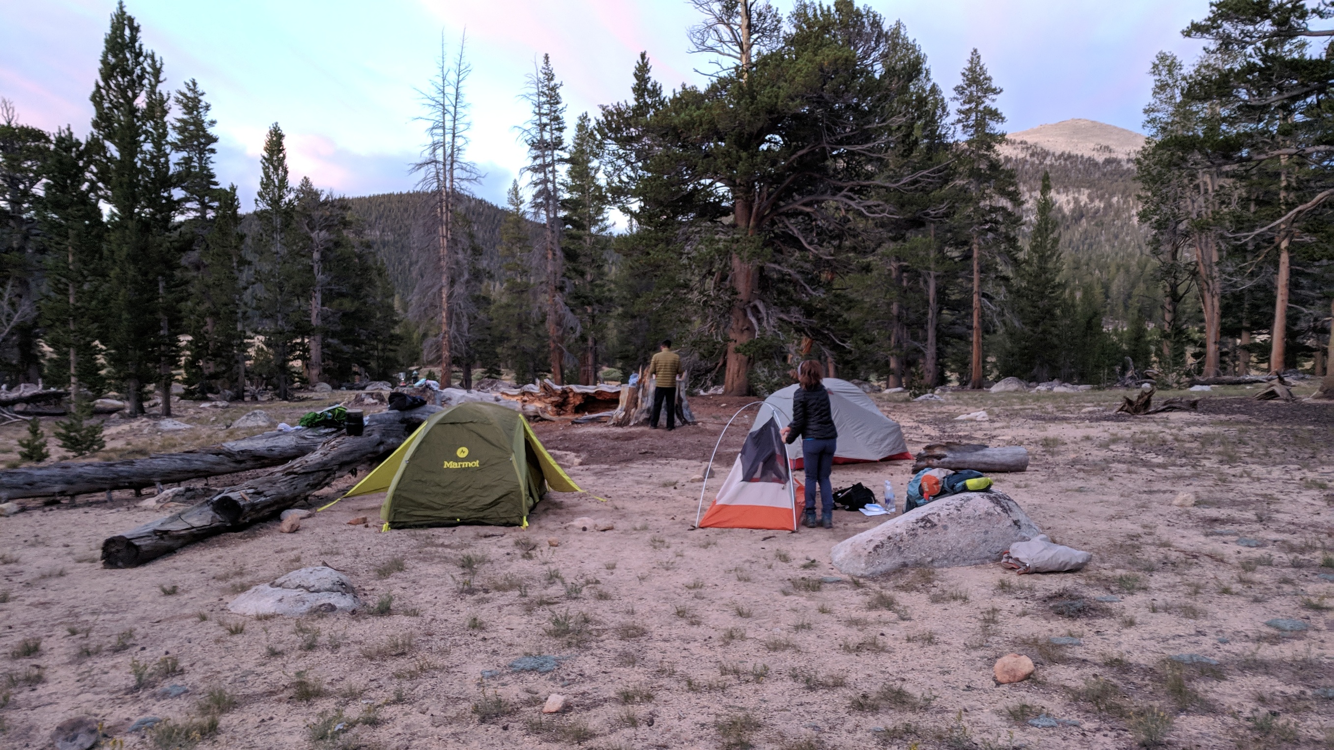
I hiked with two friends: James and Andrea. This was a first backpacking trip for both me and Andrea, so we learned some lessons. We all left work early and drove the 7 hours to Lone Pine on Friday afternoon. We drove up the mountain, arriving after midnight and set up camp in Horseshoe Meadows at the trailhead.
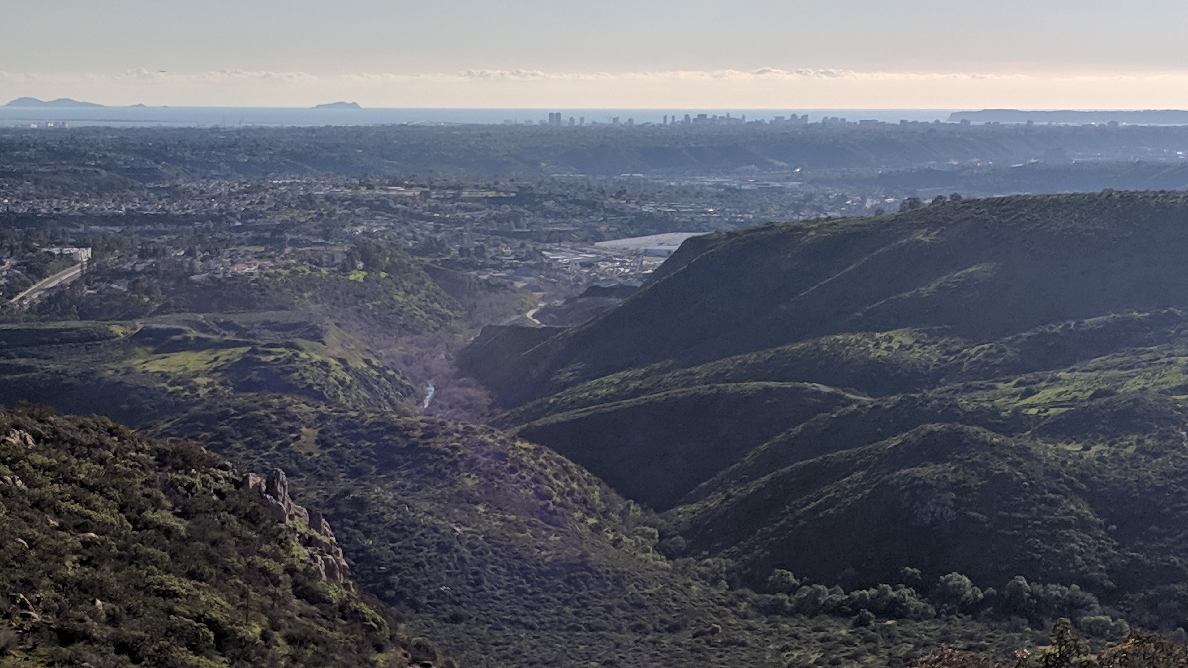
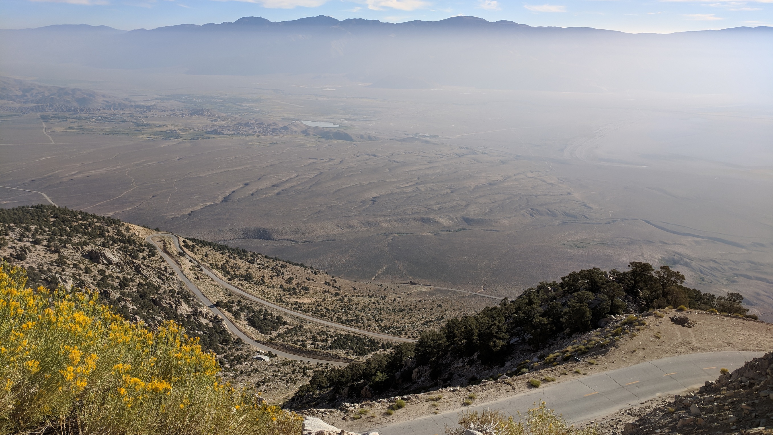
The next morning, we had to drive back down to Lone Pine (30-40 minutes each way) to pick up our backpacking permits from the National Park visitor center. The views out over the Owens Valley as you descend the mountains to Lone Pine are pretty breathtaking:
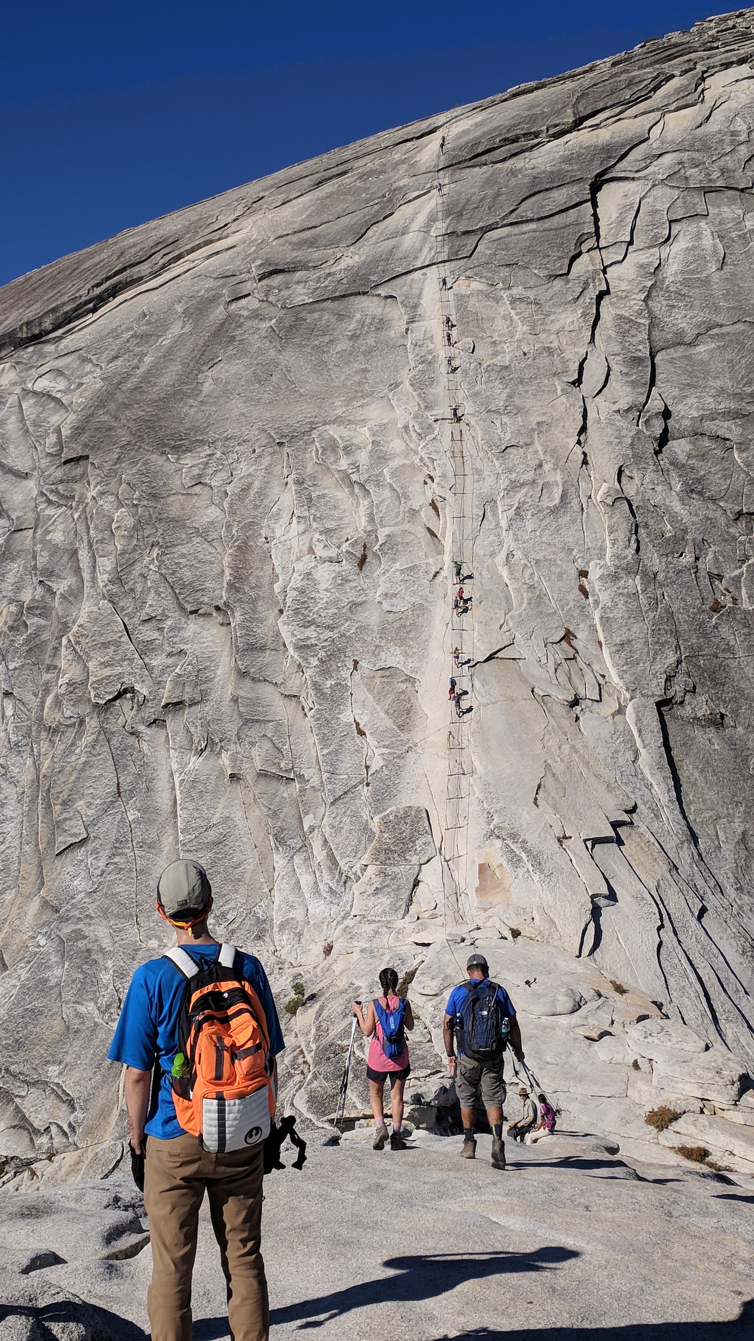
Got back to the trailhead at around 10am and started hiking. Here are my hiking companions, James and Andrea. Note: in the Sierras, you’re required to bring a bear canister if you’re backcountry camping. The canister is huge and bulky and weighs about 4 pounds on its own. We were able to fit our food (and toiletries) into two of them that James and I carried. (Andrea took some of our gear.) But that sucked.
We ascended Cottonwood Pass and hooked up with the Pacific Crest Trail at the top
Ate lunch at Chicken Spring Lake, which is a popular stopping point for PCT hikers.
Then we hiked alongside a ridge, arriving at our first night’s campsite, Soldier Lake, by about 6pm.
Campsites there are on a rocky promontory at the bottom of a bluff on the lake shore. There isn’t a huge amount of space, and when we got there, there were only a couple of spaces left. But, when we tried to set up our tents, we got gruffly chewed out by an older guy who said he was sick and didn’t want anyone near him. We acquiesced then and fit our tents in and around other campers, but in the future I’d tell the guy to pound sand.
So, I was pretty cold that night. Temps were in the mid 30’s, and I didn’t have much experience keeping warm. It was a rough night’s sleep. Now I’ve got that system all worked out. No change in gear, just a change in how I sleep and what I keep nearby.
The next day was our big hiking day. We had a long ascent up the backside of New Army Pass, and then an ascent of Mt. Langley. There were no water sources until camp that evening, so we filled everything up and carried about 5L each up the pass. 5L is 11 pounds of water. Ugh.
Trudging up the back of NAP. The pass is actually off the image to the right.
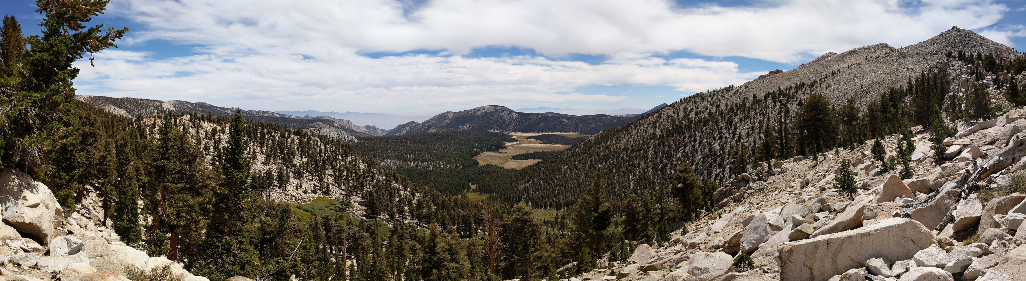
View from the top of New Army Pass. (I have this image printed on a 24x36 canvas hanging on my kitchen wall.)
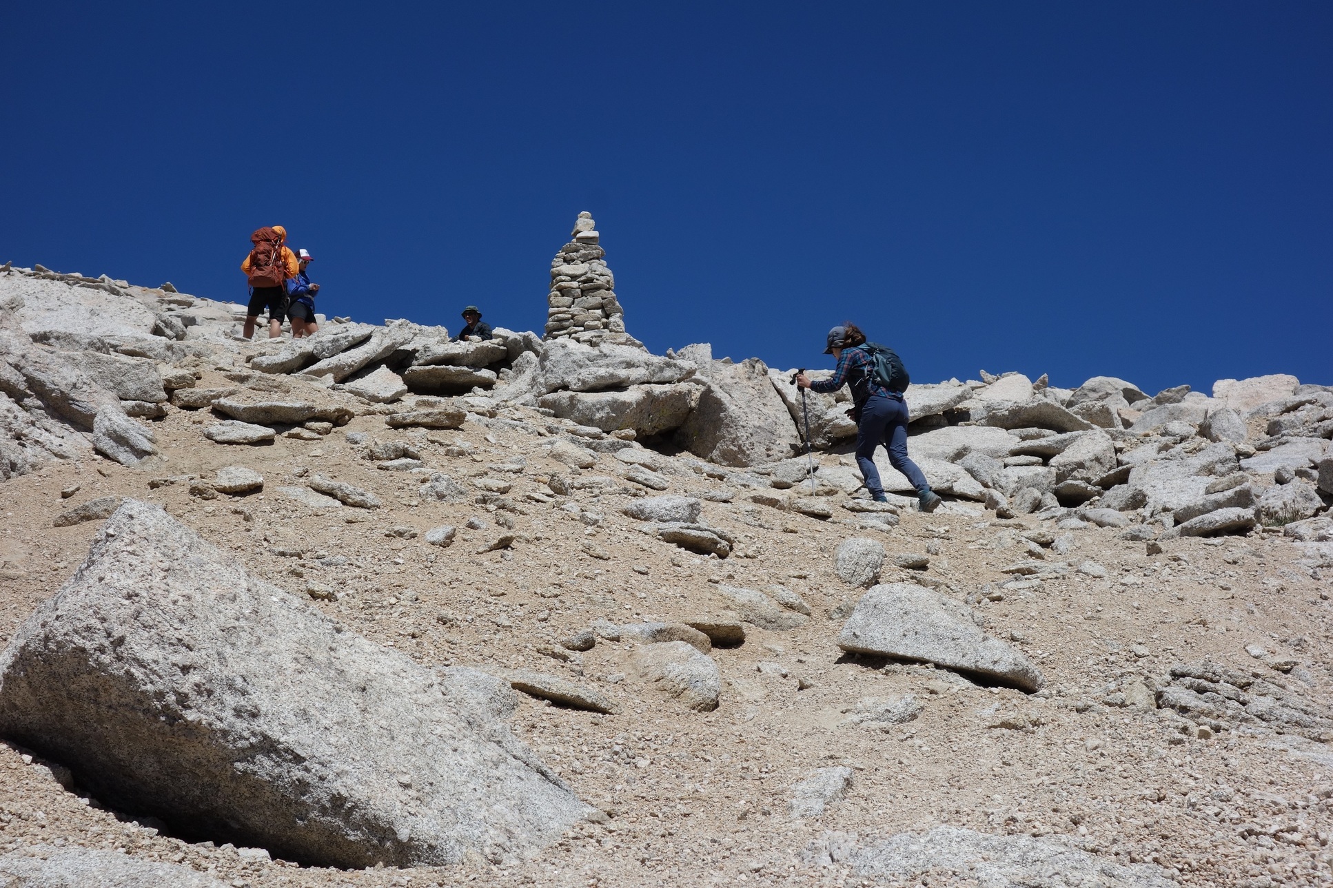
So, we made a tactical error here. There’s a saddle between NAP and the trail to Langley. It’s about 300’ lower than the top of the pass and the trail to ascend from the saddle is about 1/2 mile. We had climbed the pass to dump our packs at the top, but that meant we had to descend back to the saddle, then reascend when we got back from Langley. We could have just dumped our packs behind a rock in the saddle. It wasn’t a gigantic deal, but none of us were happy to climb that 300’ trail again.
NAP is at about 12,300’, so by this point we were well above the tree line. About half-way up to Langley summit, all the other vegetation disappeared as well. The trail itself petered out, and we were following a series of giant rock cairns erected by the forest service. There’s no permanent trail because the ground cover is loose rock and gravel that probably shifts around constantly. It’s very steep, hard hiking at quite high elevation
Finally summitted though. My first 14er. (Both James and Andrea had hiked Whitney earlier that summer, so not their first.)
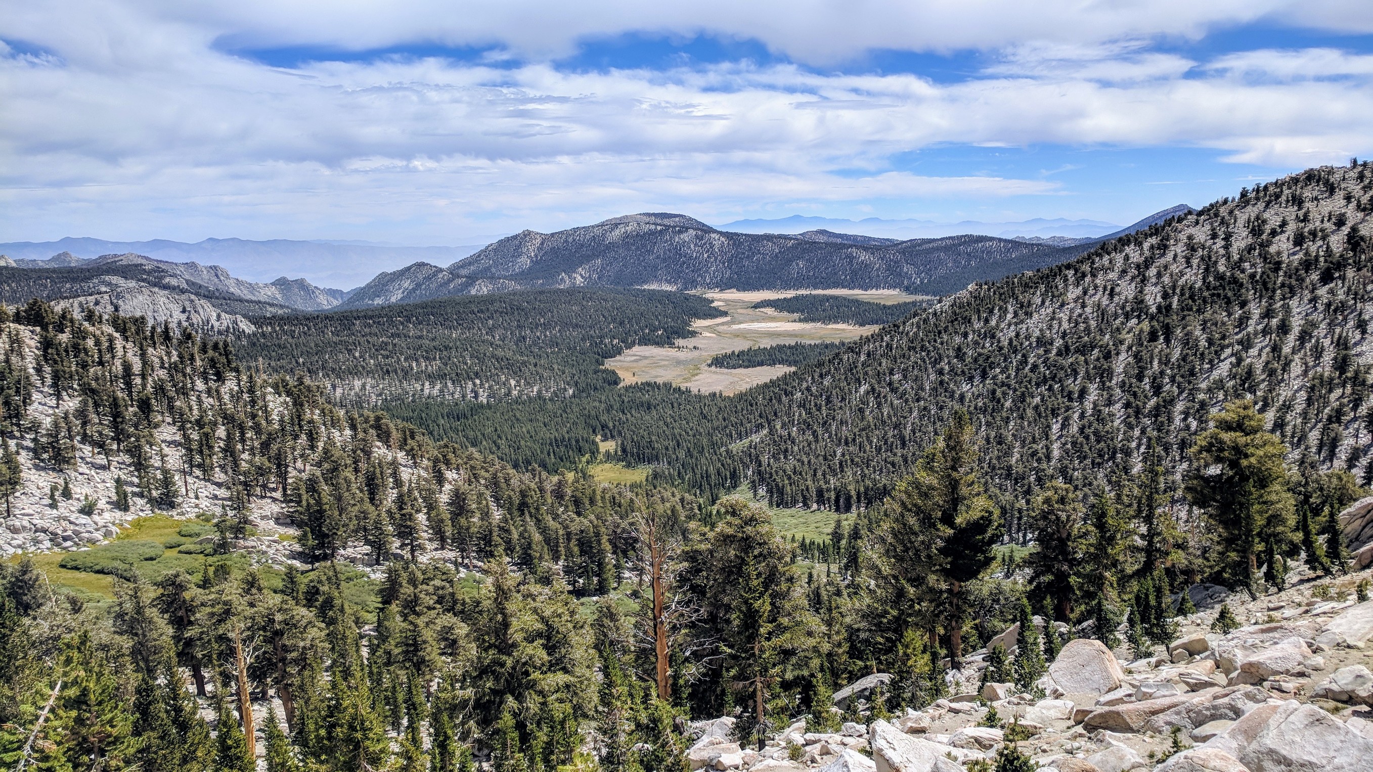
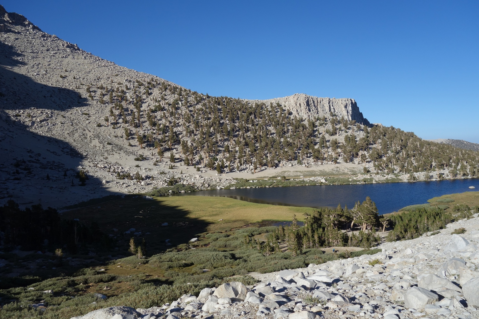
We trudged back down to our packs, collected them and hiked down the front of the pass to our campsite on Long Lake (in the middle of that stand of trees you see down there.)
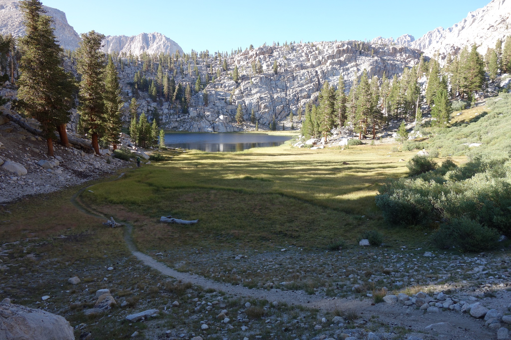
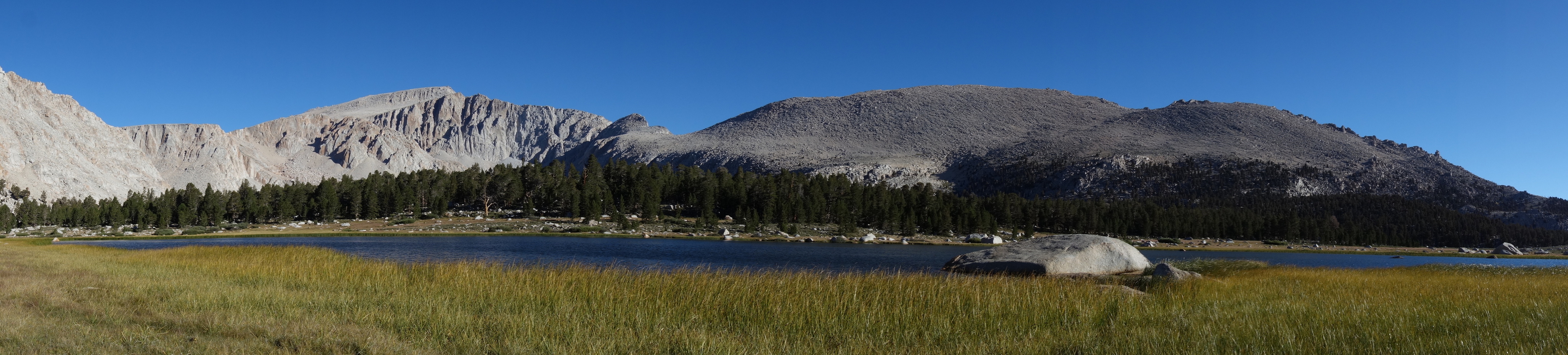
We camped and cooked and got up early again the next morning to knock out the 6 or so miles back to our cars. Passed some nice lakes on the way
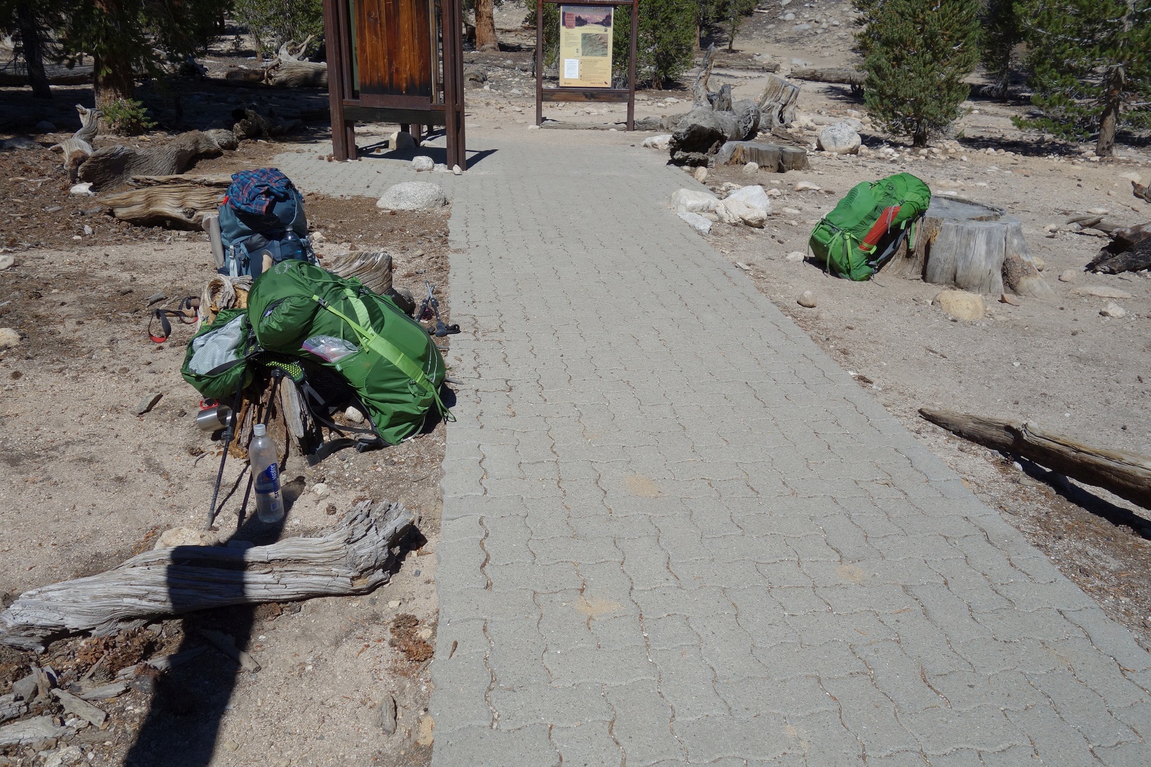
And back to the trailhead
As a first backpacking trip, this was great: difficult, but not too long. The altitude wasn’t a problem. (I took Diamox to prepare and it seems to have worked.) I tend to prefer more trees in my hikes, but the High Sierra has its own charm.