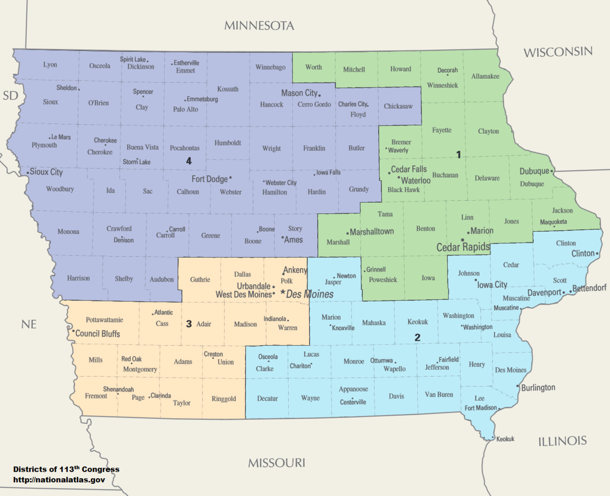
Let’s look at the Iowa map @ShivaX posted earlier. That is about as compact a map as you could draw. And last election 3 of 4 seats went to Democrats. It could have been 4 of 4 were it not for a narrow Steve King win. Yet, overall, the vote was about 56-44 Dem. So pure proportionality it would have been more like 2-2.
Thing is, because of how sears are set, each percentage above 50% increases representation, absent aggressive districting otherwise, more than 1%. Mathematically, and based on historical results, a 55% margin results in >60% of representation. 60% approaches 75%, and 65% is nearly 100%.
Look at Utah for an example of the latter.
And this is especially pronounced in more limited numbers of seats. When there is one seat it’s self evident. When 2, it is also likely to see skewed results. A 55-45 margin is likely to see a 2-0 split.
Look at Nebraska and Kansas for states that invert things. Both voted ~42% for Democrats last election. Nebraska is 3-0 GOP and Kansas 3-1. In states like these the results are not only not shocking, but to achieve results otherwise would require pulling all sorts of shenanigans such as non continuity of districts or extreme distortions of district lines.
And any actions otherwise would be the politicians picking their voters.
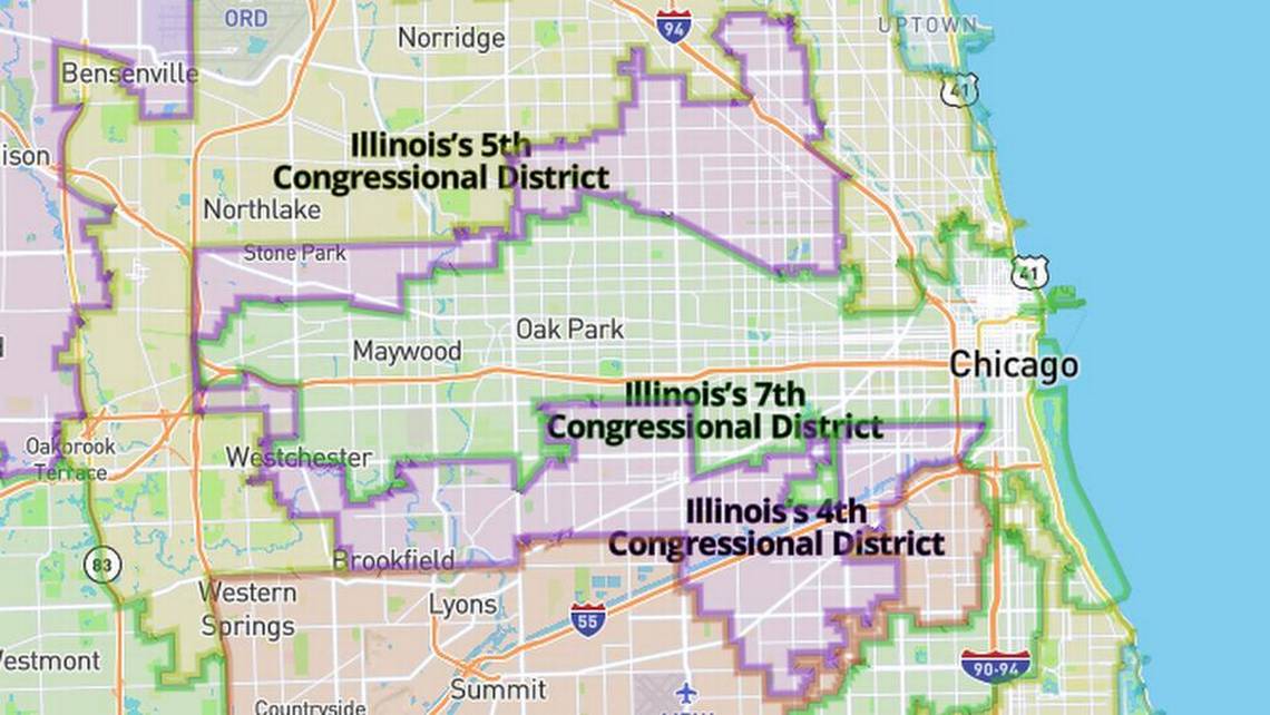
@Tman let me show you the district where I worked before coming out to Oregon. And it is an example of gerrymandering that may be actually worth doing. I present the Illinois 4th congressional district
Now this is, on its face, gerrymandering. It’s a ridiculous district, one whose lines are sometimes connected literally by roadways only. That seems pretty bad!
Now when you dig into it more, it starts to make more sense. First, every single bordering district is democrat held. There is no partisan advantage. No matter how you broke the same number of geographic districts in Cook County, absent nonsense like Austin Texas (which probably wouldn’t be possible anyhow due to all surrounding counties being Dem as well, except DuPage narrowly). So the representative mix on partisan lines is not impacted.
So why draw it like that?
Well the answer is demographic. Chicago has a large Latino population. However it’s still clearly a minority. But what this district does is connect two large Latino communities into a single district where they have he plurality. This is because otherwise, of the 5 or so representatives from Cook County, which has a larger population than our entire state, would have no representative for the Latino community.
So is this case of definitive gerrymandering ok? It’s certainly up for reasonable debate. I’ve personally gone back and forth, my initial reaction was a strong WTF. But as I’ve thought about it and looked at the actual impacts and reasons, I’ve come around. It looks absurd, but it serves an important purpose. It gives one large and important community in the city a voice. A voice they would otherwise be denied. And that community may have similar, though distinct, concerns from the nearby African American community, and certainly than the north side liberal white community.
And especially since this is done without partisan intent. That’s an important difference.
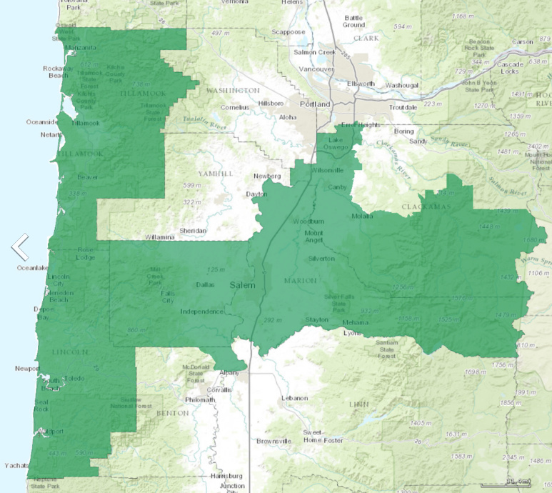
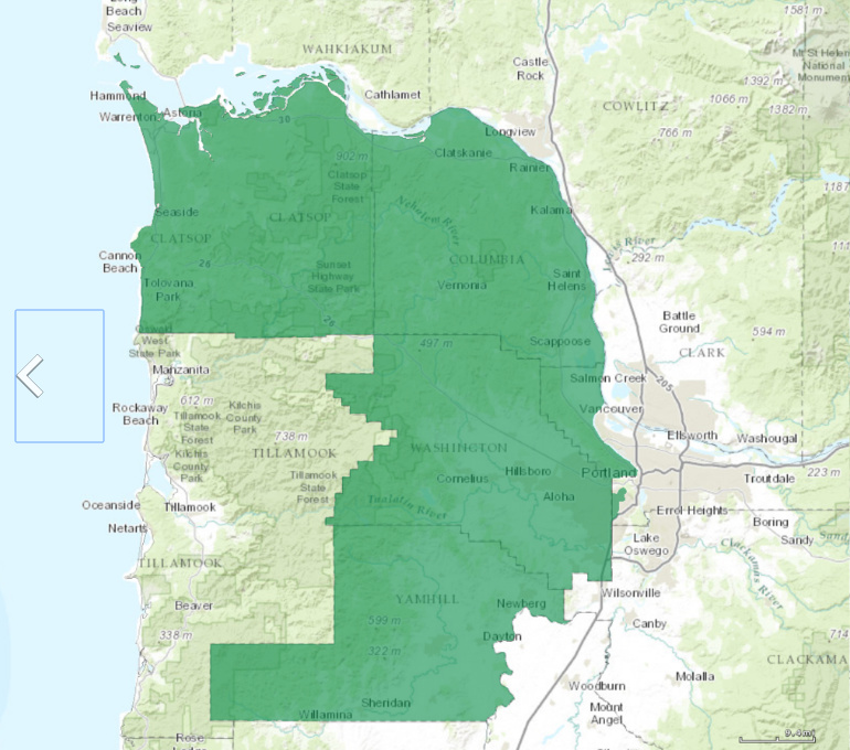
And while you may feel that, in an idealized world, separating the rural votes from the Urban ones in Oregon May be desirable, and that may be true, from a practical perspective the population here does not support that mapping without some absurd North Carolina style shenanigans that would be equally dismissive of voters in Eugene and the southern Oregon population centers.