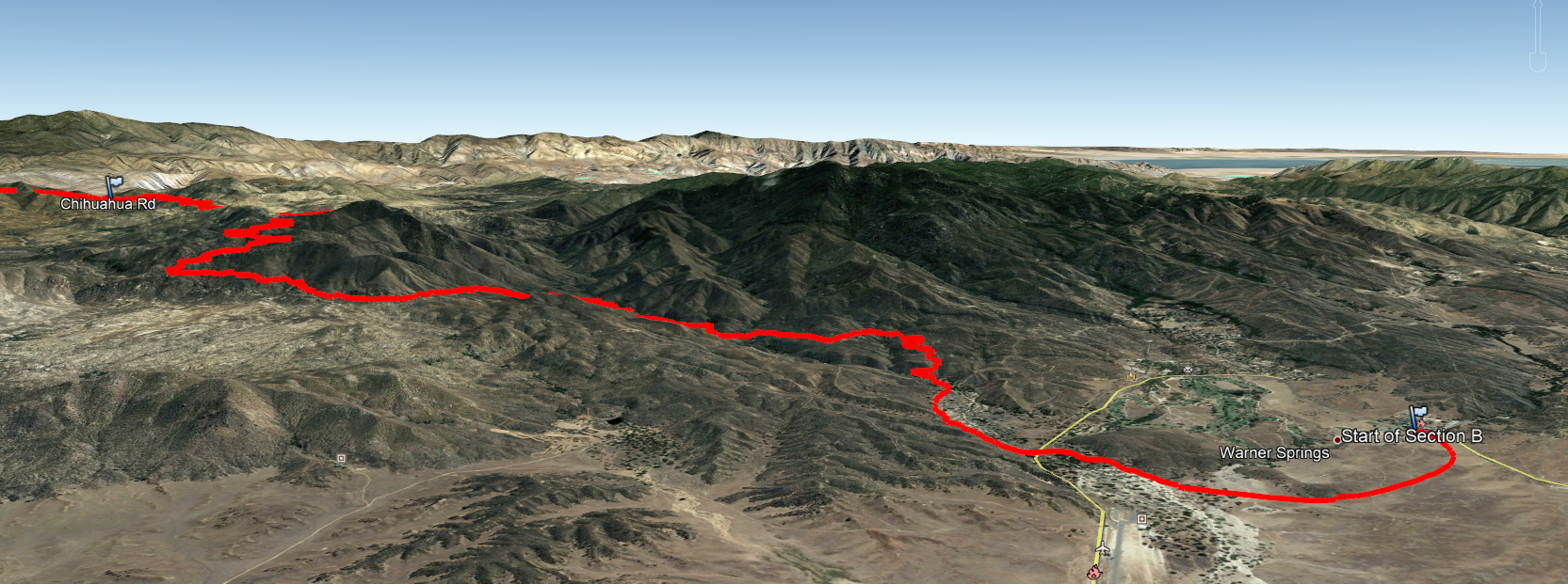
Hike Report: PCT Section B, Leg 1, Warner Springs to Chihuahua Rd.
March 9, 2019
17.8 miles (planned), 19.5 miles (actually hiked)
As posted above, the hike ascends from the tiny cattle town of Warner Springs, up through the Agua Caliente watershed and into the Anza Borrego desert wilderness. Starts at about 3000’ and ends at about 5000’.
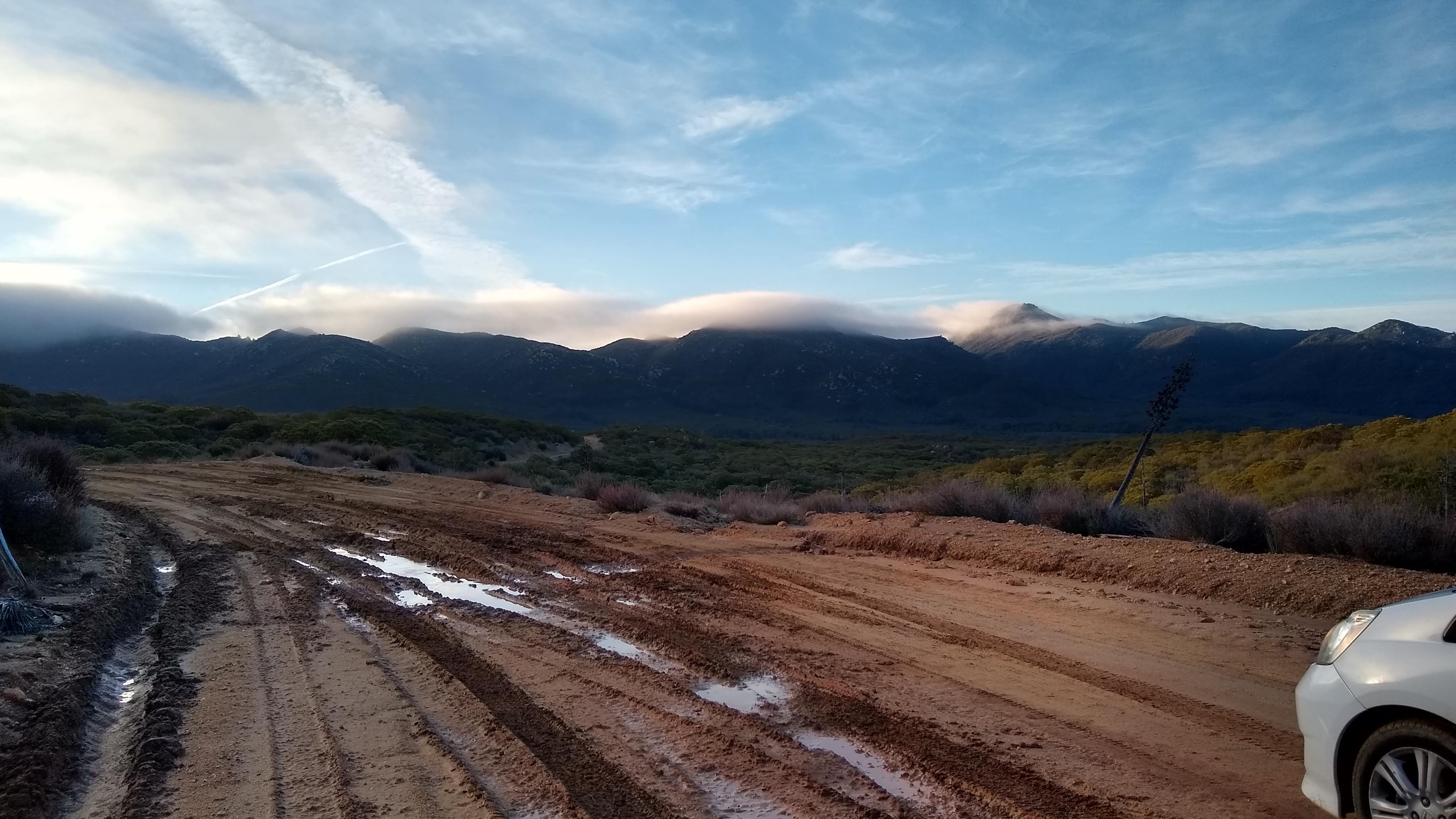
This was a section hike so requires shuttling. I did this hike as part of a meetup, and by the morning of the hike, an initial interest of about 25 folks had been whittled down to 16 by fear of creek crossings, other commitments, and flakiness. The plan was to meet at the end of the hike on Chihuahua Rd, then use half of the cars to shuttle 35 minutes away to the beginning of the hike in Warner Springs. I got up bright and early at 4am and drove the two hours up into the unincorporated communities of San Diego County northeast of Temecula. The final 5 miles of the drive were on a sandy dirt road which had been made muddy and washboard with all of the rain we’ve been having this winter. Those 5 miles took me about 25 minutes to drive in my Honda Fit. It was cold up there with mist streaming off of the Santa Rosa mountains to the east and frozen water in the puddles on the road.
When I got to the PCT crossing precisely at the appointed meeting time of 7am, there was one other guy there. We waited for 30 minutes and no one else showed up. The other guy, Bryan, was able to get cell reception by hiking a few hundred yards up the road to near Mike Herrera’s place and determined that the whole rest of the group had been intimidated by the dirt road, turned around and driven back to Warner Springs to do an out-and-back hike from there. Byran and I decided that since we had two cars, we’d do our own section hike. We’d take my car to Warner Springs and leave his pickup to shuttle back after the hike. Decision made, we got moving and finally got on the trail in Warner Springs at about 8:10am, roughly 20 minutes behind the rest of our group.
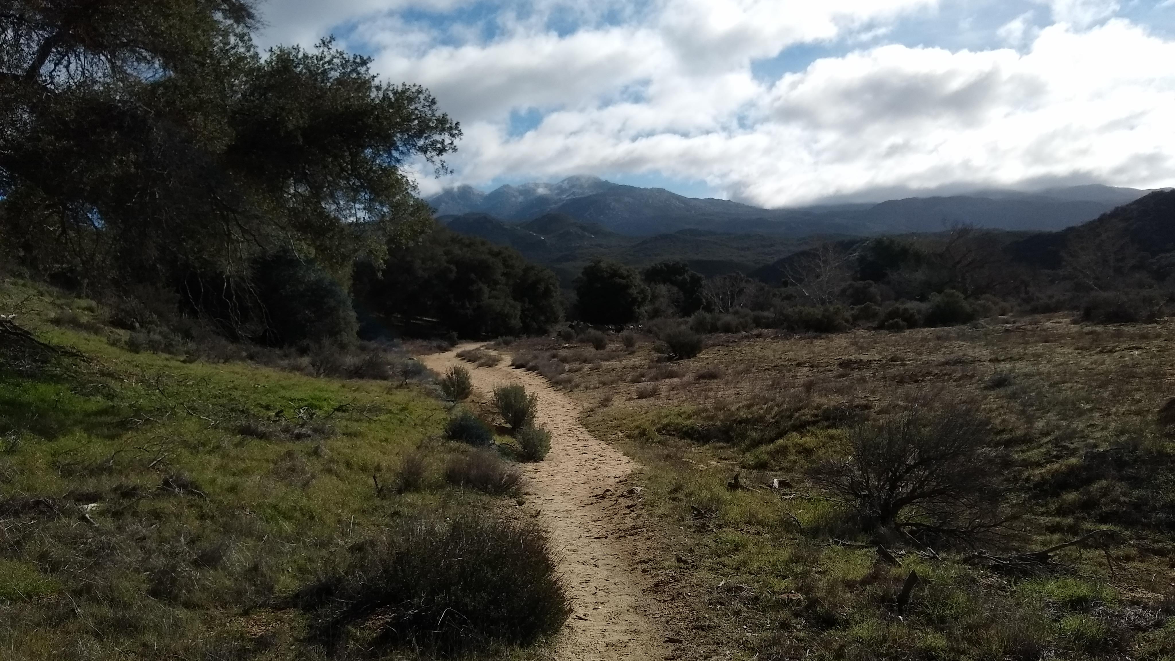
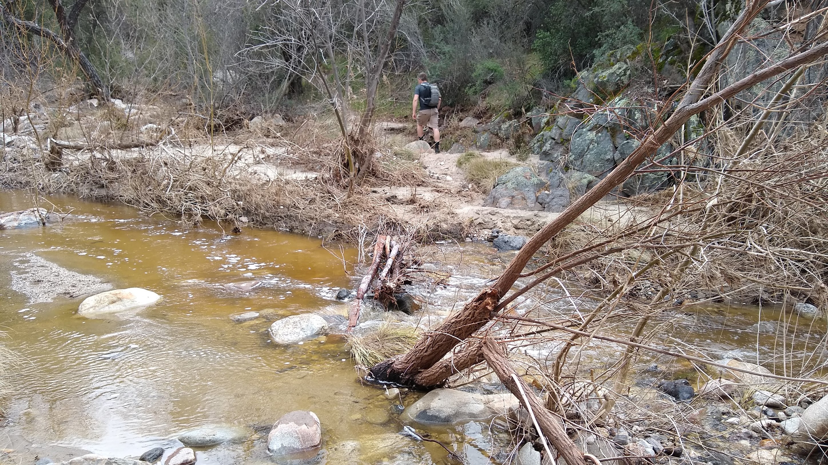
There’s been a lot of rain this year, so the creek was running high and the typical coastal riparian landscape in the creek valley was lush and green.
There were some creek crossings to negotiate, but rock and log hopping prevented my feet from getting wet (mostly.)
We caught up with our group about 4 miles down the trail as they were finished up the final crossing of the Agua Caliente creek before the trail ascended up to run along a ridgeline for a bit. With Bryan and I, 12 of us actually made the hike.
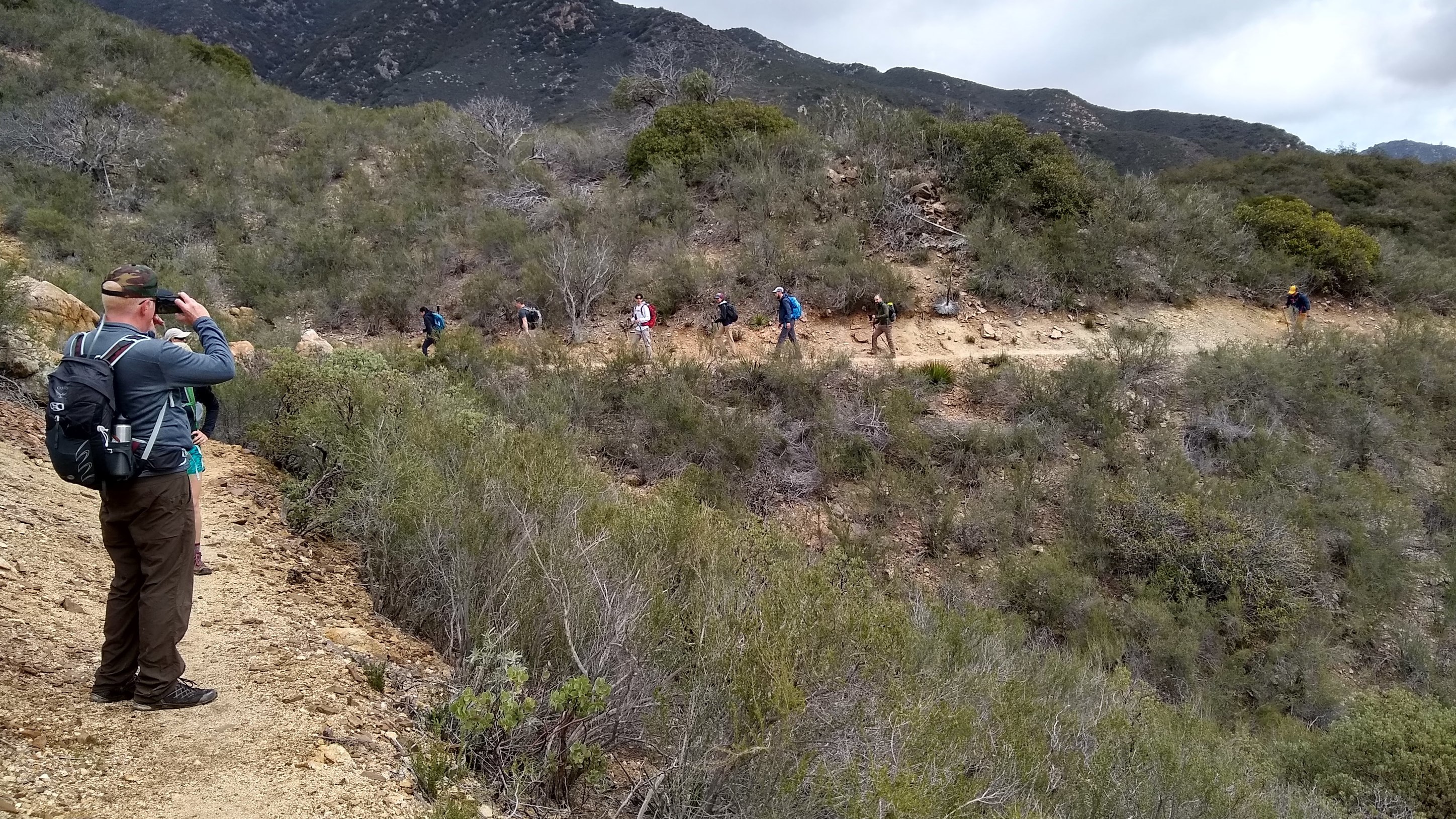
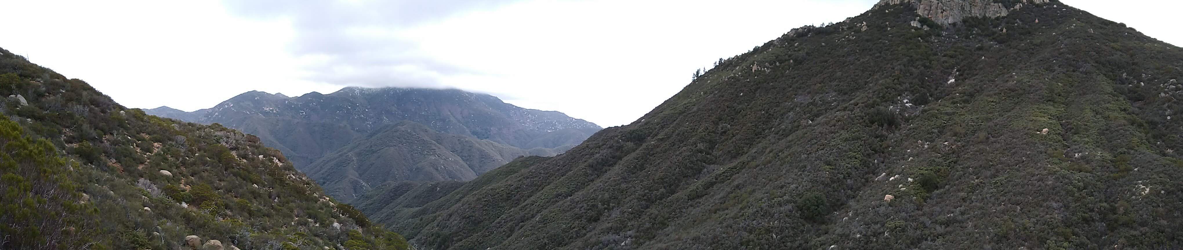
As we climbed out onto the ridgeline the vegetation transitioned to the coastal chaparral that characterizes most of the San Diego County wilderness areas. The views were pretty incredible
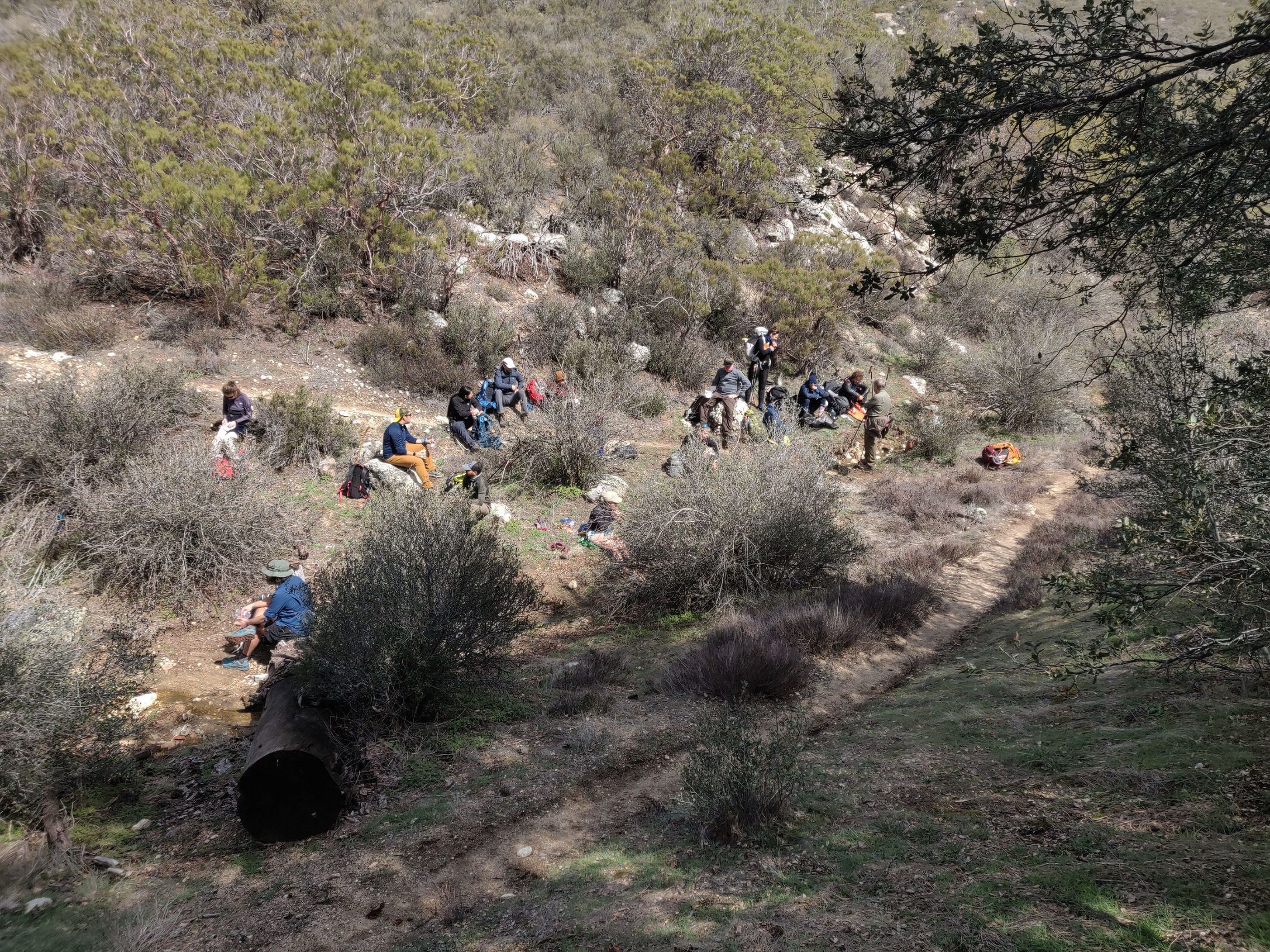
Stopped for lunch beside a small spring where we ran into some PCT thru-hikers
At this point the 10 folks who had turned around on the dirt road decided they wanted to hike through, so we arranged to do a shuttle after the hike: Bryan would haul 3 people back to the cars with his pickup and they’d return to pick up the rest of us. Kind of an annoyance for me, since I’d done the drive, but it was nice to be able to hike as a group for the whole section.
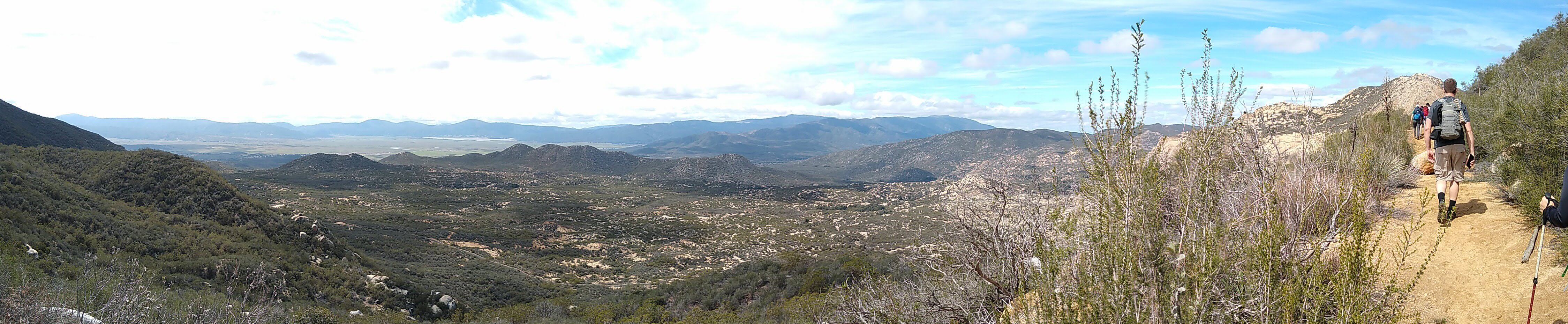
Hiking up to the Anza Borrego desert, we got some great views of Hot Springs Mountain, with snow coating the trees peeking out from beneath its cloud cap.
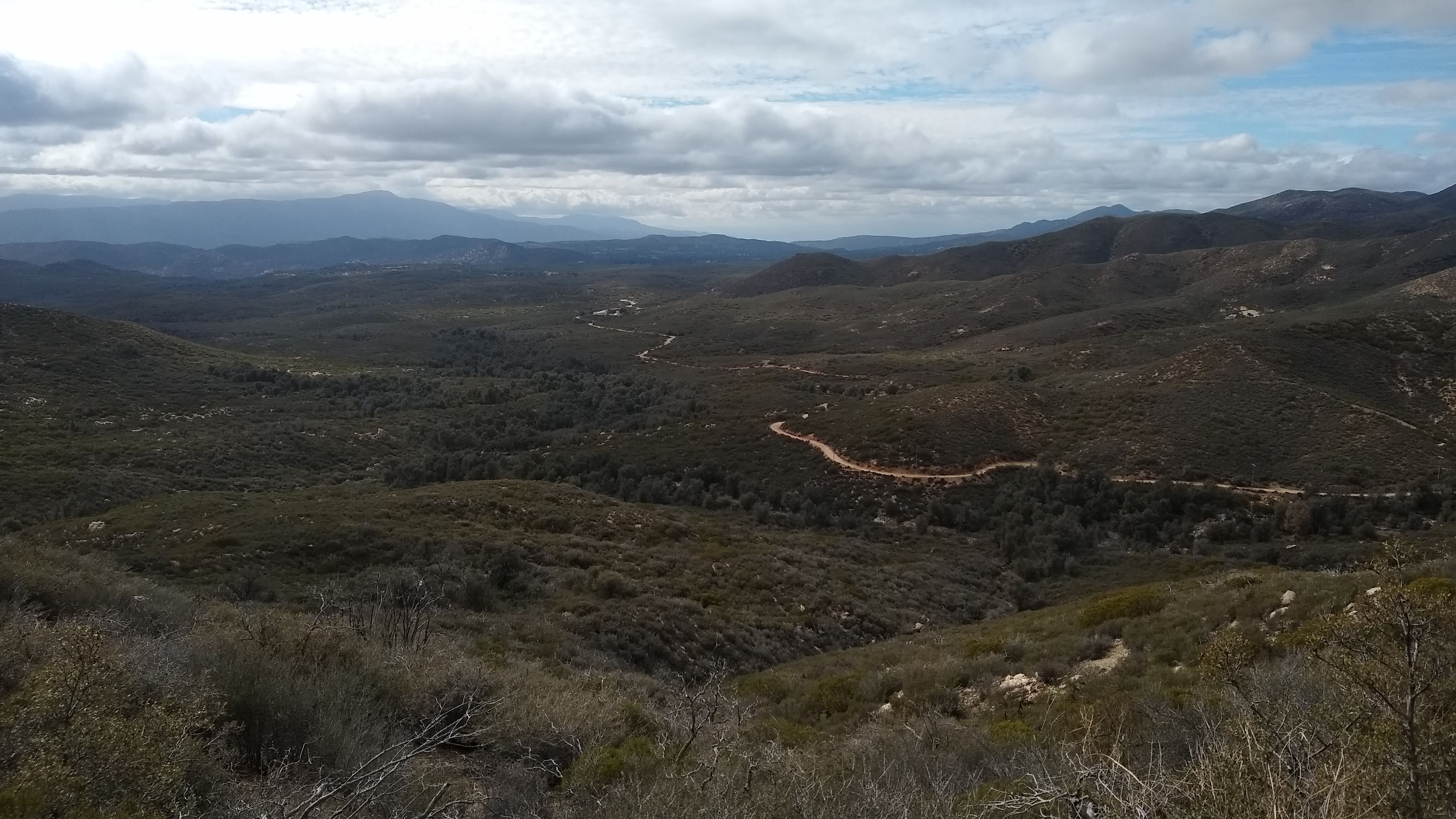
And even the desert is pretty green right now. Here you can see Chihuahua Rd (where our hike was to end) winding its way through the landscape.
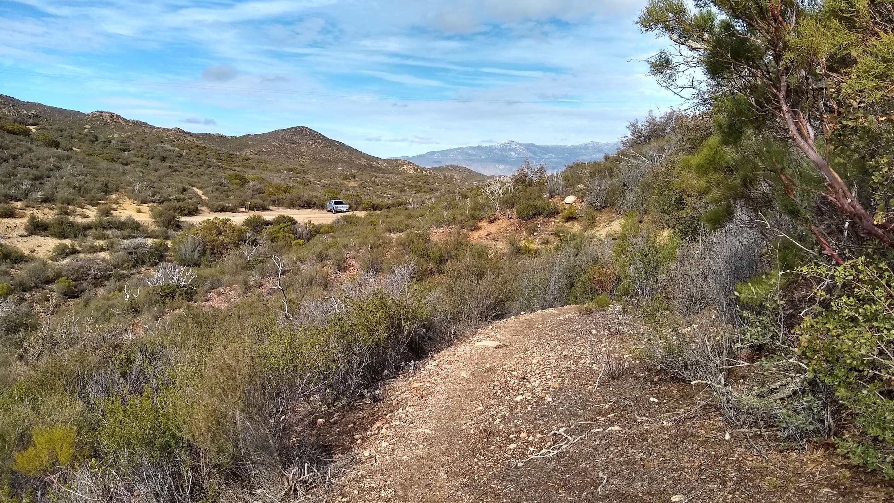
First sighting of Bryan’s pickup at the end of the hike. The PCT continues on the other side of the road.
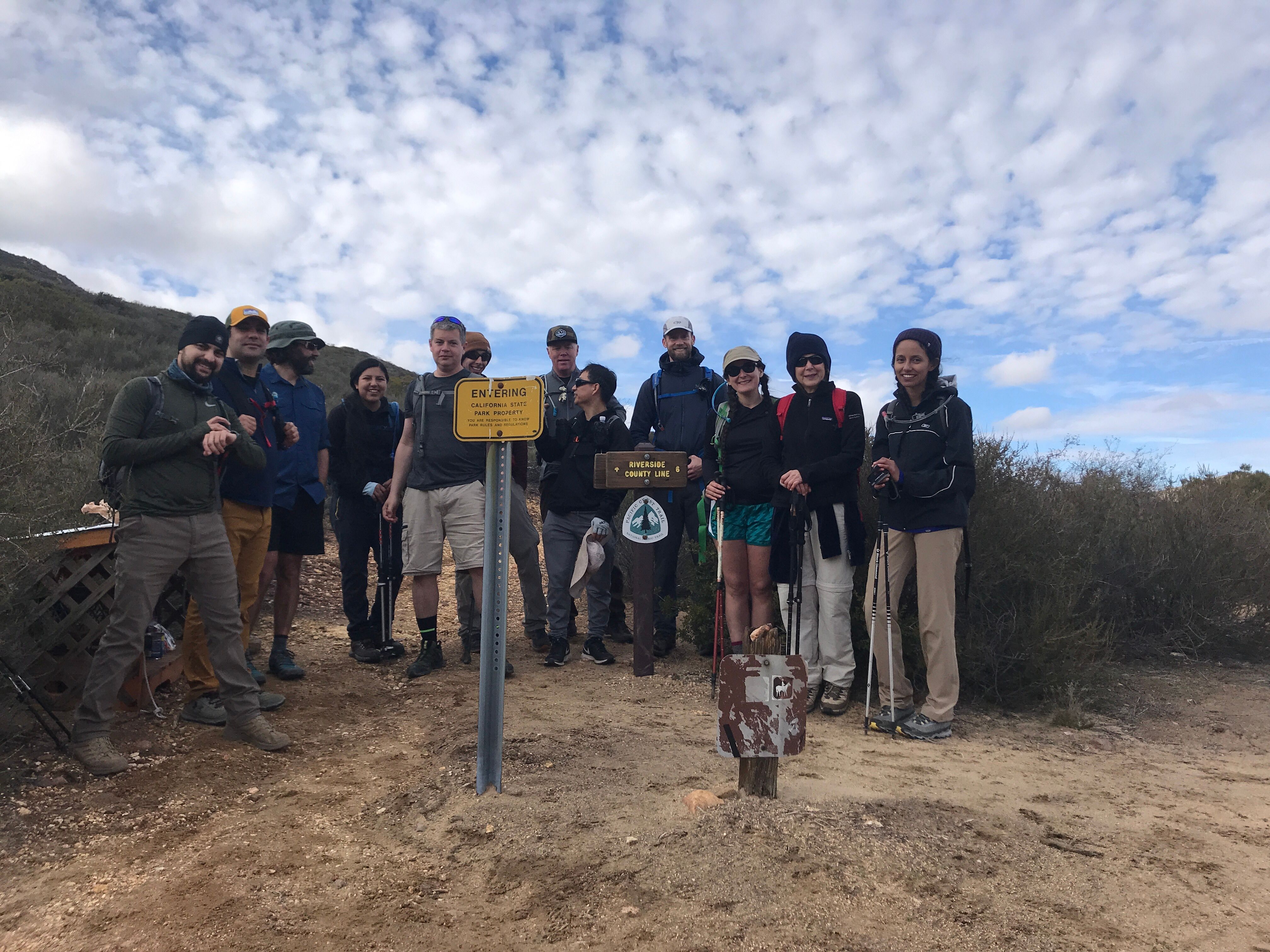
Obligatory group photo. I’m the guy wearing a blue button-down and running shorts on the left.
So while Bryan hauled 3 dudes back to town to pick up the cars, the other 8 of us hiked down the road to meet them, adding about 3.5 miles to the ~16 we’d already hiked that day. About 19.5 miles total, which I think is my longest single-day hike ever by a couple of miles. It was a lot of fun, more beautiful than I thought it would be, and a great group to hike with. I’ve signed up to do the next section (a 2-day hike) with this group next month.