Question for the backcountry experts. Are you using the Gaia app? What others? What kind of battery life on Android are you getting?
Trying to plan my two-nighter in Jasper.
Question for the backcountry experts. Are you using the Gaia app? What others? What kind of battery life on Android are you getting?
Trying to plan my two-nighter in Jasper.
I’m using All Trails. Can’t answer the Android question though
I use AllTrails too, but have had limited success with it. My pet peeve with it is that it’ll pause in the middle of a hike sometimes and I won’t know it until I’ve hiked several miles further. I’ve had other hikers report this as well. I do download its maps though and use it with GPS for trailfinding (though I find that Google Maps works nearly as well for this, as long as the trail is marked on it.) If you’re on a well-known long-distance trail (like the PCT), you can check out Guthook’s app, which I like and have never had any issues with.
As far as battery life goes, I’ve got an Android phone, and it’s not usually a problem for a 2-3 day trip provided I put the phone on airplane mode and don’t take too many photos. I’d bring a battery pack though, just in case.
I’m considering getting a Garmin watch just for hiking, or maybe one of those inReach beacons. I haven’t been satisfied with any of the phone-based solutions so far. (I will say that Half-mile’s PCT app is pretty great, though it’s now deprecated and hasn’t been updated since 2017.)
This thread has been a lot of fun to read through. Thanks for sharing all your trips! I’m just a day hiker myself in addition to being on the other side of the country. I’m a little jealous of those amazing hikes and beautiful views.
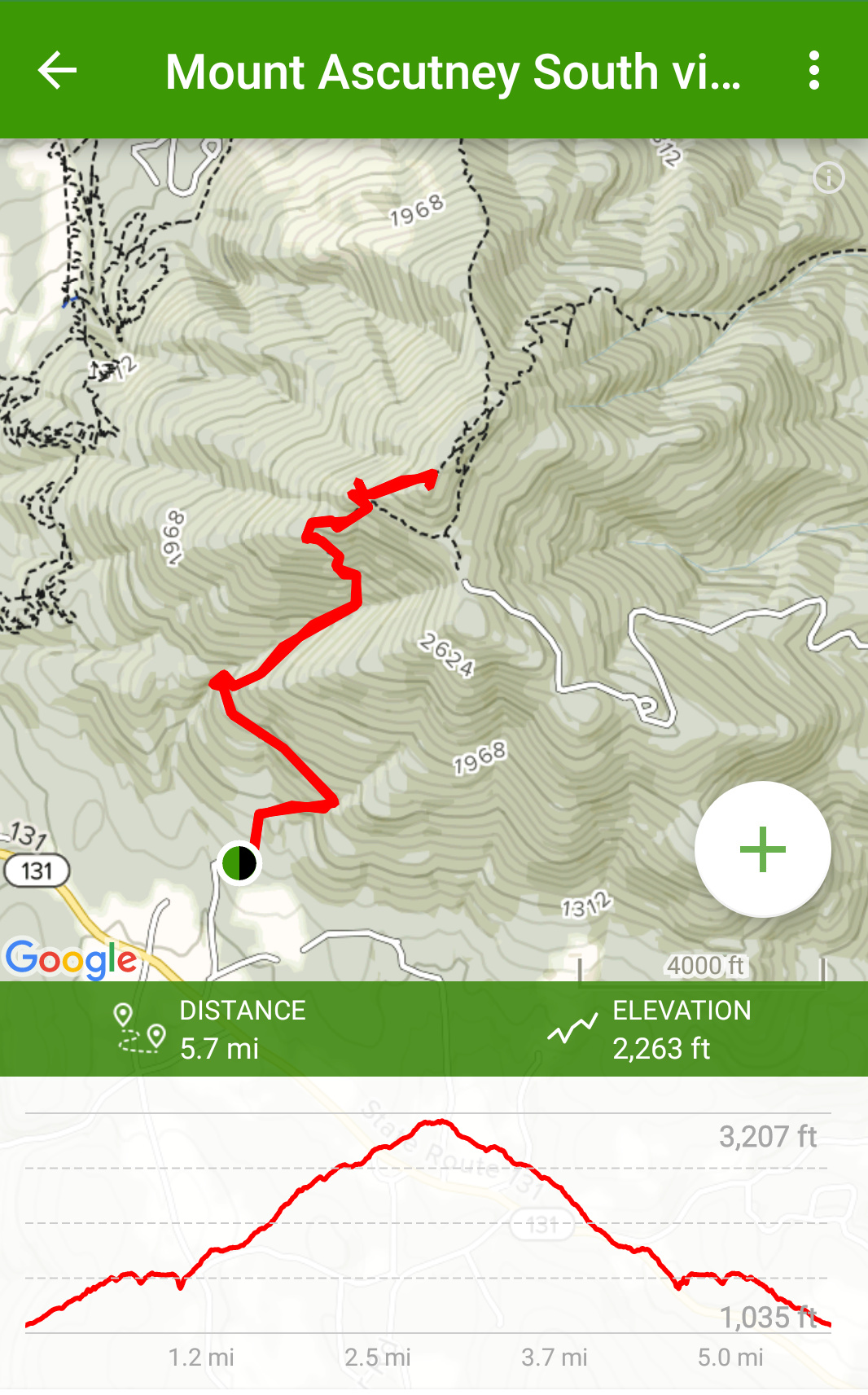
My season is really just starting here, it’s been a cold and muddy spring so they’ve encouraged people to stay off a lot of the trails. The trip this weekend was a great way to get back into hiking and realize how out of shape I’ve gotten over the last month or two. It’s a roughly 2.9 mile steady but steep climb up Mount Ascutney via the Weathersfield trail. Decent views, plus it’s only a 15 minute drive away.
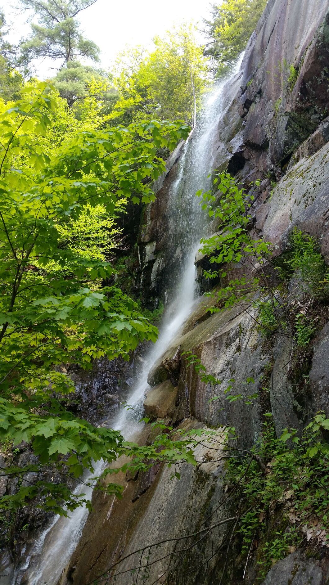
Yes that’s a road to the top. Luckily you can’t ever really see it or the cell tower it leads to. Once you get to the top, there’s a nice mile or so loop to a couple of lookouts where the actual views are. The summit is too wooded to see much of anything from, although there is an observation tower that you can go up. I didn’t bother with that this time since it was a little hazy that day. The Weathersfield trail is nice because it follows a stream for maybe a half mile or so along with a few waterfalls, including the creatively named Cascade Falls.
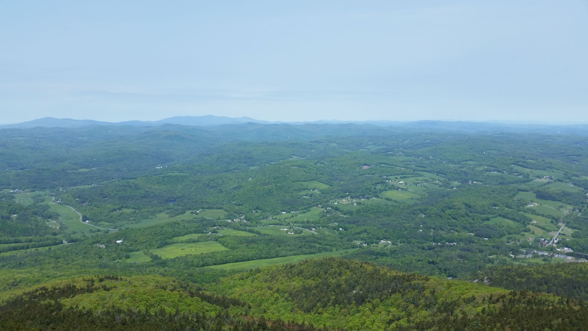
The first real overlook is the West Peak, which unsurprisingly looks west towards the town of West Windsor and, further on, the Green Mountains. This is taken from a platform people use to launch hang gliders. In the bottom right is the village of Brownsville and the now defunct Ascutney Mountain Resort.
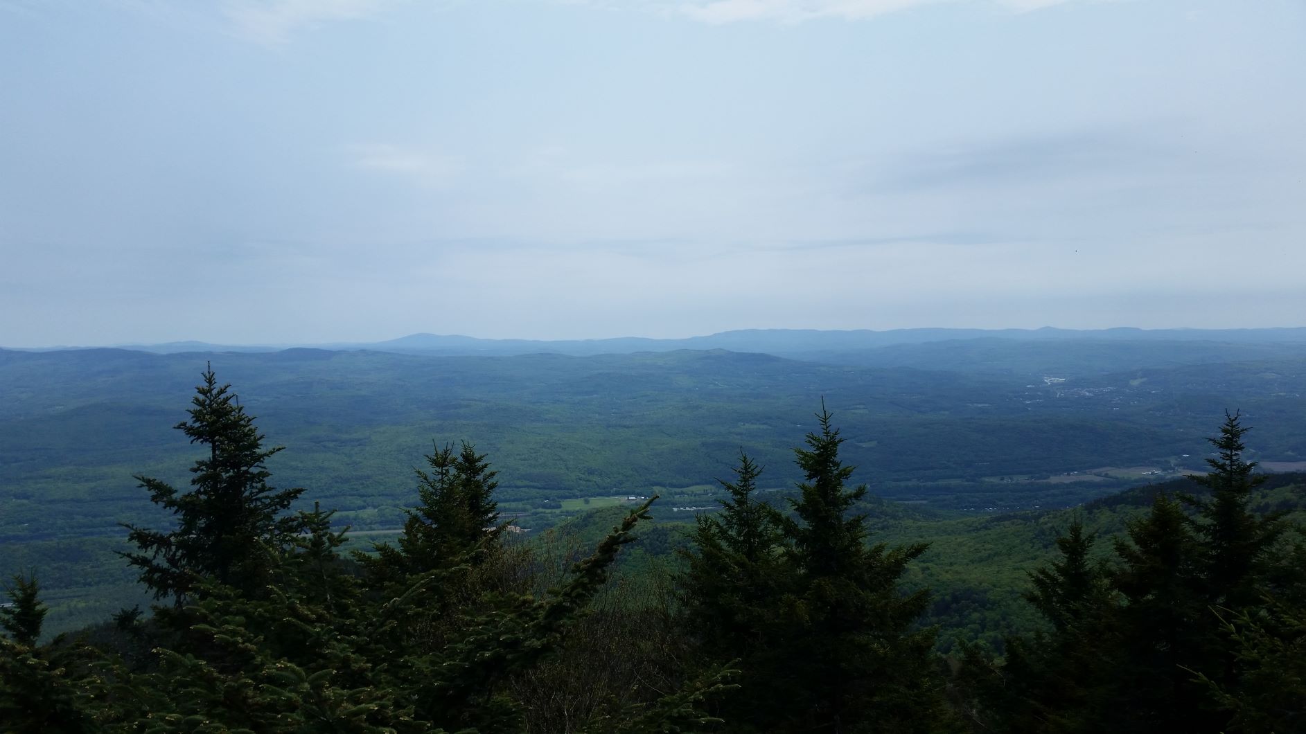
Further along the loop you get to Castle Rock with views east across the Connecticut River to New Hampshire. On a less hazy day you can see the White Mountains.
From there you get to Brownsville Rock, but the view is essentially the same as from West Peak and the black flies were getting bad so no photos.Then you complete the loop and pick up the Weathersfield Trail back to the bottom. Including several stops along the way, the whole trip took me around 7 hours because I’m definitely not prepared to go sprinting up a mountain like the rest of you.
Next time you should hang glide down.
I’m quite jealous of your amazing hike and beautiful views. Thanks for posting that hike report. The pictures are amazing! So much green!
Between the three of us, we have the major categories covered.
Snow, sand, and spring flowers.
And until last year I was in Chicago. @Otthegreat I have been jealous for years 😉
That would almost definitely cut down on the travel time!
Thanks @Matt_W! All that green can be a mixed blessing. It’s beautiful but our mountains are so low and forest-covered that it’s rare to find really great views.
@CraigM Chicago is a great city, but I get that. Being stuck in suburban Philadelphia for several years made me realize I never wanted to live in another flat place again.
So now that I’ve done one proper volcano summit, naturally I want to do more. Mt Hood is an obvious candidate, and at a little over 11,000’ it’s the tallest in Oregon. Iconic.
Mt Adams is just east of St Helens, and is a forgotten, but taller, peak. Capping at 12,250” or so, it’s the second tallest in Washington.
Then there is Ranier. The tallest peak outside California, Colorado, and Alaska. And less than 100’ difference from the tallest in the lower 48, Mt Whitney.
But there is a challenge. Even though these are all 3 hours or less away, Ranier being the furthest, they’re all significant in their difficulties. Mt Adams is, actually, probably the easiest and most doable. It’s within day hike realms, and conditions are amenable to starting at daylight. It’s probably about a 6-7 hour trip for me. 10 hours tops. High elevation, yes, and significant snow and glaciation near the top. But not a particularly steep or imposing hike. I’d have to break down and get a pair of crampons though.
Mt Hood, though 1000’ shorter, is actually far more difficult to summit, despite being only 7 miles round trip, and less than 5000’ elevation gain. But the last climb is technical. I could make Chimney Rock without much special consideration, my fitness and practical ability make that trivial even, but going through the Pearly Gates to the peak? That may not be possible without actual rock climbing gear. Ropes, anchors, and the works. It’s nearly sheer climbing, and conditions? I would like to do it, but I may need to scope out the climb by going to chimney rock first. Assess the difficulty there, topographic maps don’t quite answer whether I can climb it my way.
Also they recommend starting at 1am due to recommendations to be heading down by 8am due to the sun making the ice and rocks potential fall hazards. I guess rock falls during he day are common. Hmm
And then there is Ranier. Though it is 100’ shorter than Matt’s local 14er, Mt Whitney, it seems this is not something you can casually do. I would not think twice about day hiking Whitney. Ranier gives me great pause. Glacier crossings, chasms, avalanche potential, and all that combine for a very risky hike. While Adams may typically be a two day, but is easily plausible for 1, Ranier seems to be a serious mountain that requires special gear as well. And the type of dangers that make my solo hikes potentially inadvisable.
I want to do it, but caution is prudent. Nothing as steep as the peak of Hood, but the glacial crossings and high elevation aren’t to be taken lightly. And though the raw physical climb parameters isn’t outside the bounds of my capabilities in a day, the dangers may be. I’m in great shape for this kind of thing, distance and elevation are never my limiting factors. But I’ve St Helens is the only real serious mountain climbing of that type I’ve done, aside from Elk mountain in the winter.
So perhaps my plan should be this: do Adams, that’s a known quantity and level of technical climb. It’s a matter of weather, not gear or capability. Then do an exploratory Hood climb to chimney rock. Get the lay of the land. Hood is close enough that failing to summit isn’t a loss of weekend.
Then see where things go. I’d love to give Ranier a go, but I’m not sure that’s possible. Time to ease in and see where things stand.
That sounds like a good (and awesome) plan. From everything I hear, Rainier is a technical mountaineering route: the kind of thing I wouldn’t attempt without a guide. If you’re looking for a 14er, consider Mt. Shasta, (which is closer to you than Mt. Whitney is to me:) It requires ice axe and crampons, except maybe in late summer, but is non-technical and can be done as a day hike.
I have a friend who summited Rainier, Whitney, and Shasta in the span of 9 days. Keep in mind that each of these mountains are north of 14,000 feet.
She also almost summited Lassen in-between, but the last 50 meters of that require a lot of intense climbing, so she called it a day.
Oh, yeah, and on Shasta she inadvertently rescued a missing hiker who search and rescue and had been looking for. She has photos of the National Guard helicopter evaccing the girl off the mountain.
I am not making any of this up.
I definitely considered Shasta, but there is an as yet unspoken limitation. Bedtime stories with my kids.
Ranier is at the fringe of the range where I would not need to camp overnight. Which means I can do bedtime video calls with my kids. Giving that up is not something g I do lightly. So for me almost all climbs need to be something I can be done with, and back into cell service, by 6pm. Two day hikes are all but out of consideration. I don’t mind getting up at 4 am to drive, but if I can’t be on WiFi by 6pm, I pretty much don’t consider it.
Shasta does have a decent town nearby, there’s probably a Starbucks near the trailhead…
And @Woolen_Horde that’s a cool story! She sounds like someone with a lot of fun stories to swap. I had a similar brush with rescue teams twice in one week. Once as an outside aide, once as rescuing someone in my party. But doing Bright Angel Trail in August is fun, but hot. As we were returning from the river we saw a group of 6-8 college age people going down. No backpacks or anything, just an, now empty, water bottle each. We advised them to turn around, being near Indian Garden (an oasis campground with water fountains) still, but they didn’t. We took a lunch break there, and told the rangers. At some point an hour or so later we saw a rescue chopper. I can only figure it was them.
The other is I had to help haul one of my friends out on a sterns(spelling? A one wheeled stretcher) because she hadn’t drank enough water at canyon of the ancients. Carrying her out of the canyon during dark, not fun.
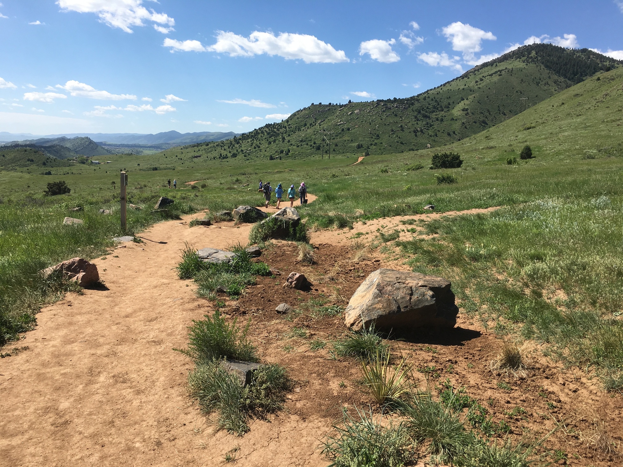
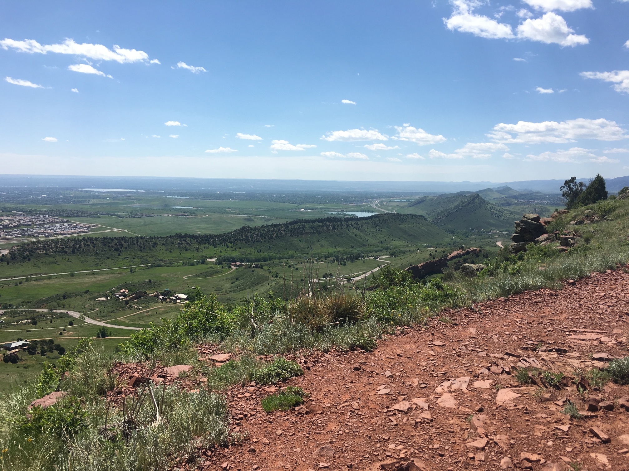
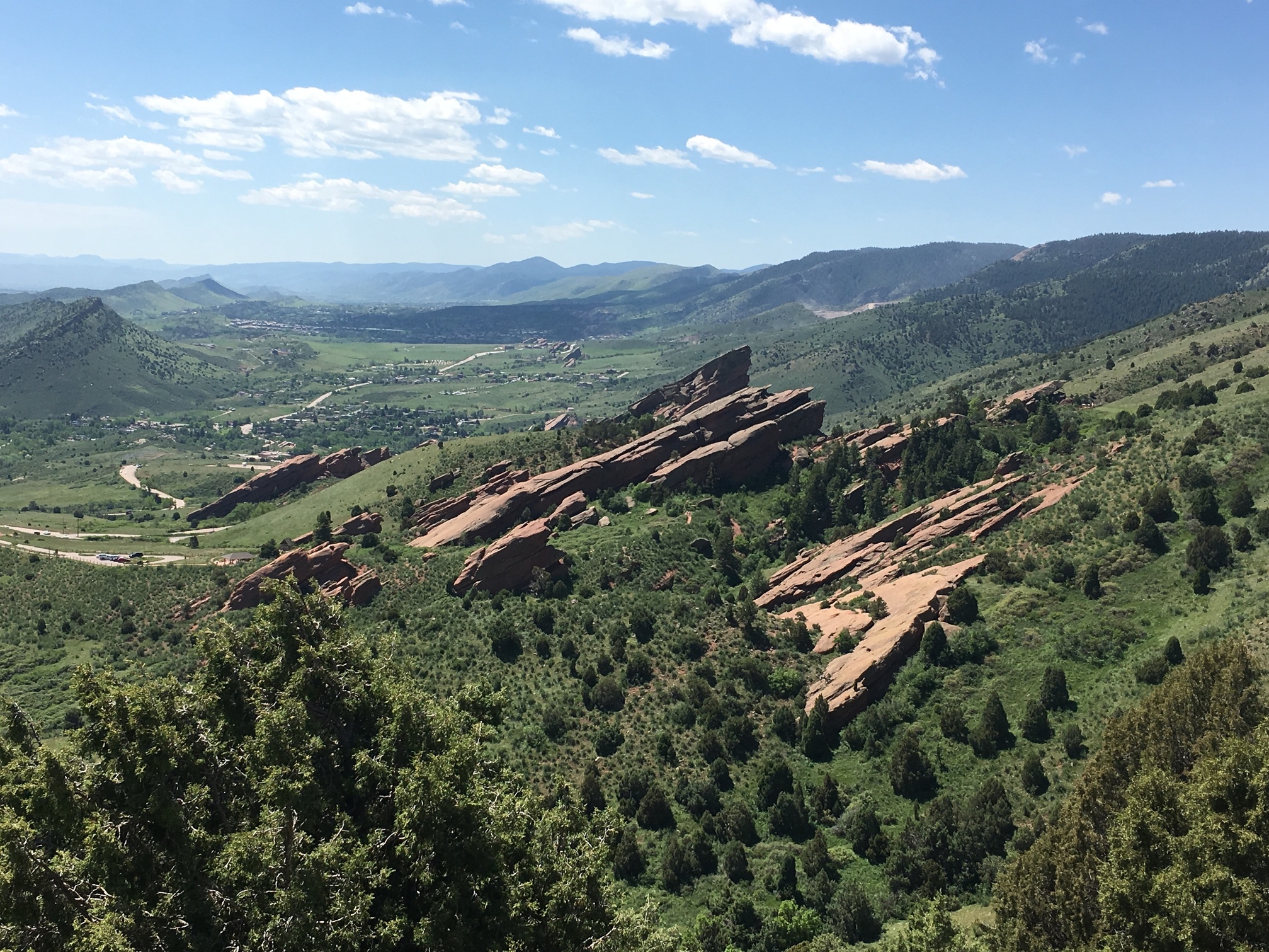
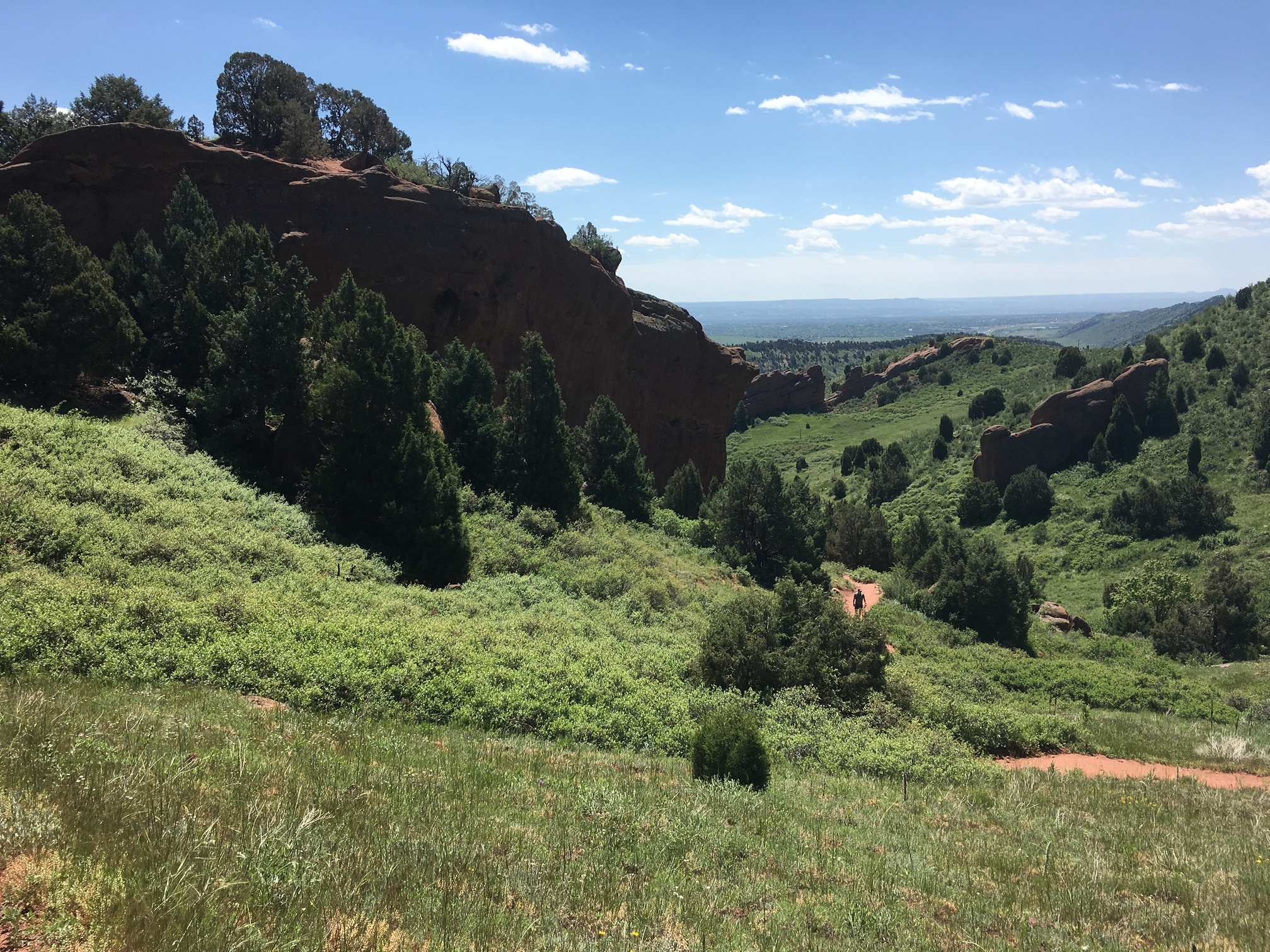
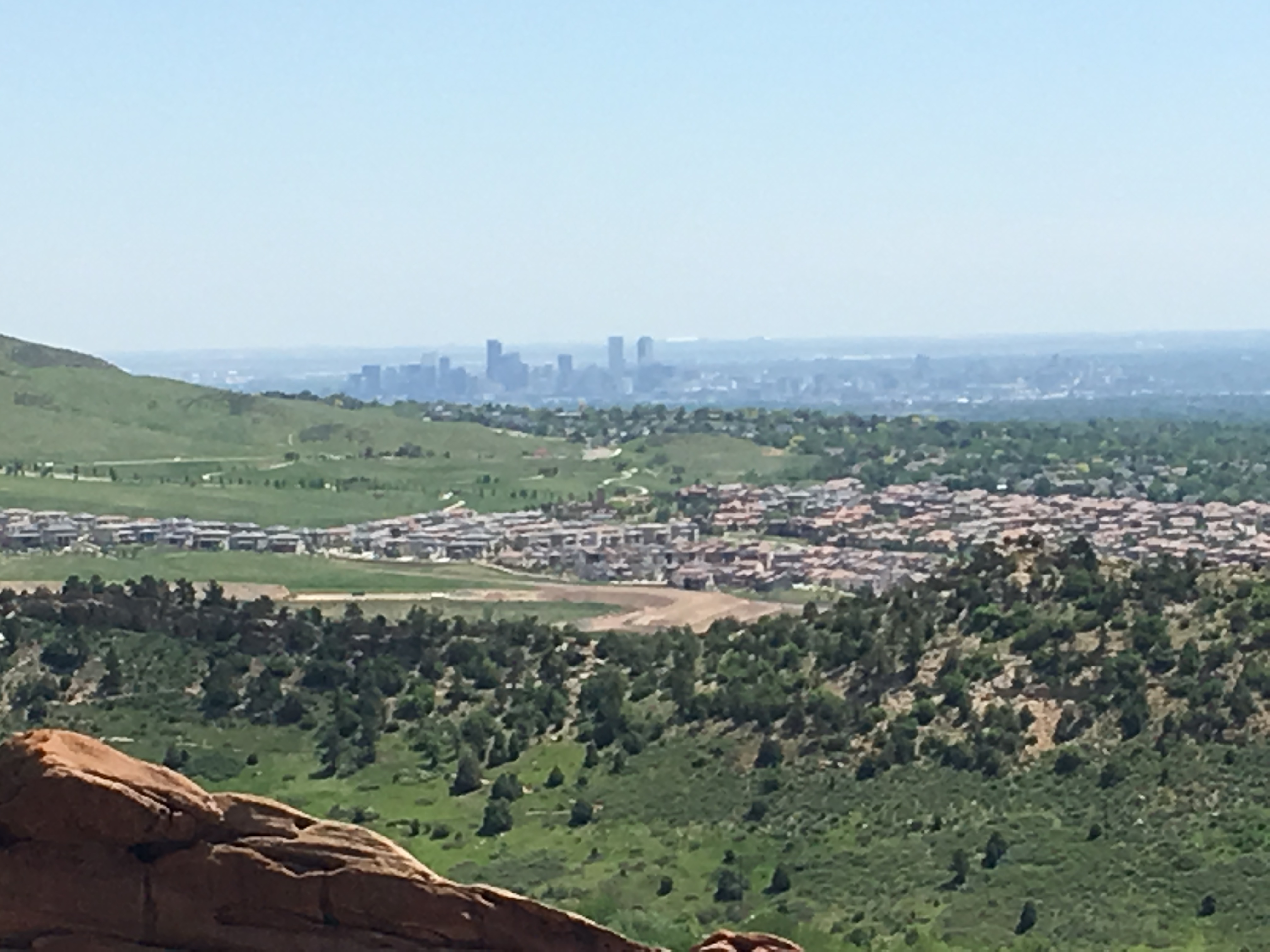
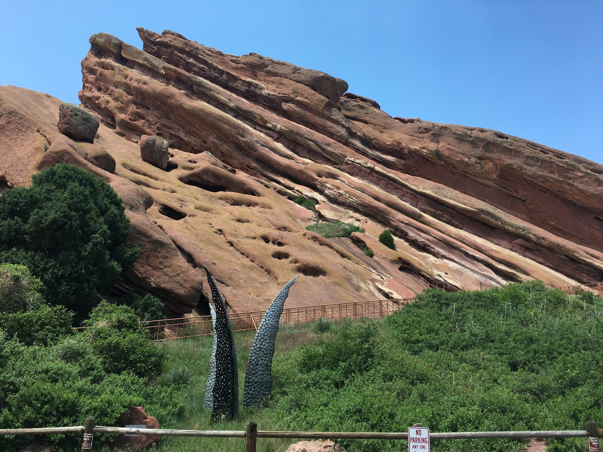
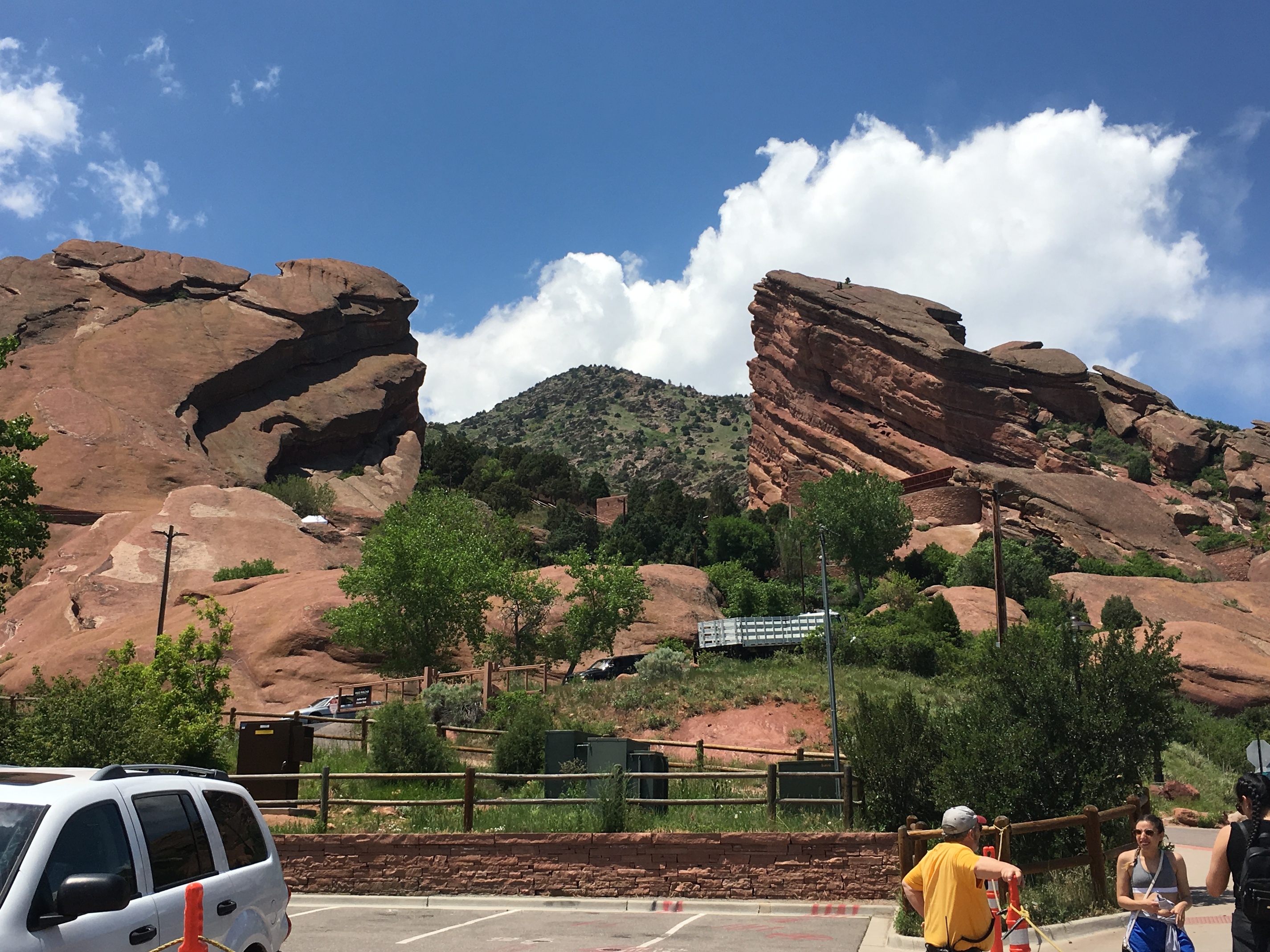
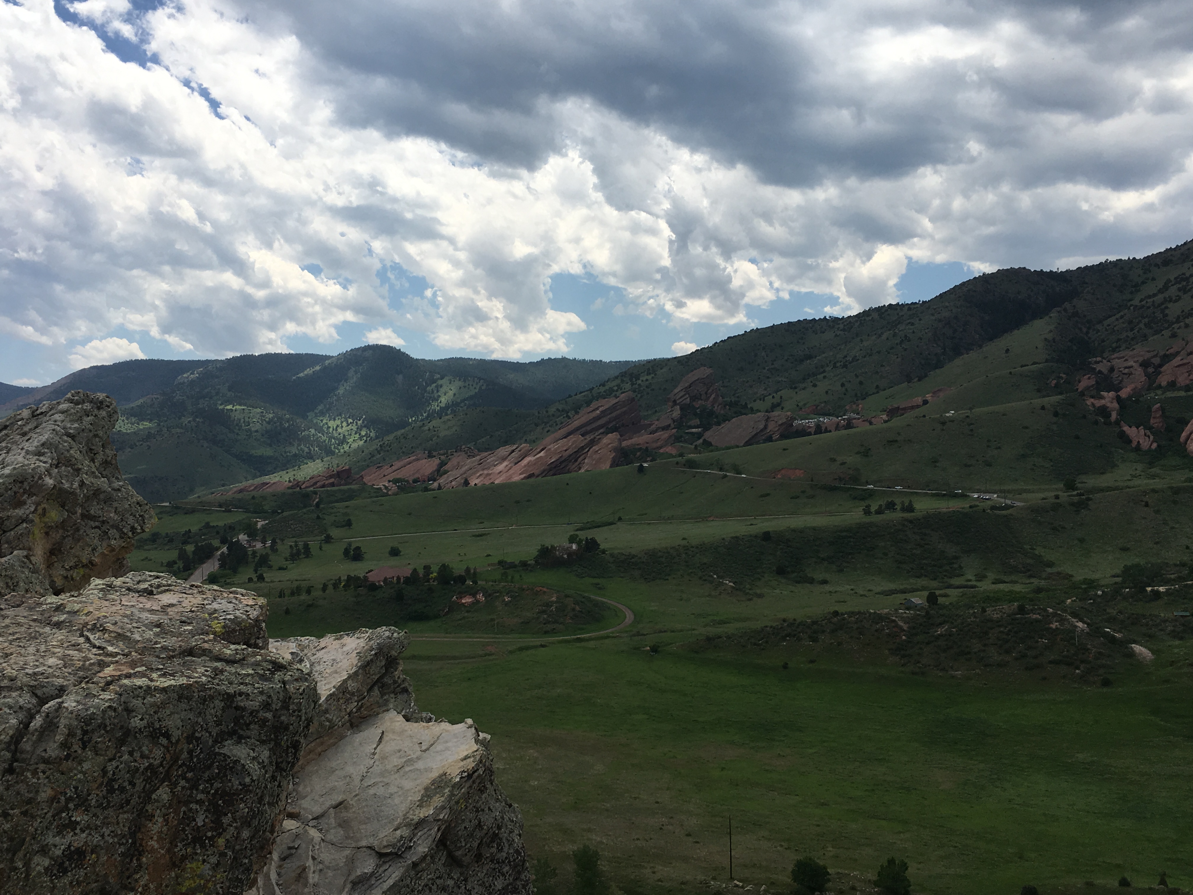
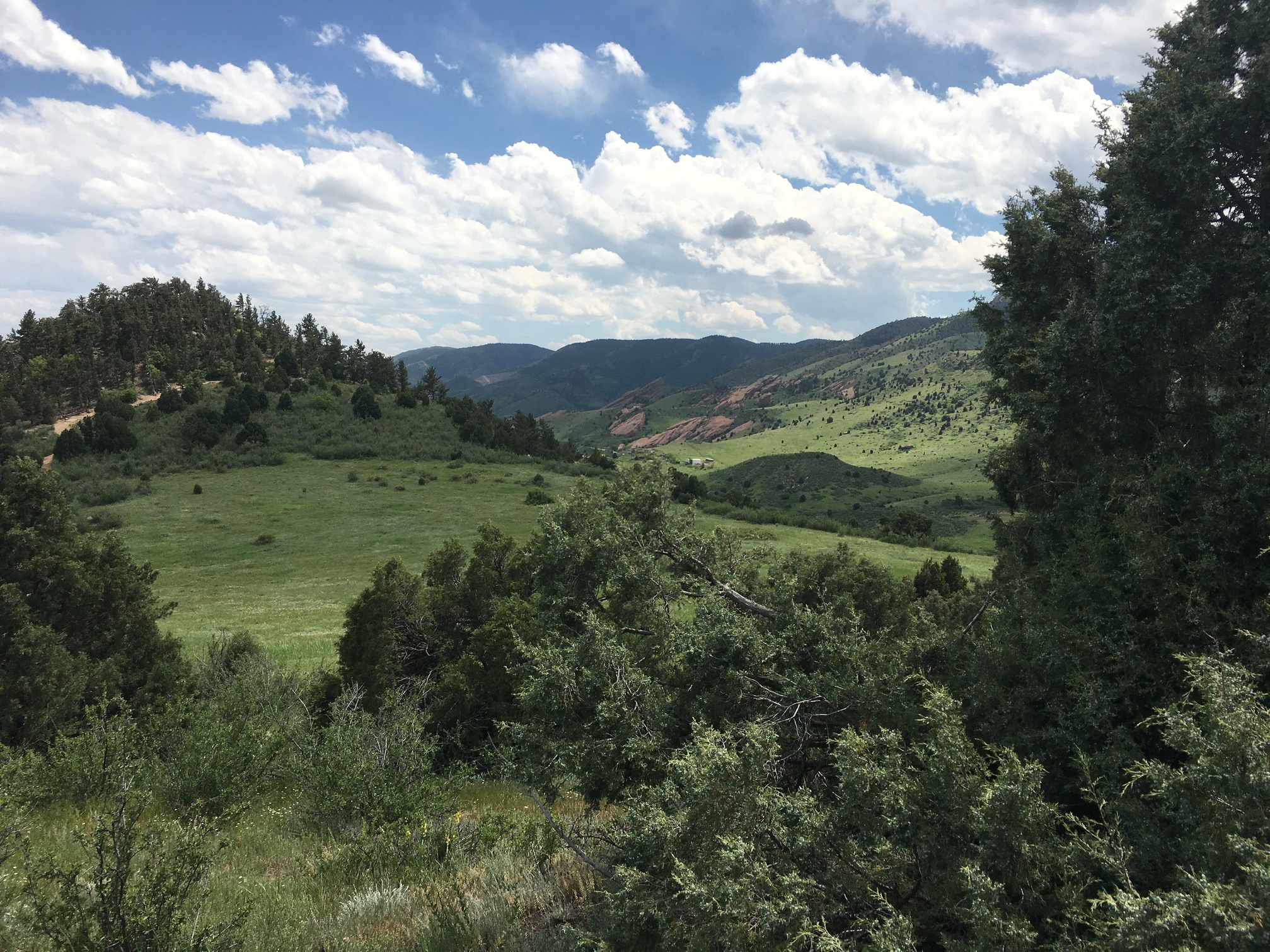
Well change of plans. I had planned on doing Mt Adams today, but a last minute need to travel to Chicago meant I spent today in Denver. 16 hour layover (that is currently on hour 18) and I bugged out. Hopped a train to Golden and hiked Red Rocks and the Dakota Ridge. Not super difficult or major elevation changes, but a nice enough mountainside trail.
Not much more to say, it’s been a long day and I just want to get to Chicago. But was a nice way to spend a day in an unexpected circumstance.
I’m very jealous. Colorado is a dream hiking destination for me. I’d love to do parts of the CO Trail someday.
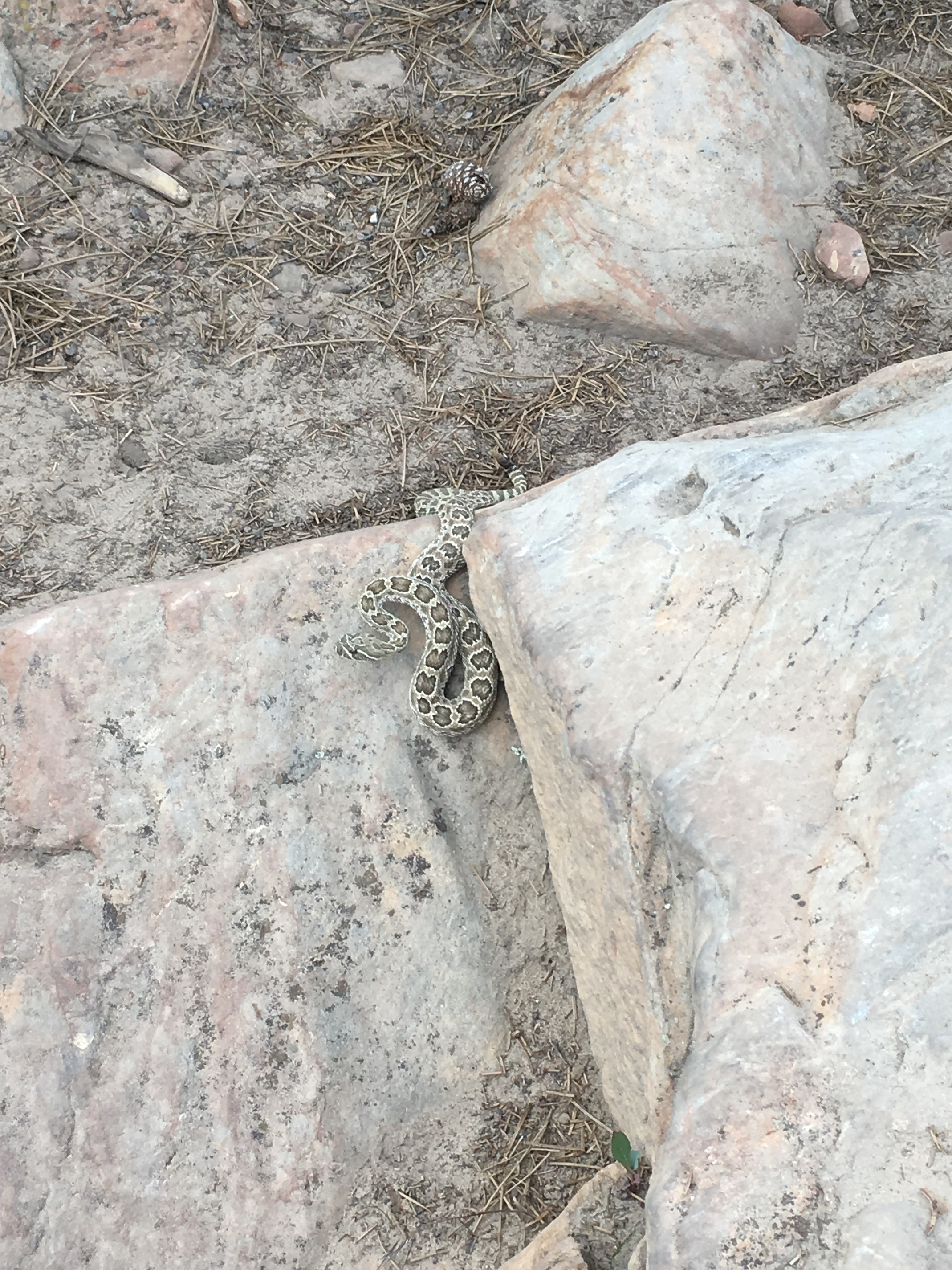
Nice snake!
That’s not a bad way to spend a layover.
Colorado is a place I’d really like to do some hiking one of these days too.
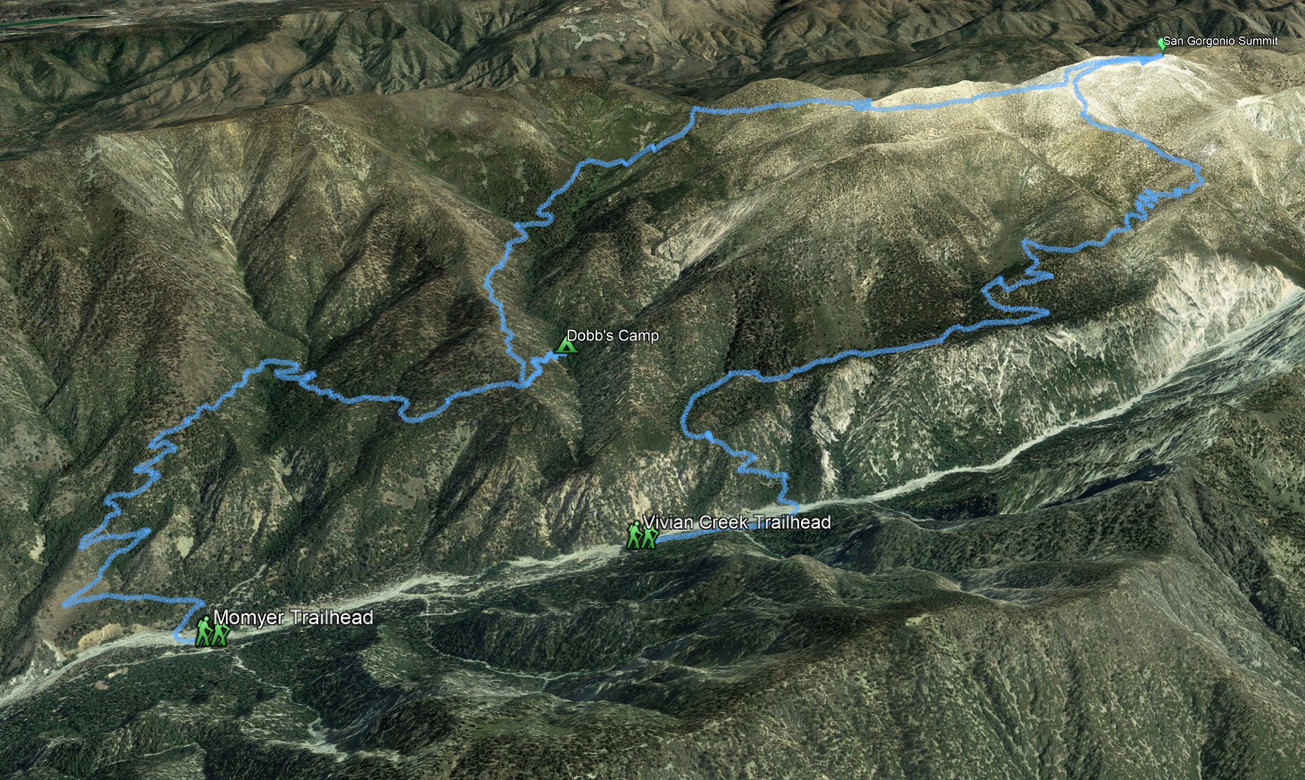
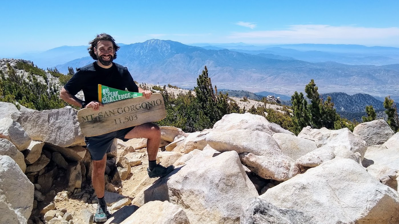
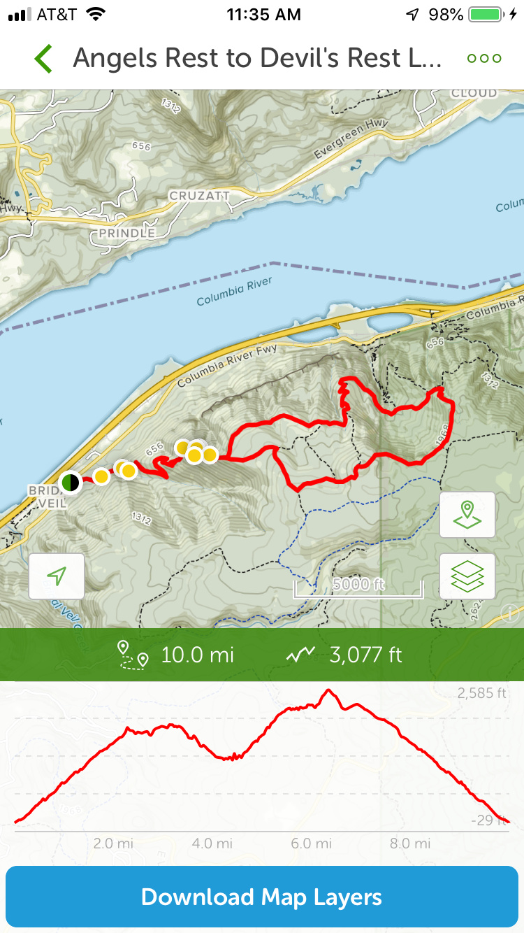
Hike report: Momyer to Vivian Creek via Mt. San Gorgonio - 24 miles over two days
Mt. San Gorgonio is part of the San Bernadino Divide, a long ridge that extends east-to-west about 60 miles across most of San Bernadino County, west of Los Angeles. There are 12 peaks along the ridge above 10,000’, culminating in Mt. San Gorgonio near the eastern end–the highest point in Southern California at 11,503’–before dropping into San Gorgonio pass–one of the deepest mountain passes in the 48 states–with Mt. San Jacinto rising from the desert on the other side.
There are many routes to the summit of the mountain. But since the Lake Fire in 2014 decimated the trees on the north face, the most popular route (hundreds of hikers on summer weekends) is the Vivian Creek Trail, the shortest route to the summit, which ascends 9 miles starting at about 6,000’. Less well known and far less travelled is the Momyer Trail, which begins 2 miles west of Vivian Creek and 500’ lower. I planned to do a loop: up Vivian Creek and down Momyer, camping at the popular High Creek Camp on the Vivian Creek Trail. But when I applied for my permit, that campsite was full. They gave me my second choice: Dobb’s Camp on the Momyer trail, so I reversed my route. And that turned out to be better in every way.
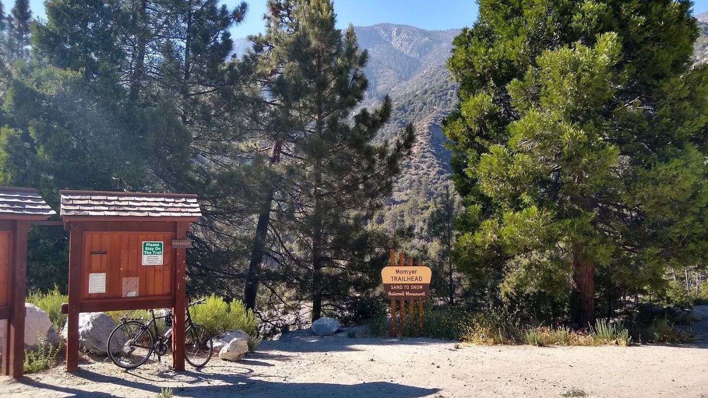
I drove up from work and parked my car at the Vivian Creek parking lot: the end of my hike. I hefted my pack, hauled my bicycle out of the back of my car and coasted the 2 miles back to the Momyer (MOH-my-er) Trail, locked up the bike and set out on the trail, starting at about 5pm
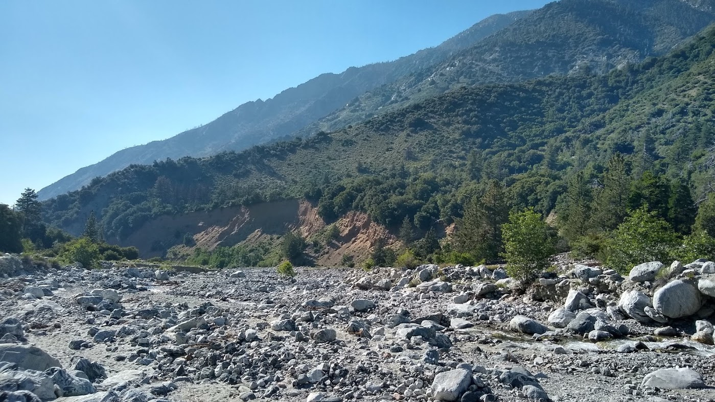
My first challenge was crossing Snow Creek, which is a raging wide torrent in spring, but just a few feet wide in summer, winding through it’s huge springtime rock bed.
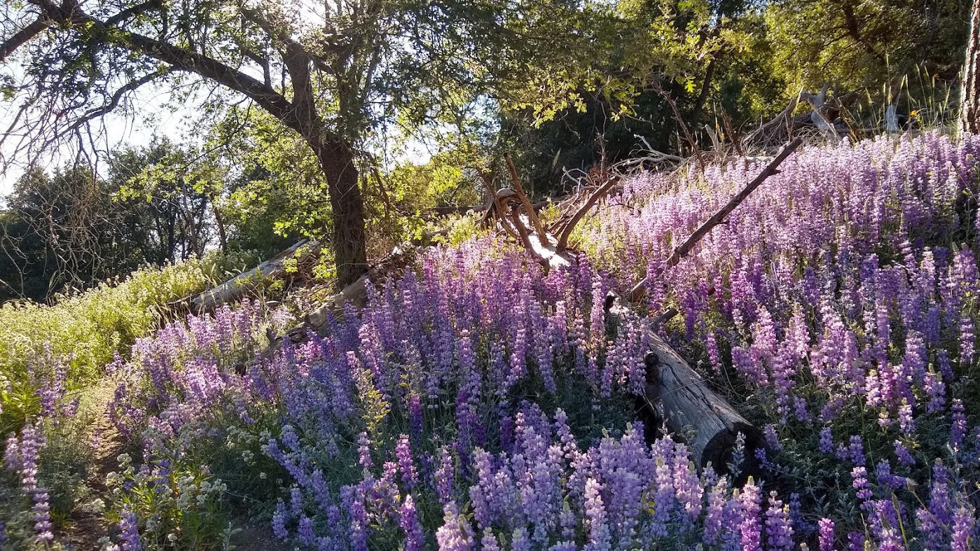
I had to travel a couple hundred yards downstream to find a safe crossing and then bushwhacked my way up the slope for about 1/4 mile to find the trail again. I wanted to reach my campsite, 6 miles up the trail, by sunset, so I sweated through the 1700’ climb over the first 3 miles of hiking. The lupins are in full bloom, and the low angle of the sun lit up the scenery.
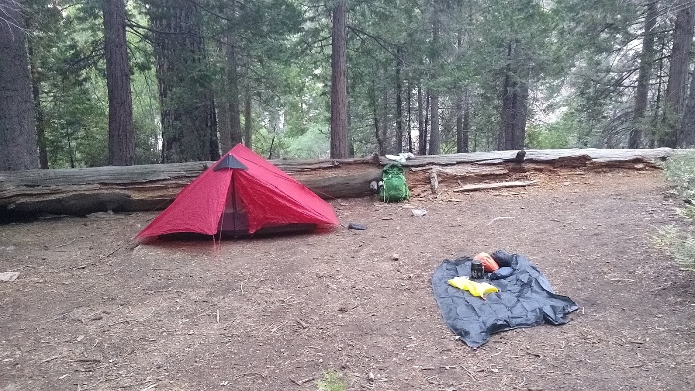
I reached the top of the climb and was able to power through the next 3 miles of relatively flat trail. Reached my campsite at about 7:30pm, with enough light and time to pitch camp and eat dinner before it got dark. Dobb’s Camp is about 1/2 mile off the main trail, 20 feet upslope from a stream cascading down a series of small waterfalls. The campsite itself is bounded by a huge fallen log that serves as a great windbreak. I had the whole campsite to myself (indeed I didn’t see a single person on the trail until after I reached the summit the next day) and the white noise of the waterfalls lulled me to an easy sleep.
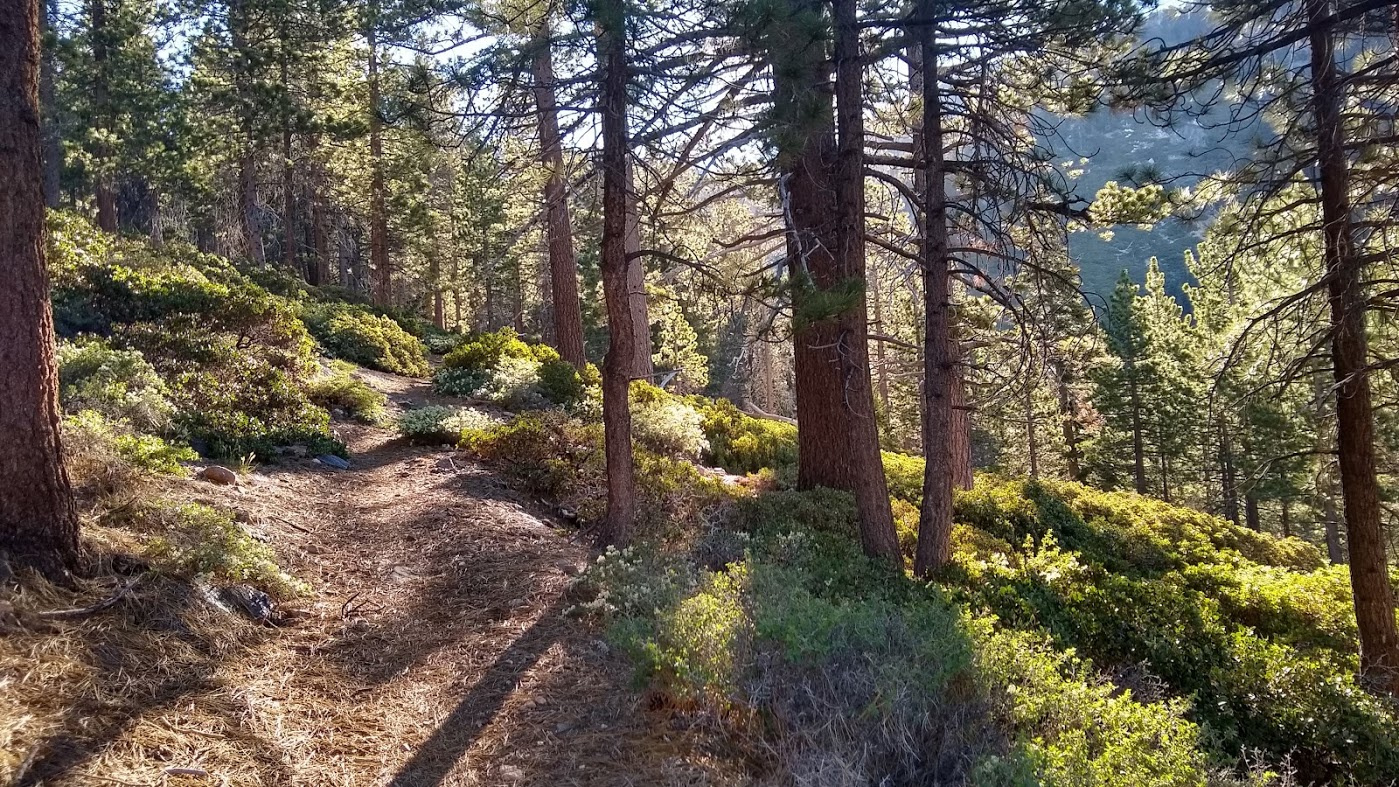
Next morning, woke up at 5, ate breakfast, filtered (oh so very cold) water, and was on the trail by 6. The morning light through the trees was pretty spectacular.
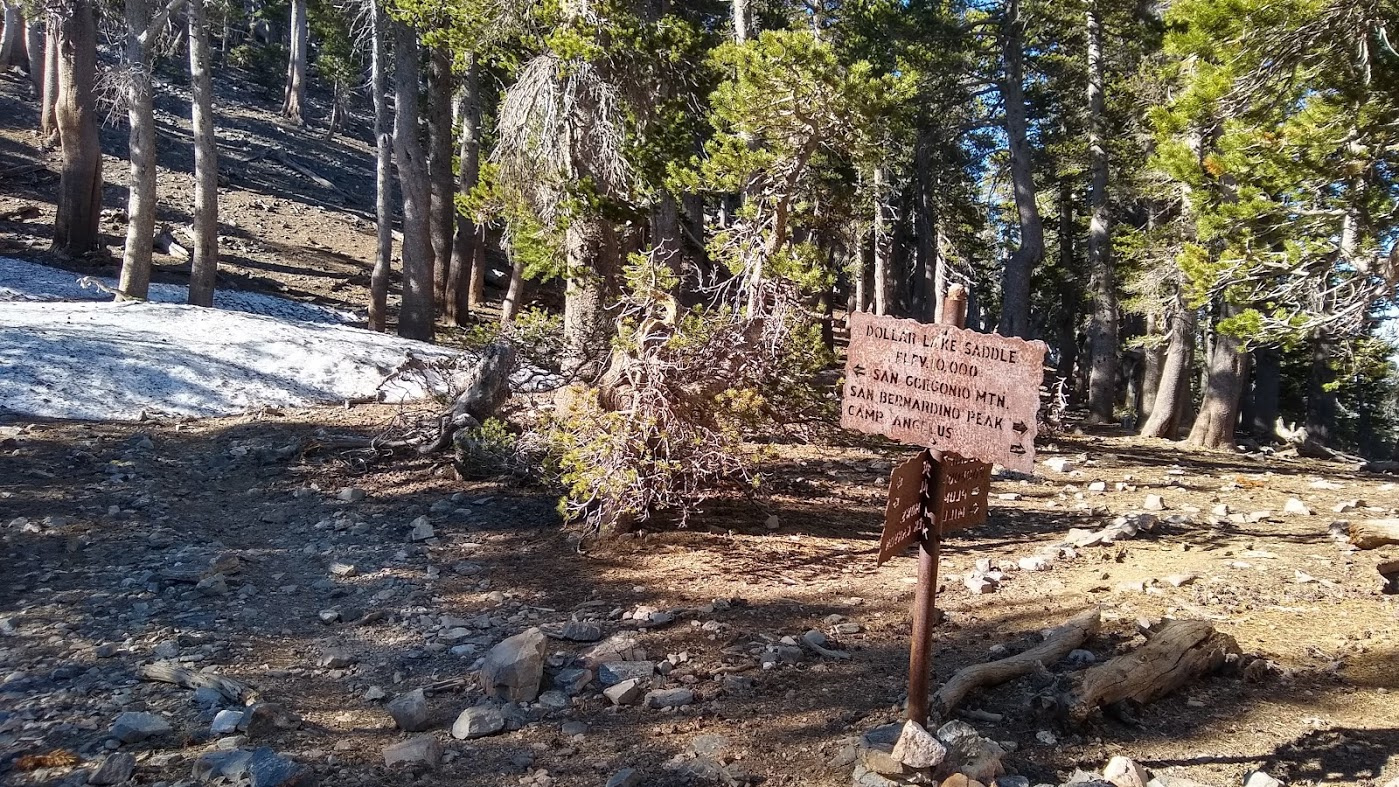
I made it to Dollar Lake Saddle, at 10,000’ by 8:30am. Here my trail met trails up the north face and across the divide, and I got my first view of snow on the ground.
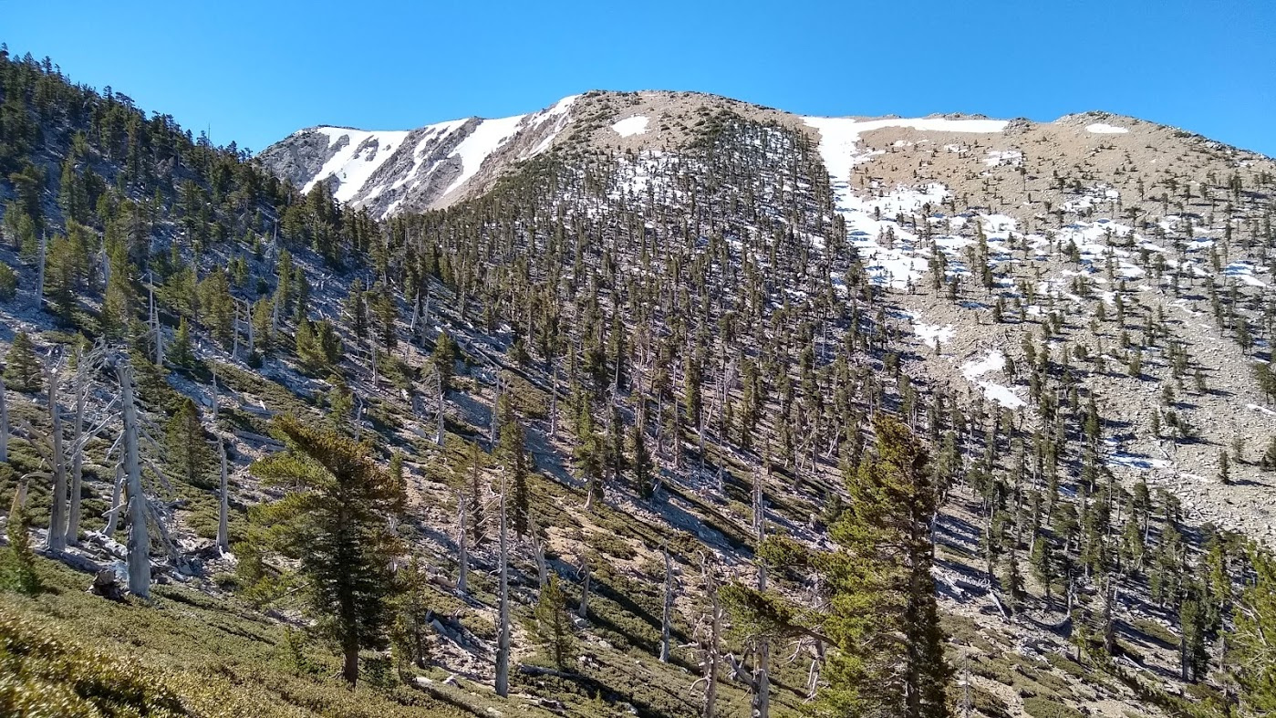
I kept trudging uphill, up and over the ridge you see below, crossing one of the snowfields on its steep slopes, which was probably the sketchiest part of the hike. I used trekking poles and walked carefully, but had some vertigo from the exposure.
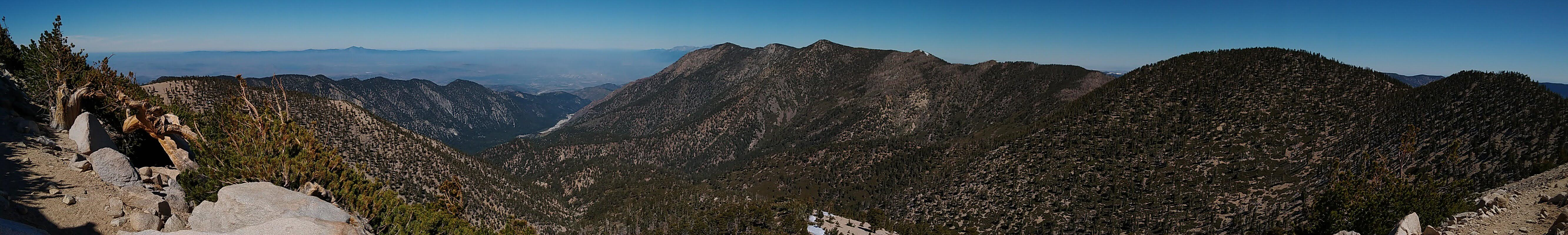
Now above 11,000’, the views to the west were pretty spectacular.
And before long, I was at the summit. Here I am with Mt. San Jacinto looming across Gorgonio Pass in the background.
I ate lunch and then spent 4 1/2 hours descending the Vivian Creek Trail to my car. On the way down, I passed my original first choice campsite, High Creek Camp, which was crowded and exposed. Glad I didn’t camp there. I really kind of loathe downhill hiking, and didn’t take many notable pictures, but Vivian Creek Canyon is lush and green, filled with ferns, grasses and redwood and ponderosa pine trees, spruces and firs in a slot canyon. It warmed up quite a bit as I descended, so all of the green was a nice respite from the warmth and my fatigue.
Made it to my car, picked up my bike on the way out and drove home through Friday afternoon rush hour traffic. A highly enjoyable hike though!
Very beautiful! I am jealous. I had wanted to test the Chimney Rock trail at Hood, but relocation efforts have meant no big climbs. However I was able to sneak in a few hours for a decent hike. A spot I hit about two months back, but from a different direction/ trail.
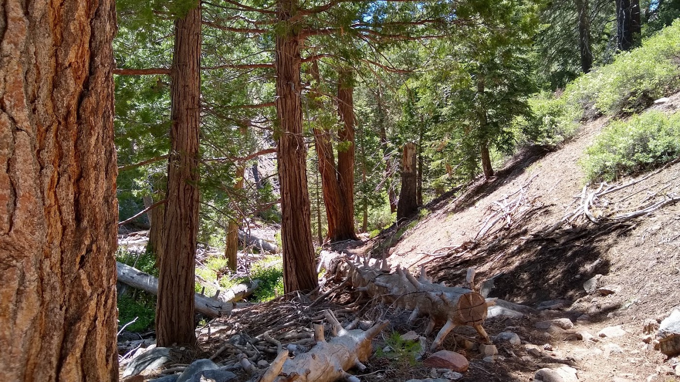
The Devils Landing-Angels Rest loop, starting at Bridal Veil falls (last time I started at Multnomah, which is East. Bridal Veil is west)
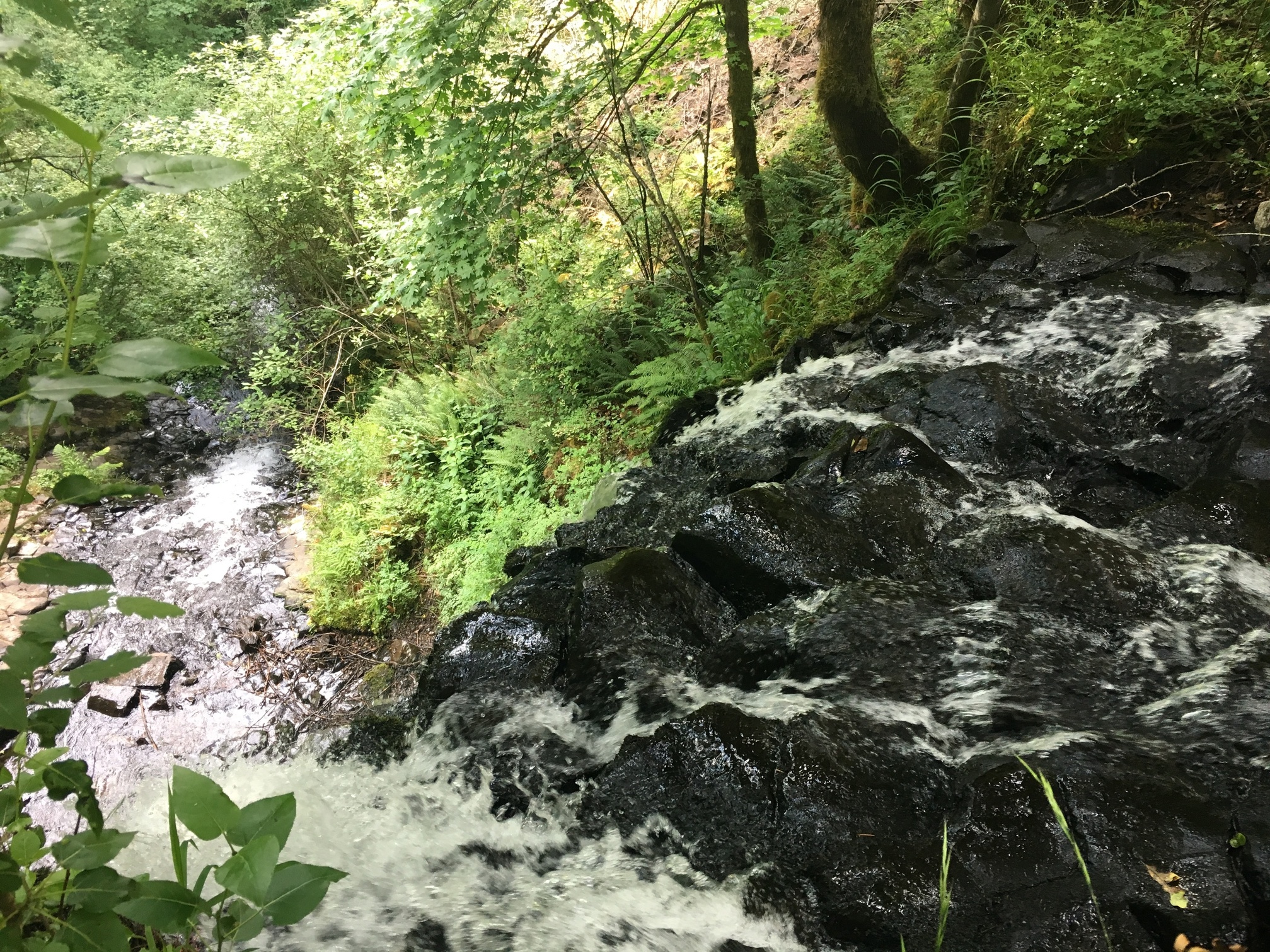
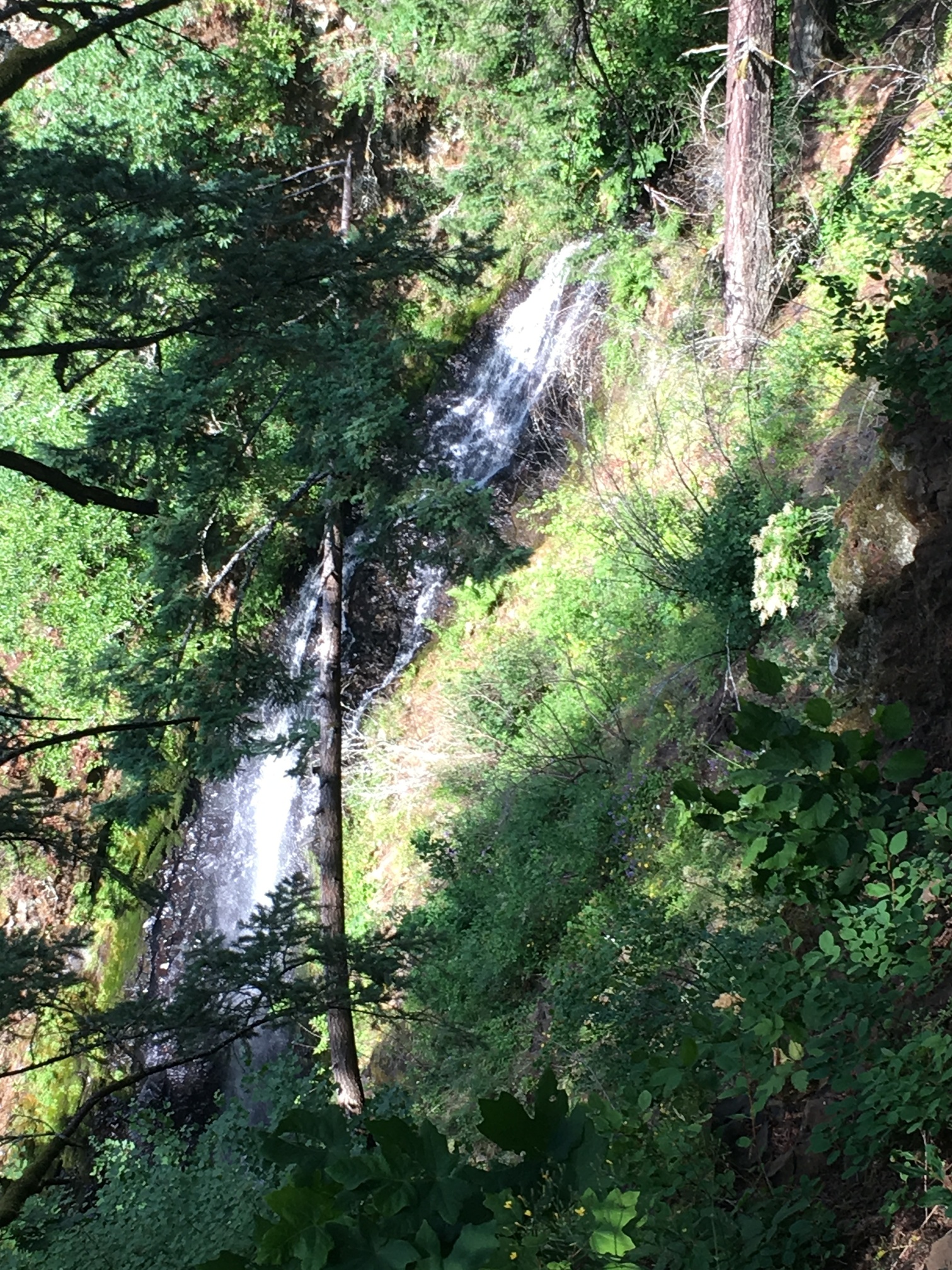
The first leg is very heavy traffic, as it is only a few miles to get to angels rest, as well as seeing the secondary falls above Bridal Veil. The trail itself doesn’t actually go by Bridal Veil, that’s about 1/2 mile west along the road and actually under the road bridge. But there are several falls along this path, including a few 40+ footers.
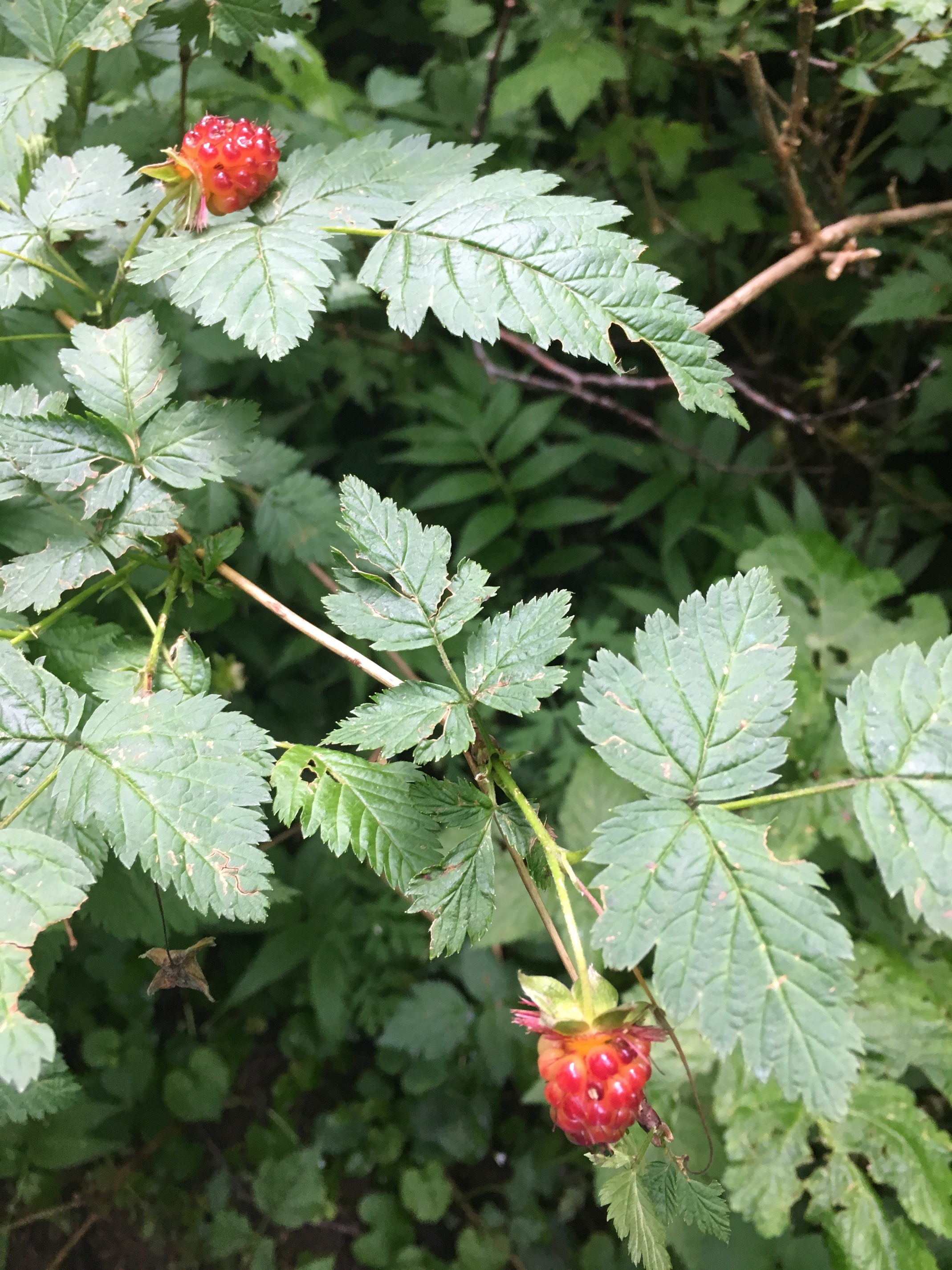
It is almost peak berry season. All along the path were berries that I anticipate being fully ripe by mid July. Blackberries are prevalent everywhere. But here there was also many large clusters of Salmonberries. A close relative to the raspberry, and similar in taste. Slightly less sweet and with a slightly more complex wild flavor. Also more delicate and don’t survive transport well once fully ripe. They also take a bright golden color.
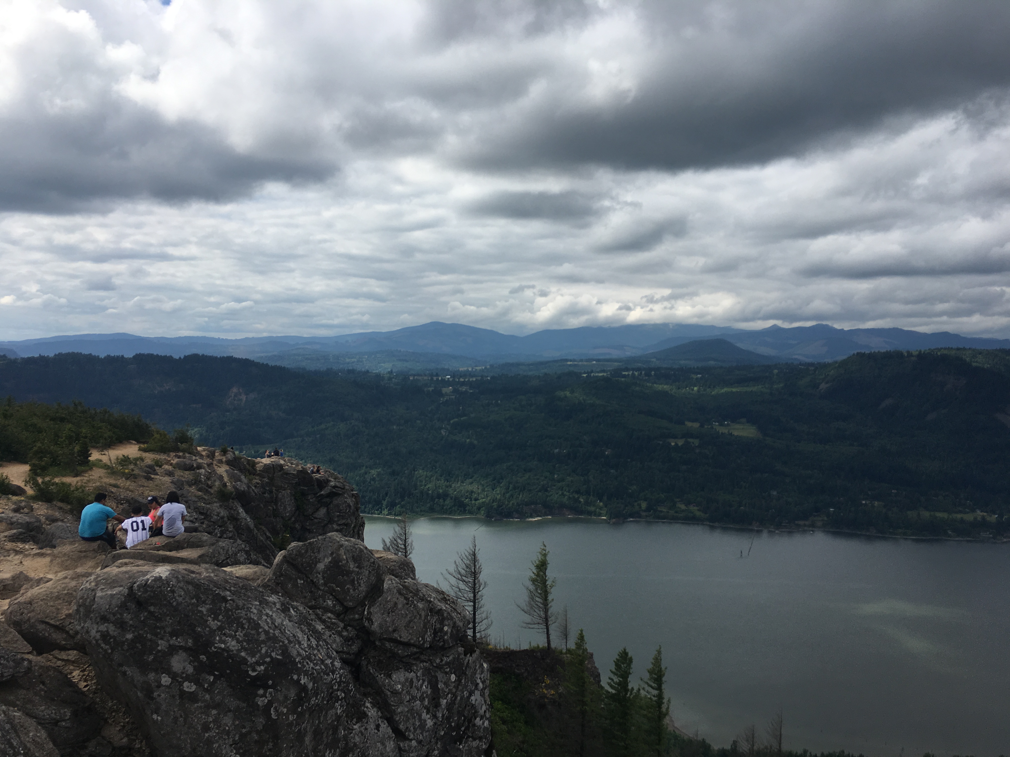
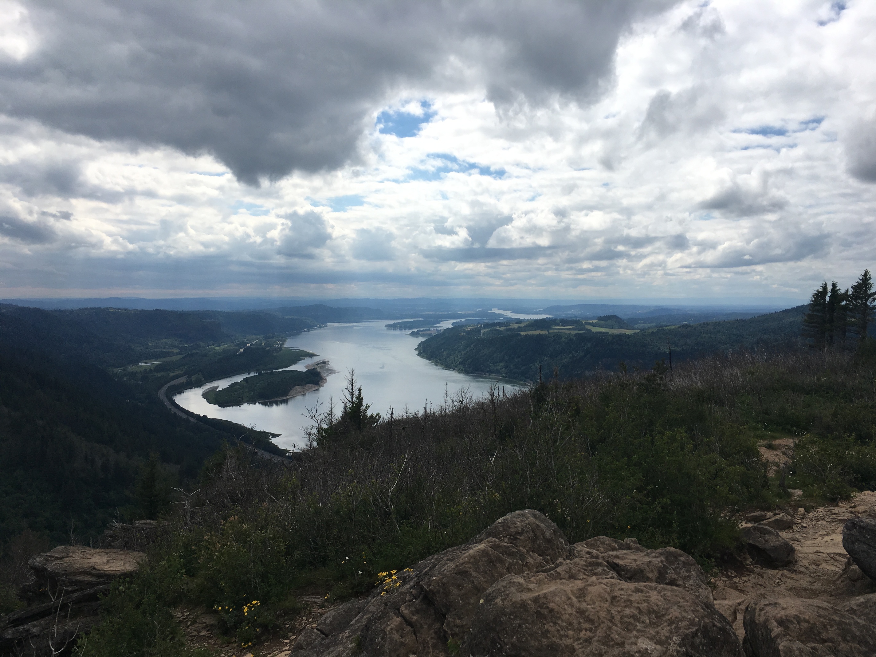
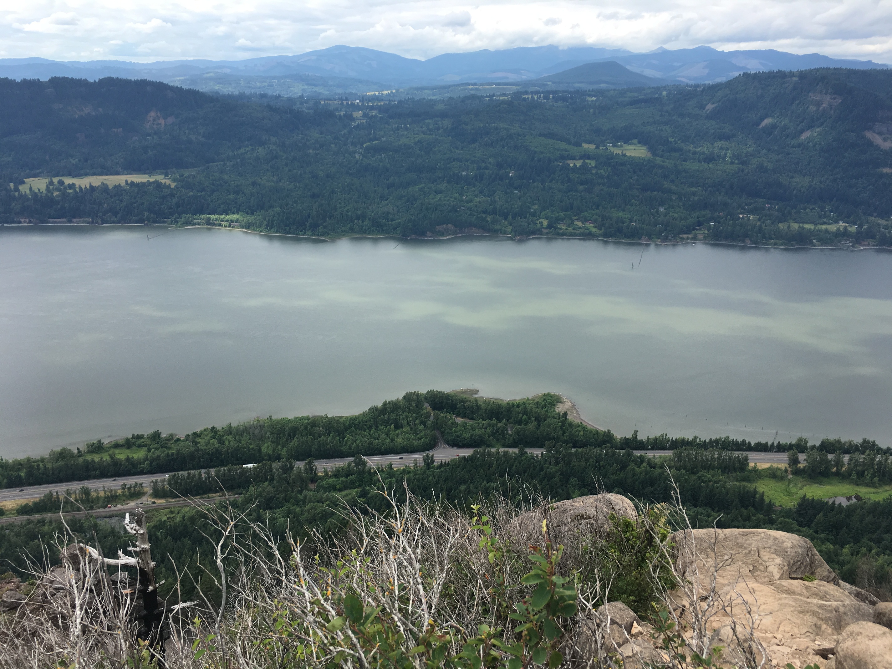
Angels rest is only about halfway up in elevation, but has spectacular views into the river valley since it is a rocky prominence that juts about 2-300 yards out from the hillside
It’s where the crowd goes from interstate to abandoned dirt road. In fact the trail this way looks almost like a deer path once you cut up to Devils Rest. The rest itself isn’t known for views, it’s in the middle of thick foliage, but along the way you can see where streams originate from cliff springs, and feel the temperature dropping. The Devils Rest itself is a cluster of volcanic rocks at the local high spot.
Not the most challenging hike I’ve done, but it’s a nice trip with some good views. Honestly anywhere along the river is nice. This has the virtue of being one of the closest trailheads in the Columbia to Portland.
Gorgeous hike, Craig!
OMG that view down the Columbia with the clouds overhead. I love spectacular cloud shots.
Great metaphor. I had the opposite; saw zero people on the way up the less popular trail, passed many dozens on the way down the other trail–on a Friday morning, not even a weekend day. (My favorite moment, after I’d been hiking down for about 2 hours, one woman huffing her way uphill as I passed asked “Is this the last switchback?” I tried to keep the pity out of my eyes, “Oh dear god no.”) On the one hand, there are too many people in SoCal. On the other, it’s often amazing how little effort it can take to get away from the crowds.
Keep the hike reports coming!
Hey @CraigM, I’m seriously considering flying up to Portland to hike the Timberline Trail (3d/2n) on the weekend of October 4. Do you think the weather will be accommodating?
Short answer: most likely yes.
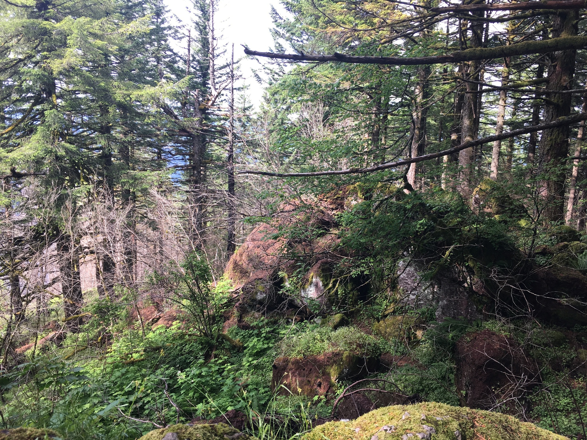
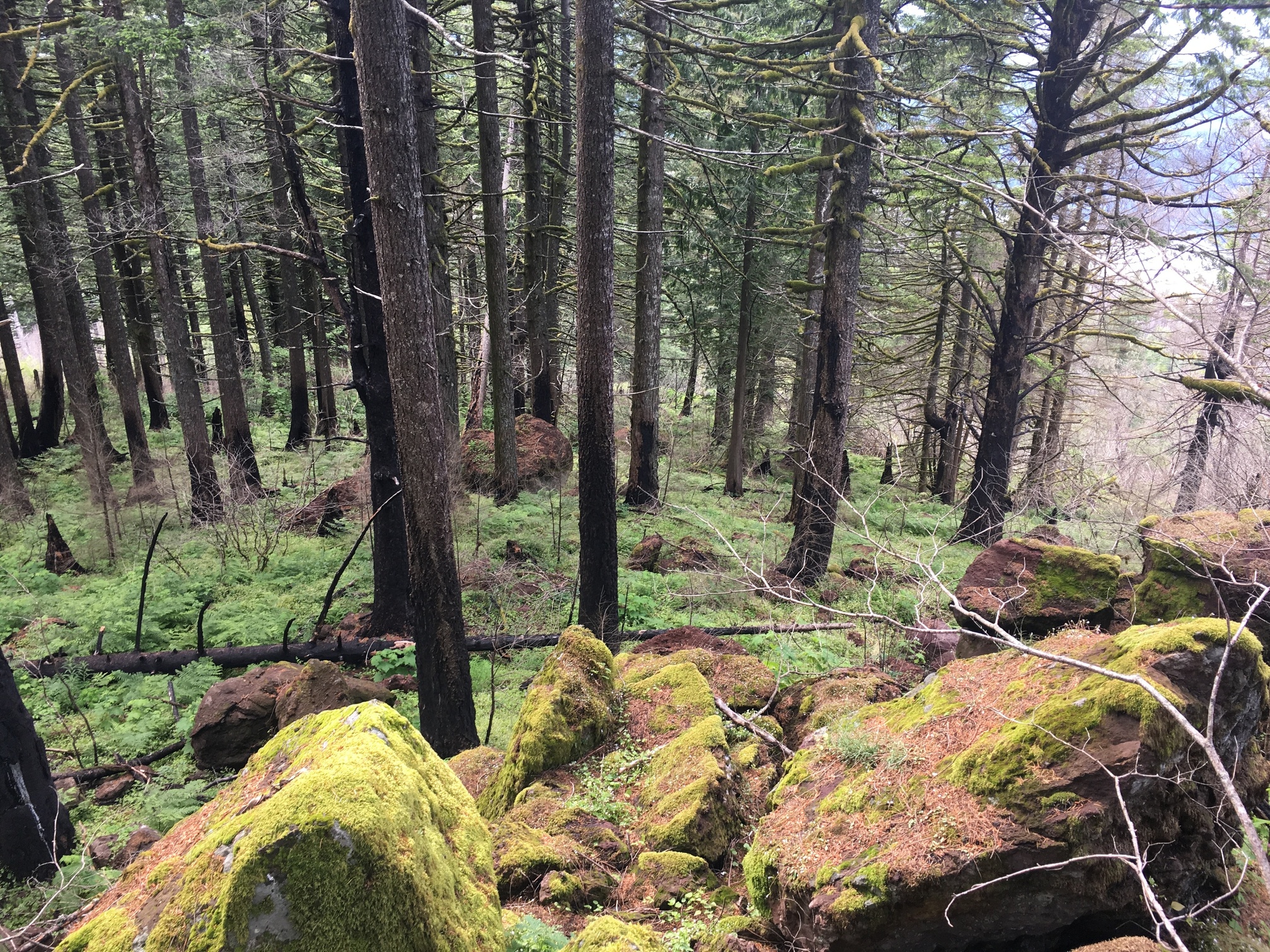
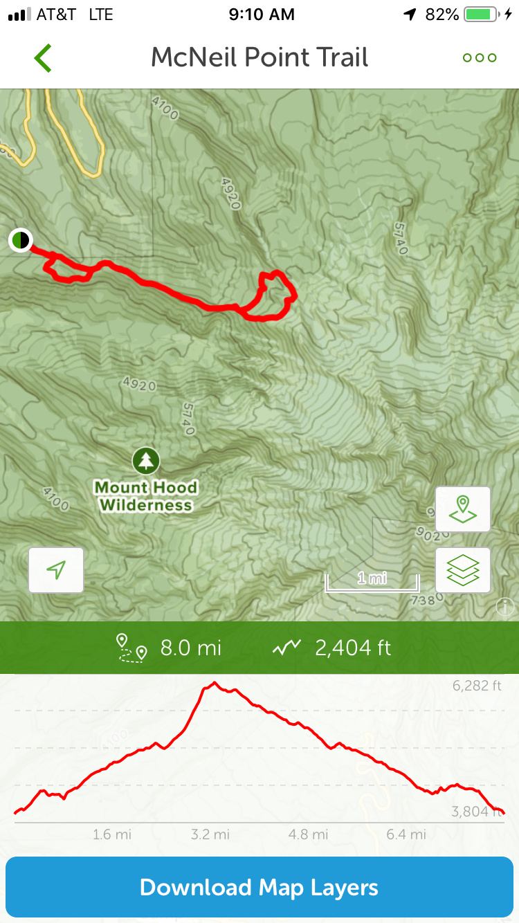
Longer answer: October is when the weather starts to transition back to rainy weather. However early October is still pretty nice. I did a couple of hikes up at St Helens last year in late October and the was mediocre. The temps were ok, but there was a persistent mist. But in early October, roughly the same weekend you are talking, I did the McNiel point trail
I started a little lower than this map, at the intersection of the PCT and Lolo Pass Rd. But while it was cloudy, it had intermittent breaks of sun too. Broadly speaking the weather is temperate, generally somewhat cloudy, but perfectly good hiking weather.